Iceland Week 2: July 23-30

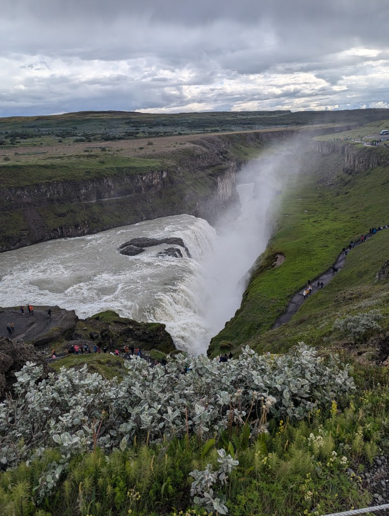
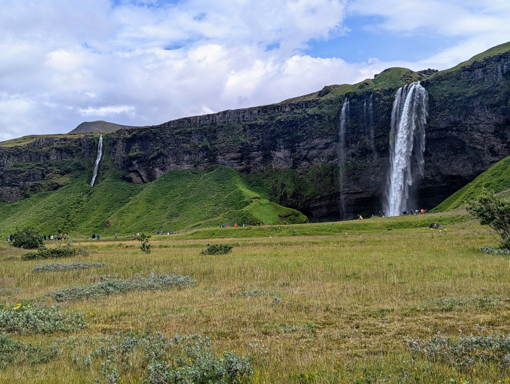
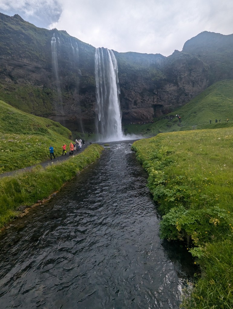
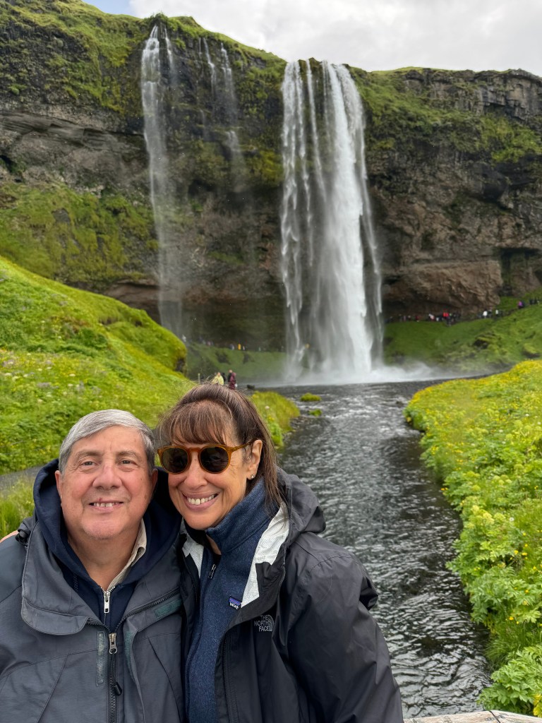
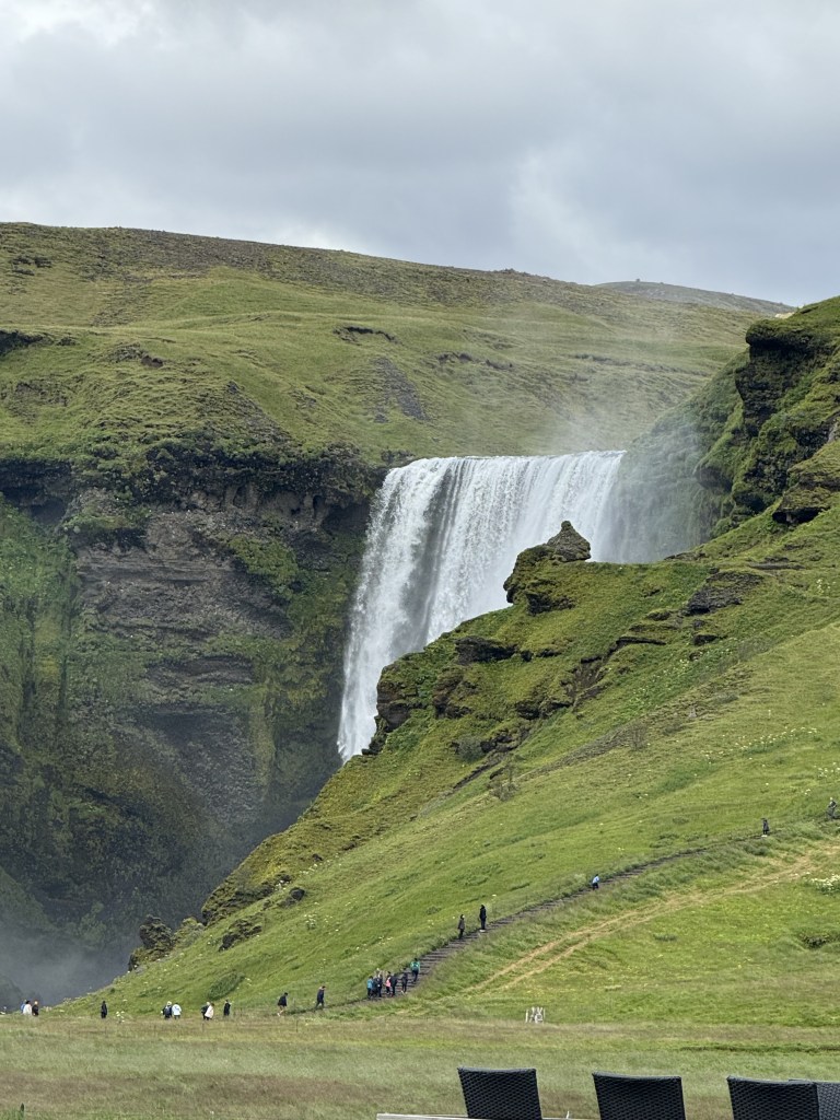
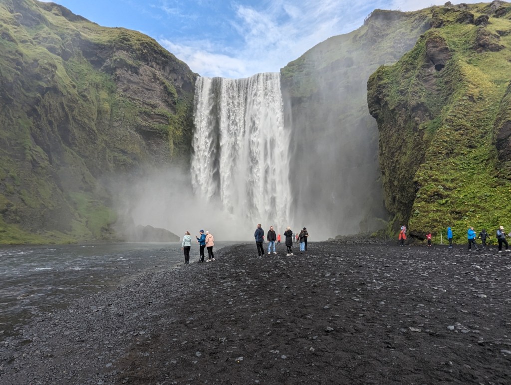
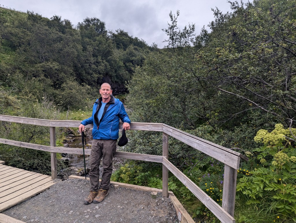
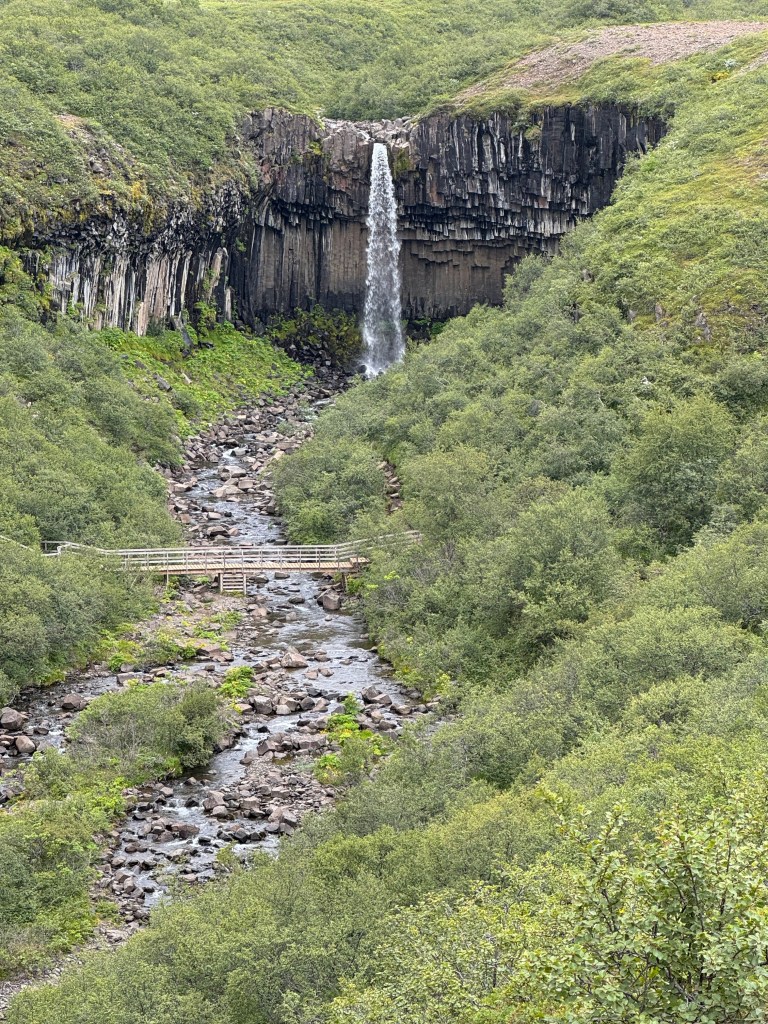
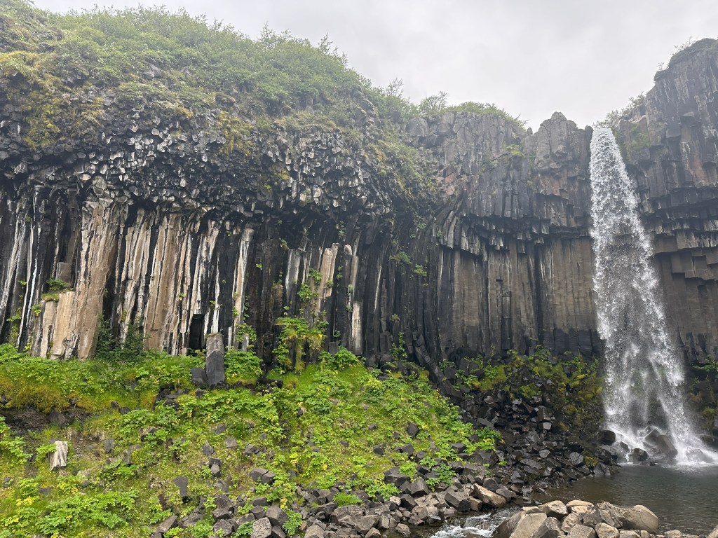
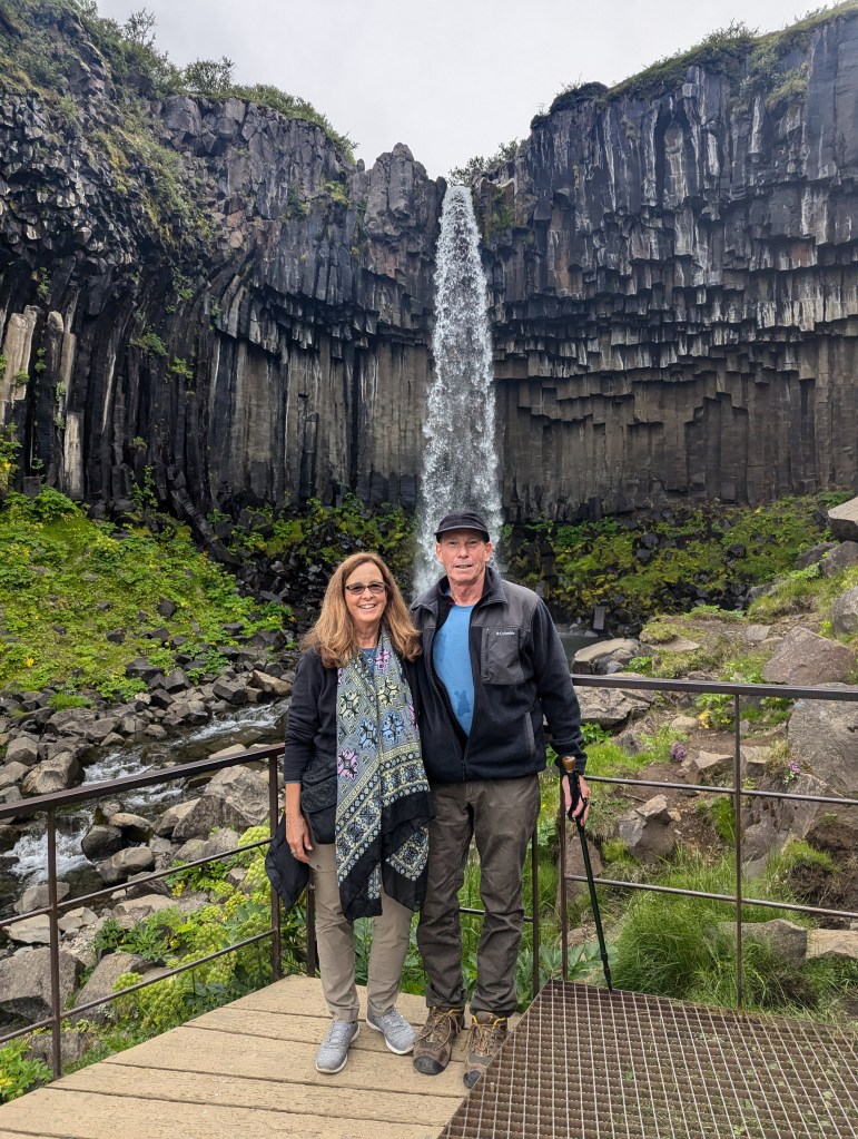
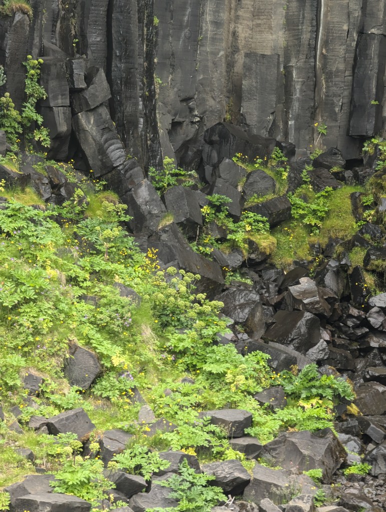
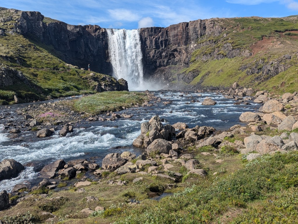
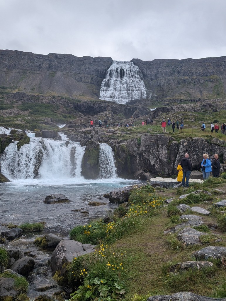
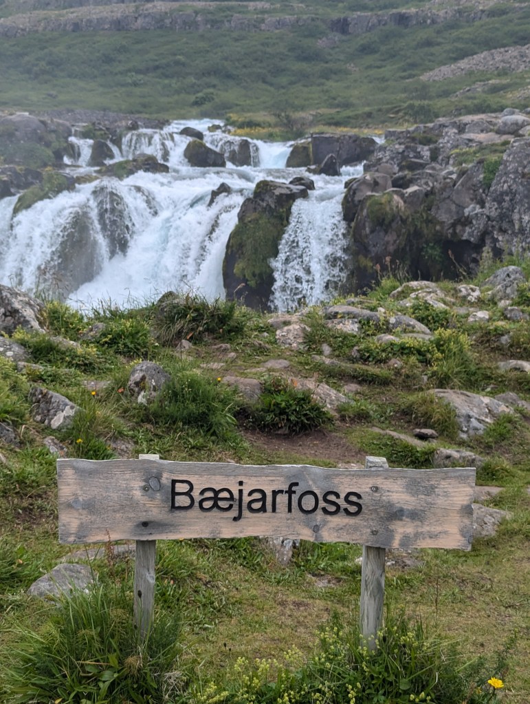
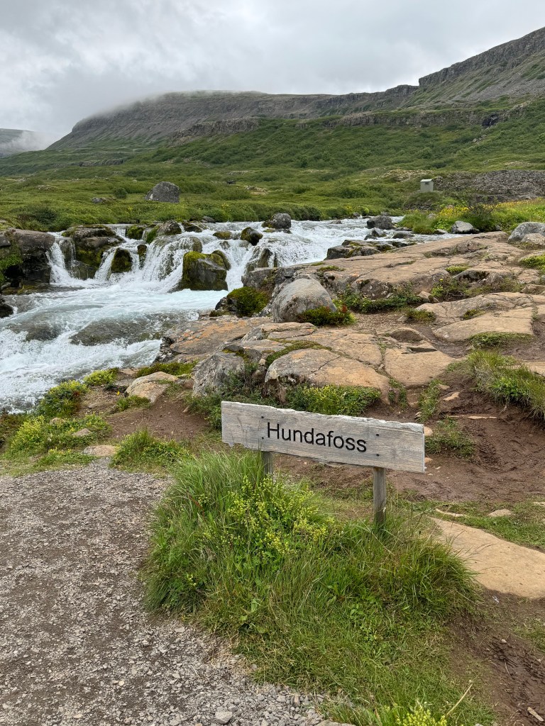
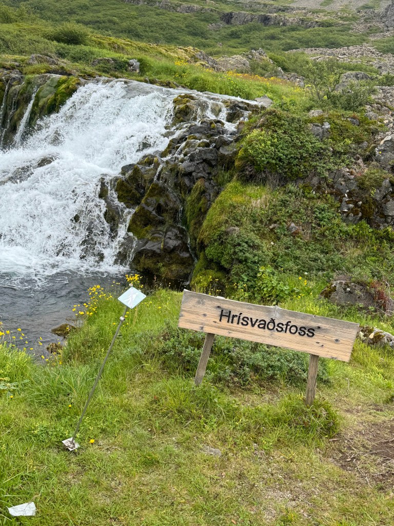
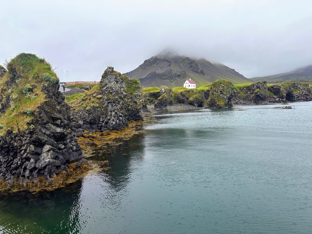
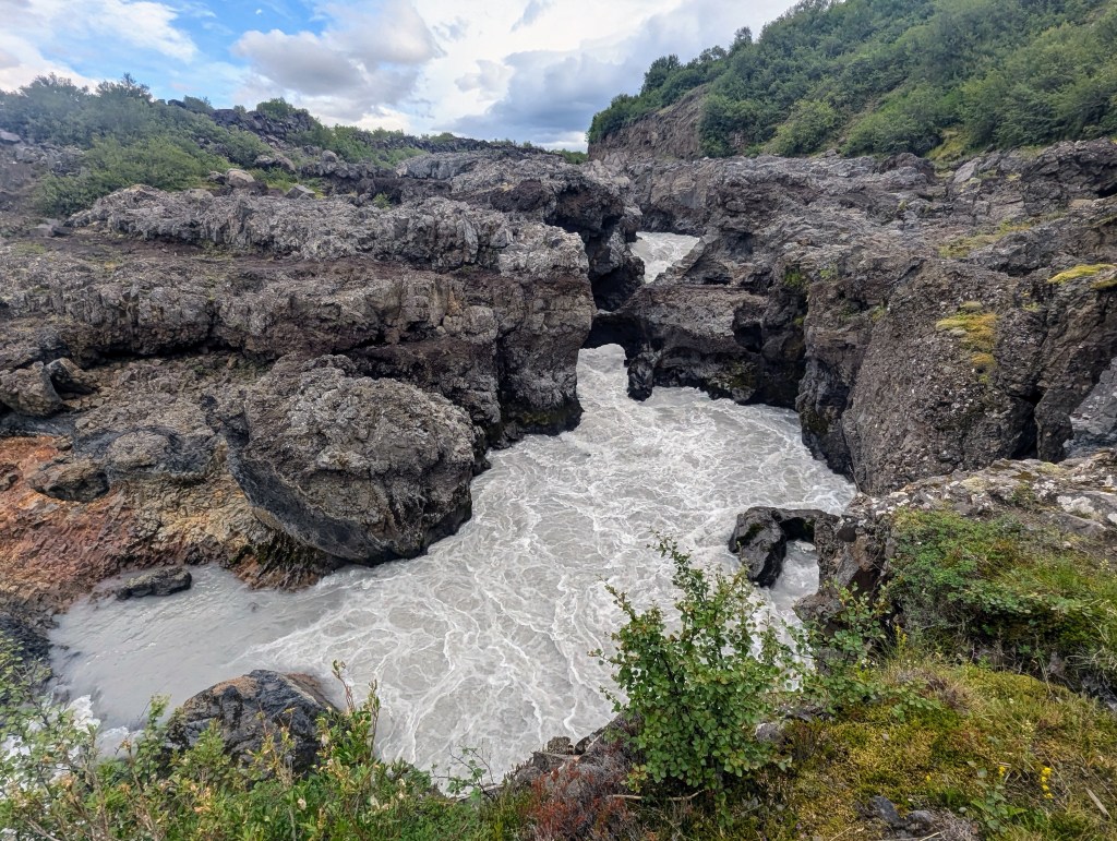
Refreshed in the morning, we said goodby to Seyðisfjörður and headed back up the mountain toward the ring road. We were struck with how many (a couple of dozen) waterfalls we had missed seeing on the way into town the previous evening due to directionality and tiredness. We stopped at this particular beauty for some pictures.

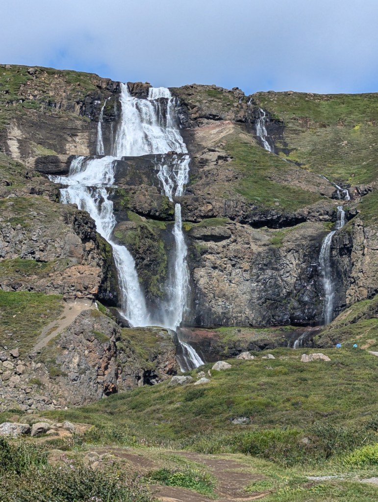
Also on the way back through Egilsstaðir we had to grab a snapshot of this. As we passed Egilsstaðir we had reached our most eastern portion of the ring road and were now headed north and west.

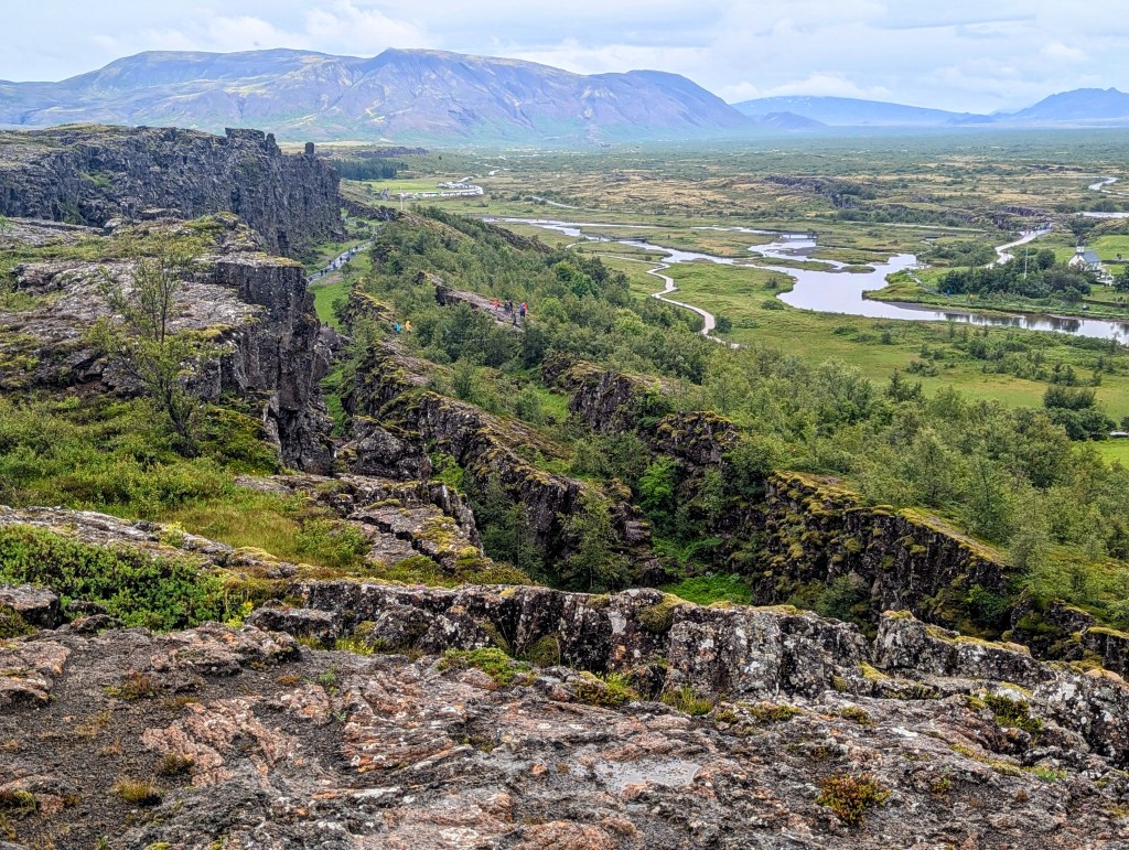
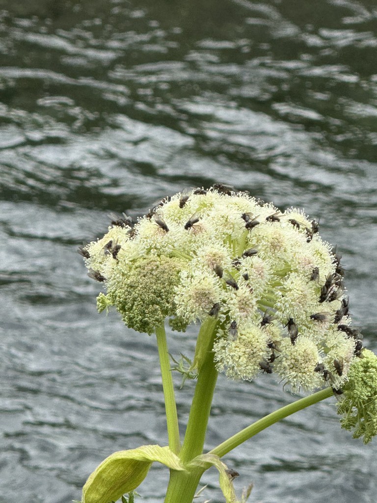
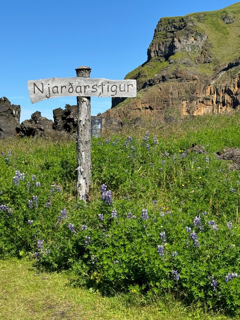
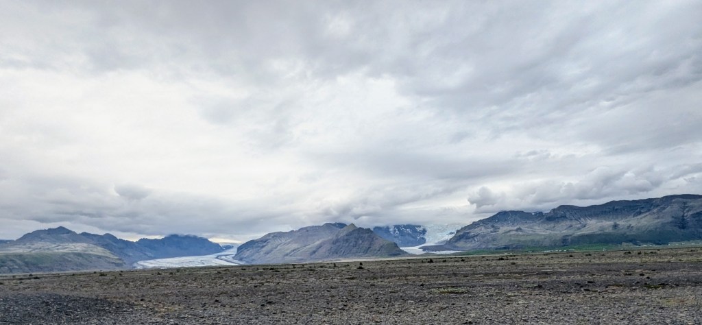
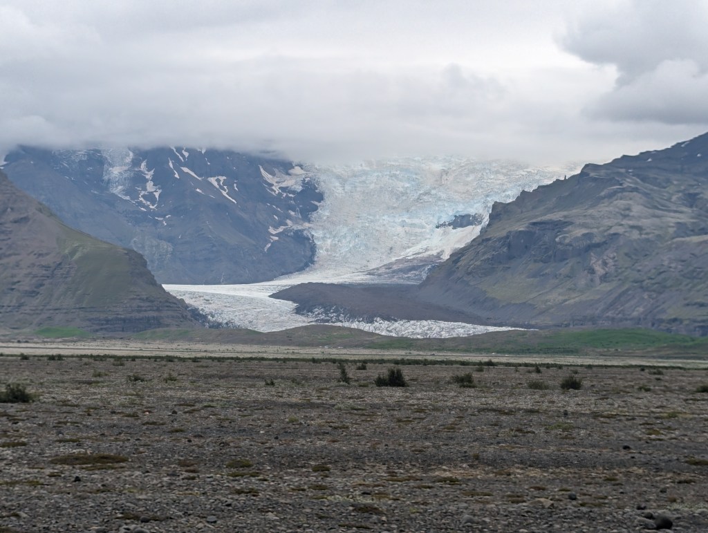
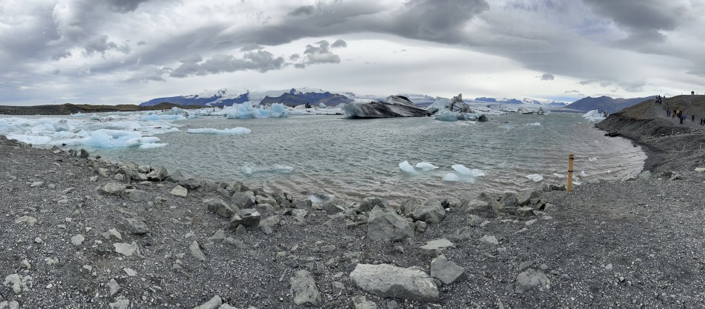
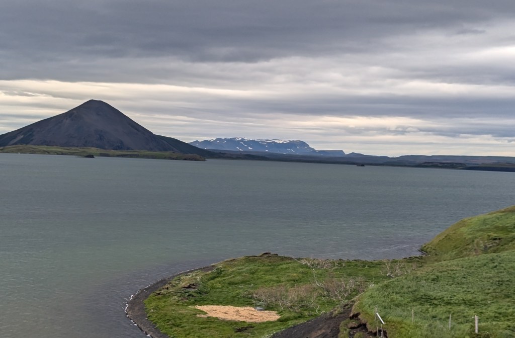
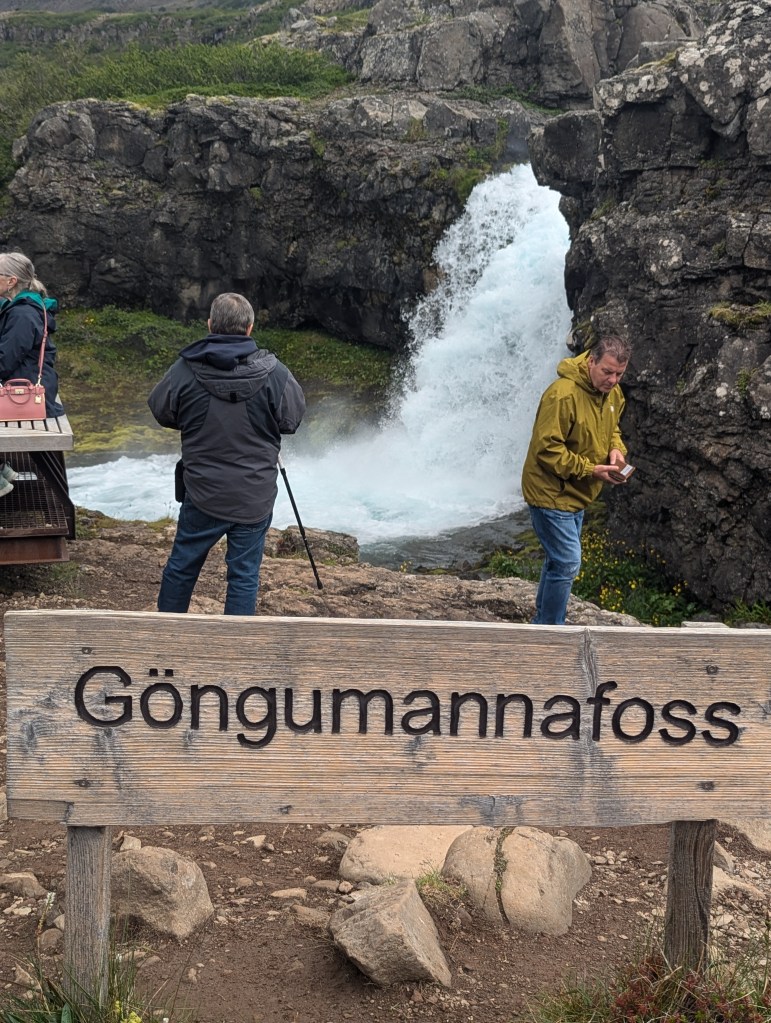
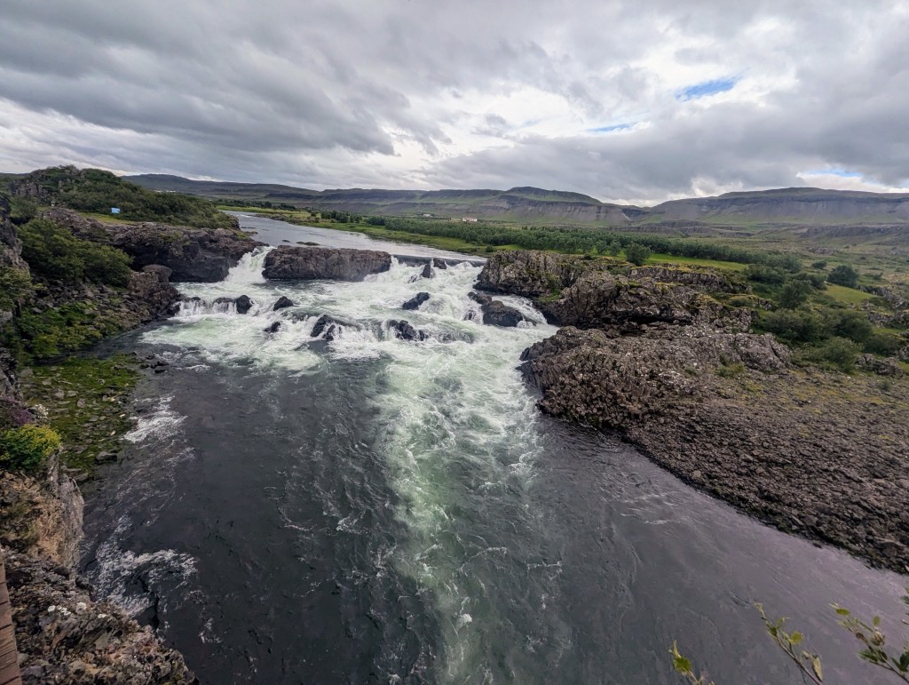
This northeastern area of Iceland was again mostly rocky and barren, not the lush beauty of the southwestern areas. But we did see endless fields of purple lupines. As we admired their beauty, we looked them up and found that they are actually an invasive species here in Iceland and causing significant problems for many farmers. Also, as thinly populated as the south was: one can drive for significant periods of time and see no dwellings, the north is even more sparsely populated. But no drive is far before there is another waterfall to capture.

RJÚKANDAFOSS

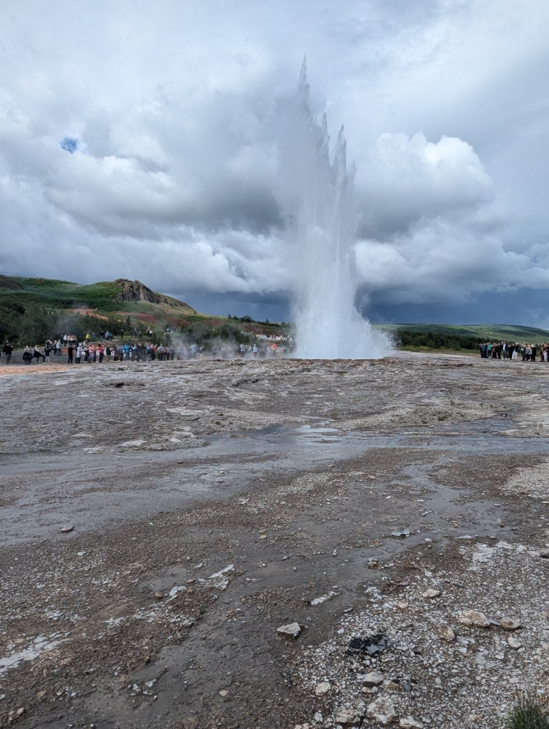
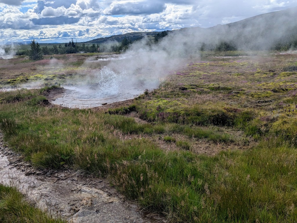
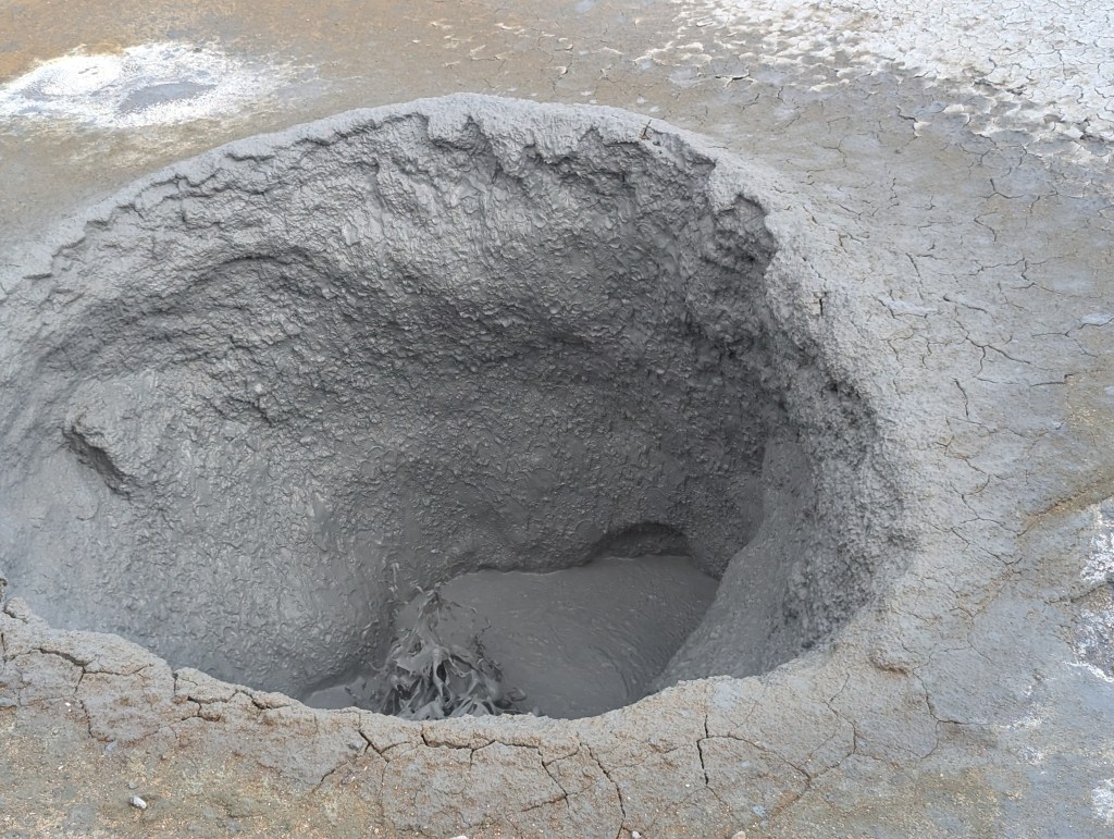
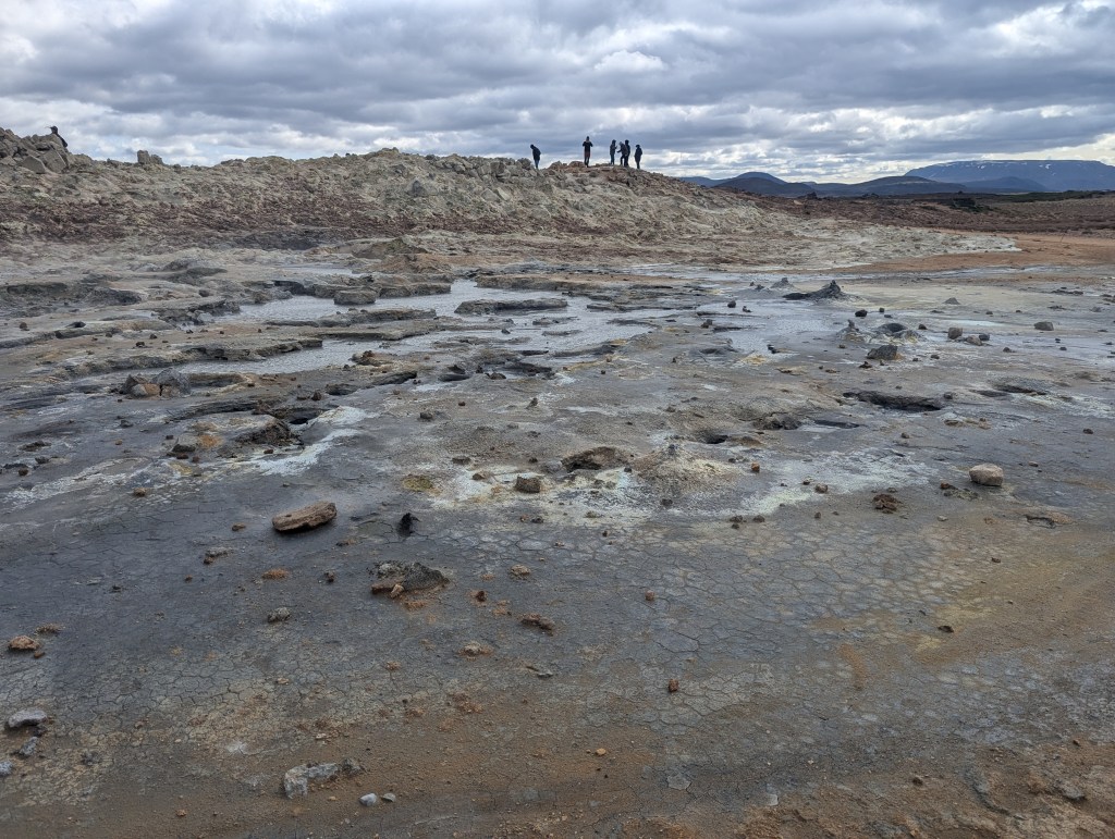
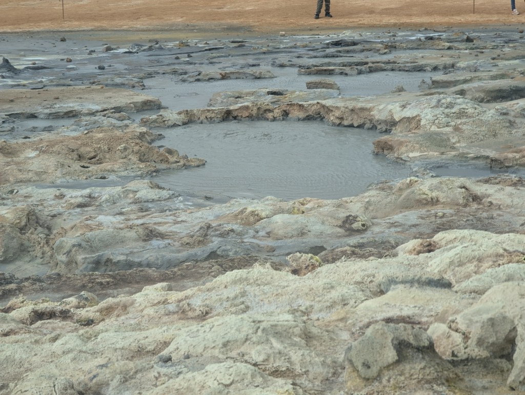
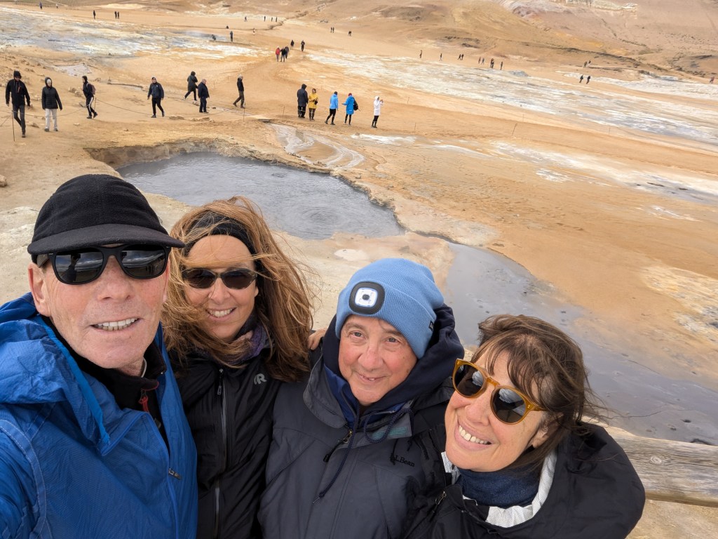
We also stopped along the way at Hverir which is one of the most active geothermal areas in all of Iceland. This region stands out for its multicolored landscapes

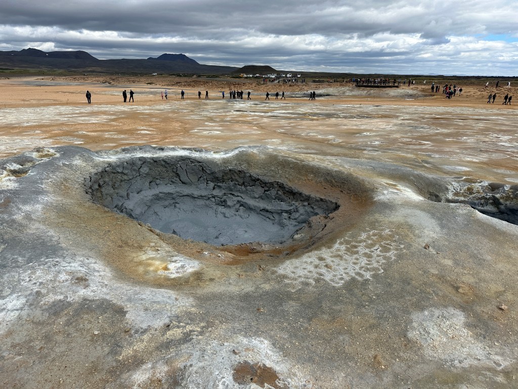
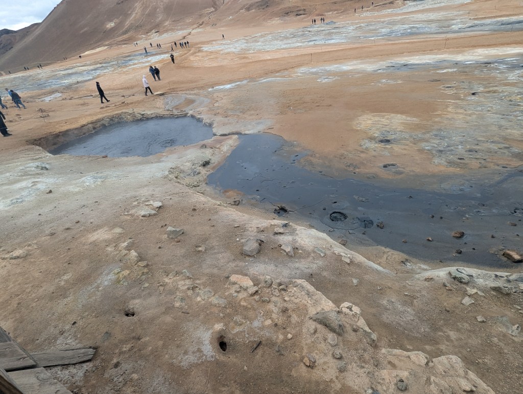
and bubbling mud pools

and boiling pools of water

and the numerous fumaroles

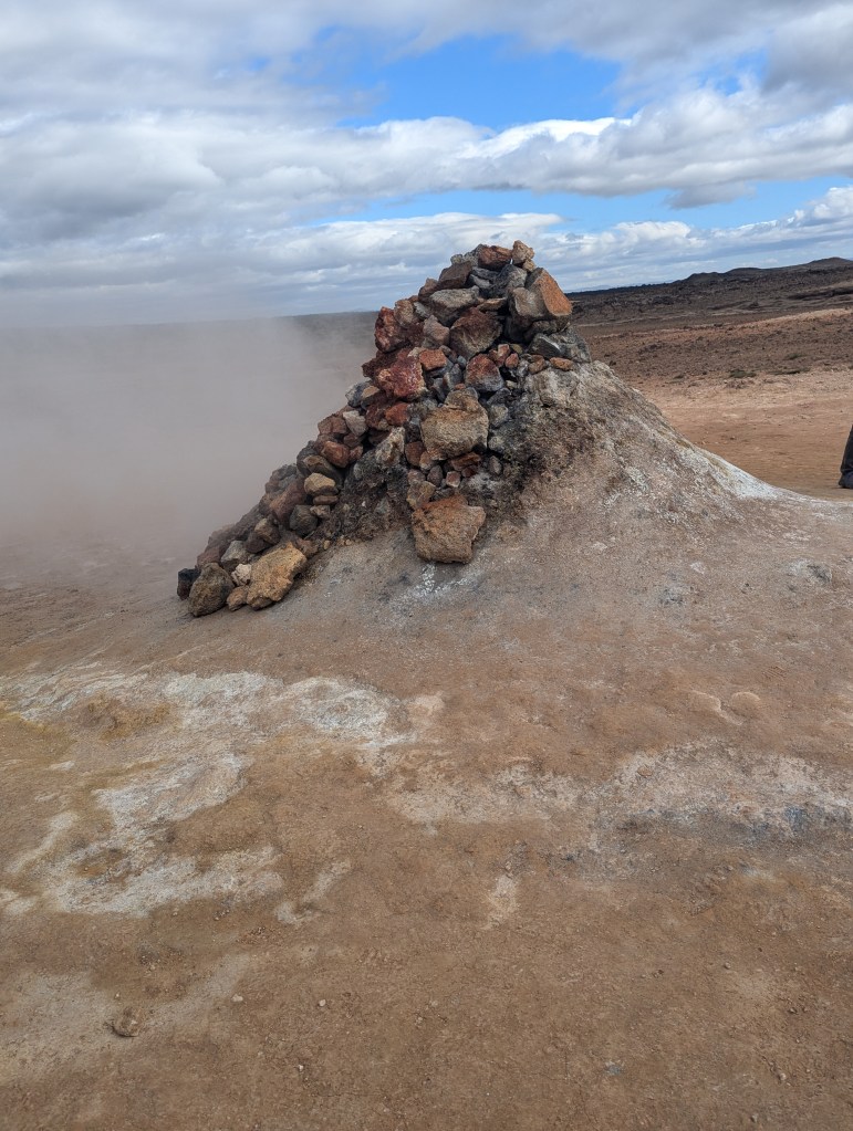
speckled across its moon-like terrain.

Finally it was time for our first dip in a hot spring. We checked in at Jarðböðin Nature Baths in Mývatn.

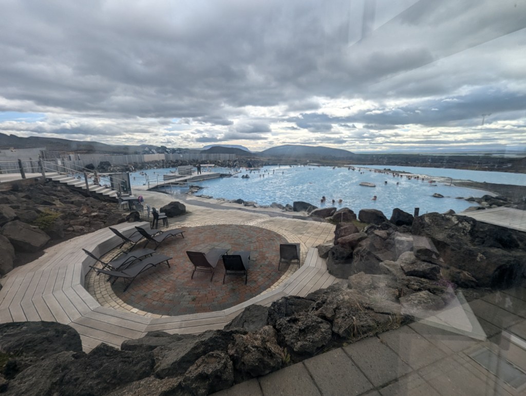
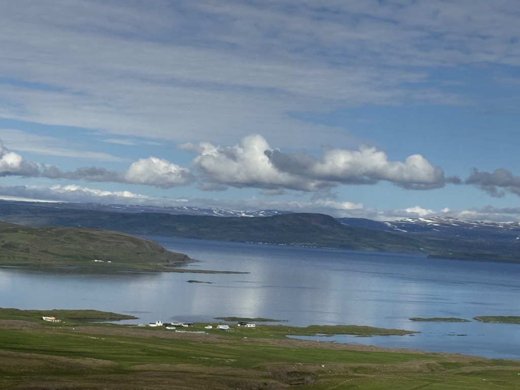
After a nice long soak and a quick shower, we drove to and around Mývatn Lake. We enjoyed an early dinner at the Skútustaðir Farmers’ Guesthouse. Afterward we strolled around the southern end of the lake enjoying the views.

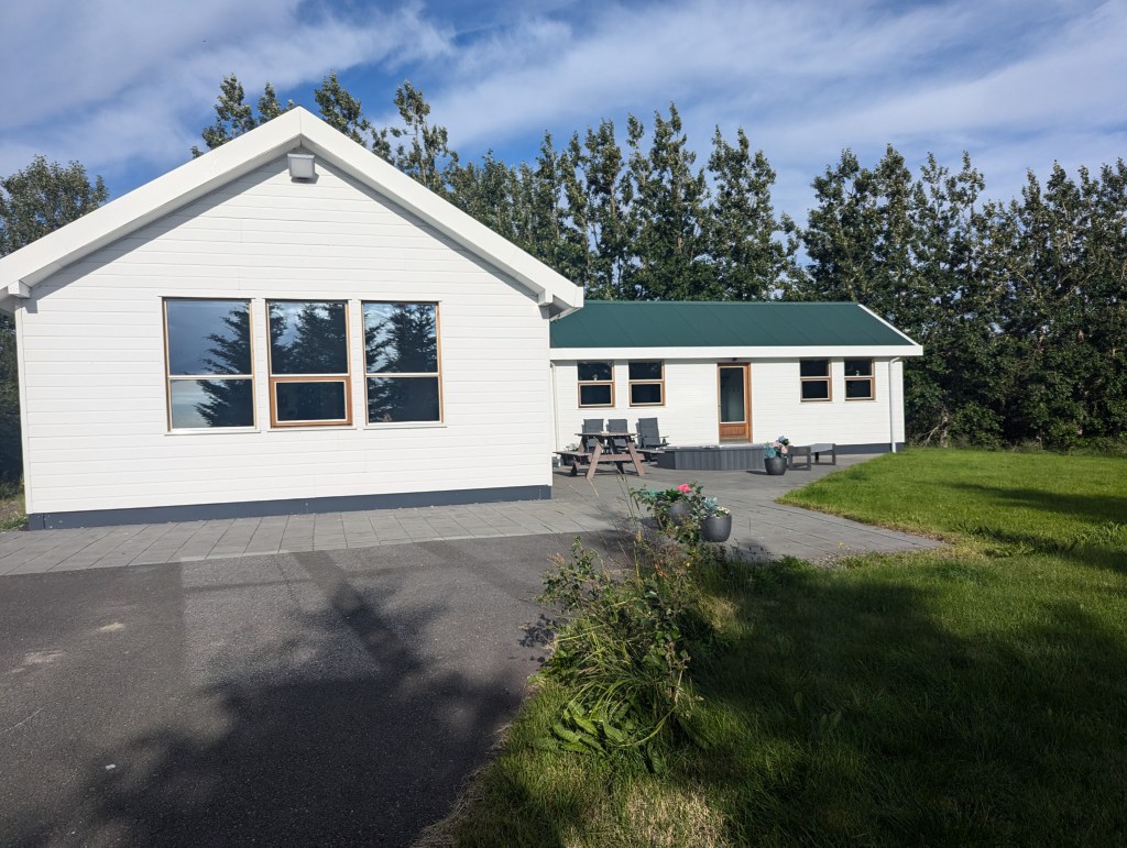
We found our AirBnb for the night in the middle of a farm 10-15 minutes from town in the middle of nowhere. We were in for the night, and it was peaceful.

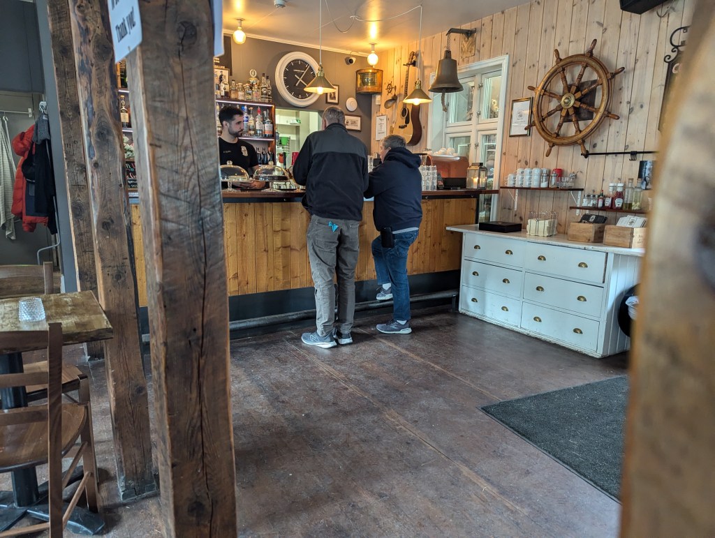
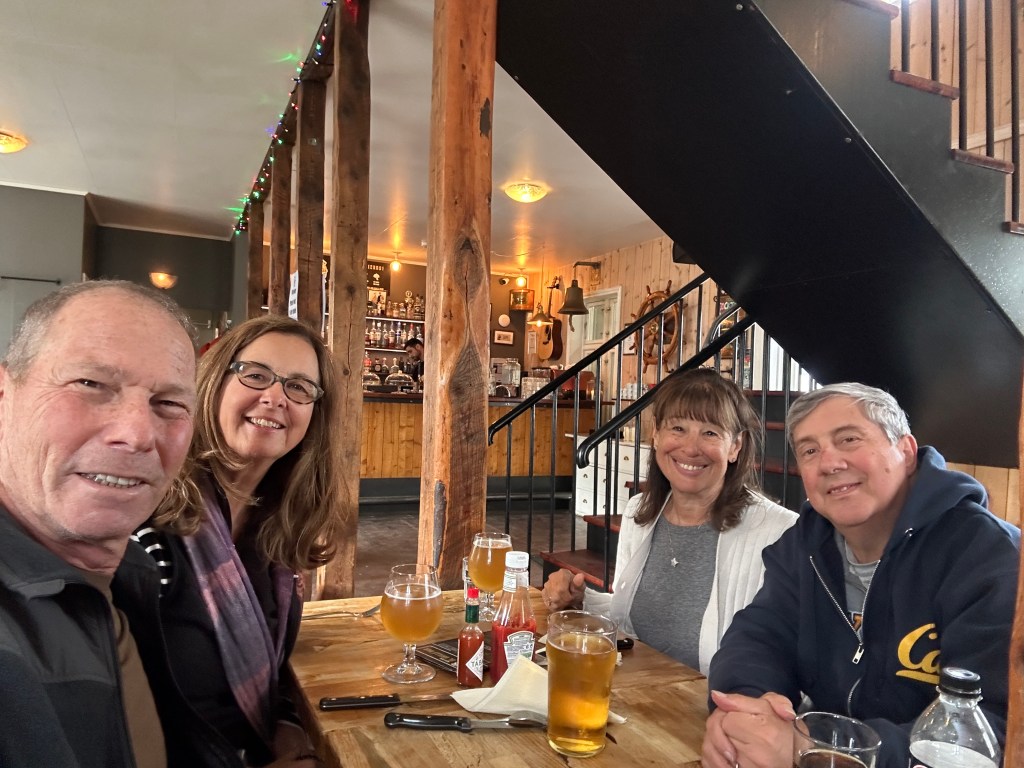
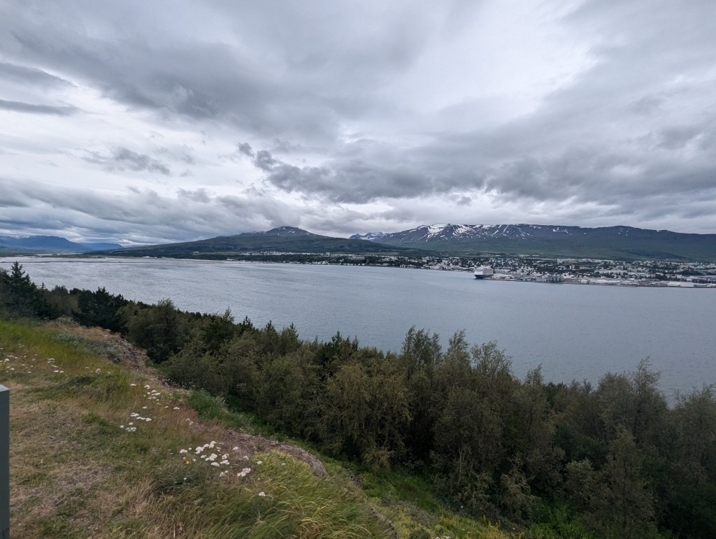
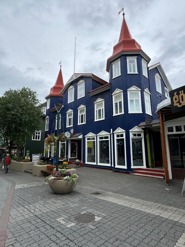
Our next stop in the morning was in the town of Akureyri. Dubbed the “capital of the north,” Akureyri has always been an important fishing port town. The way it is nestled between the mountains, it has a relatively mild winter; the port never freezes.

looking across the inlet at the town of Akureyri

We easily found the main street

and stopped for pastries at the french bakery.

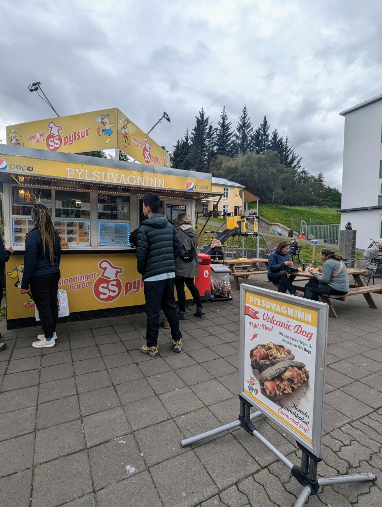
It is an international city with, in addition to the French eatery, German, American, and even Middle-eastern.

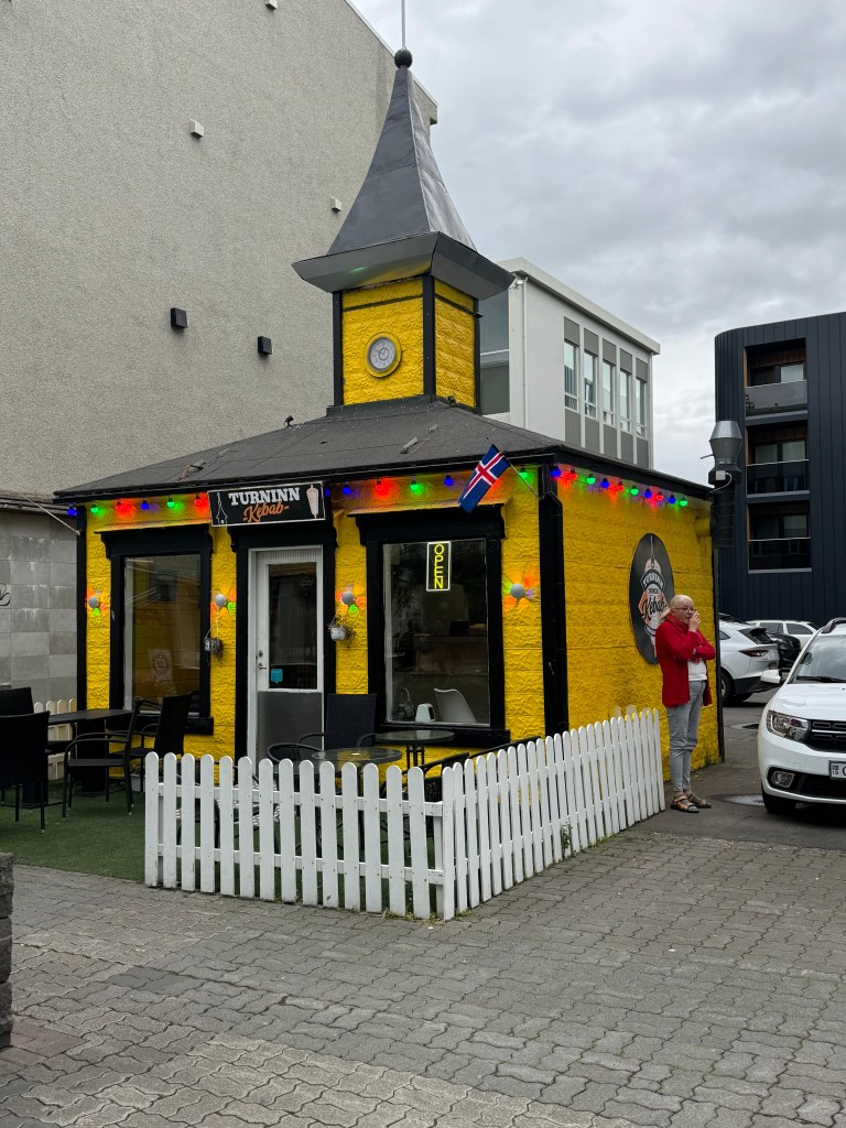
According to Feeding Phil hot dogs are quite popular and delicious, and we had yet to try one. So it was time, and yes, very delicious, as hot dogs go.

so many different toppings to choose from

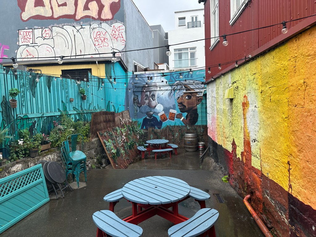
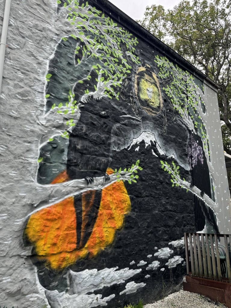
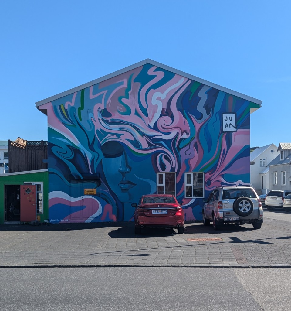
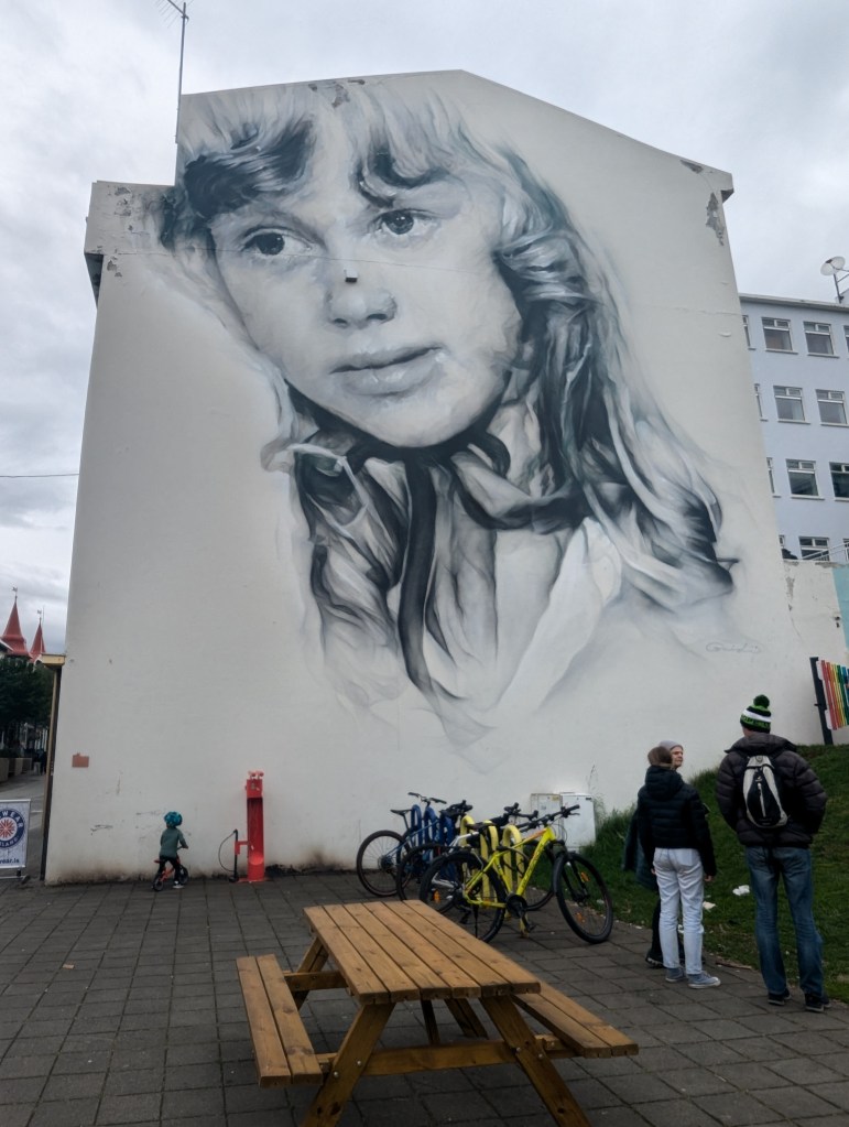
Akureyri has its share of beauty including this mural

and these flowers

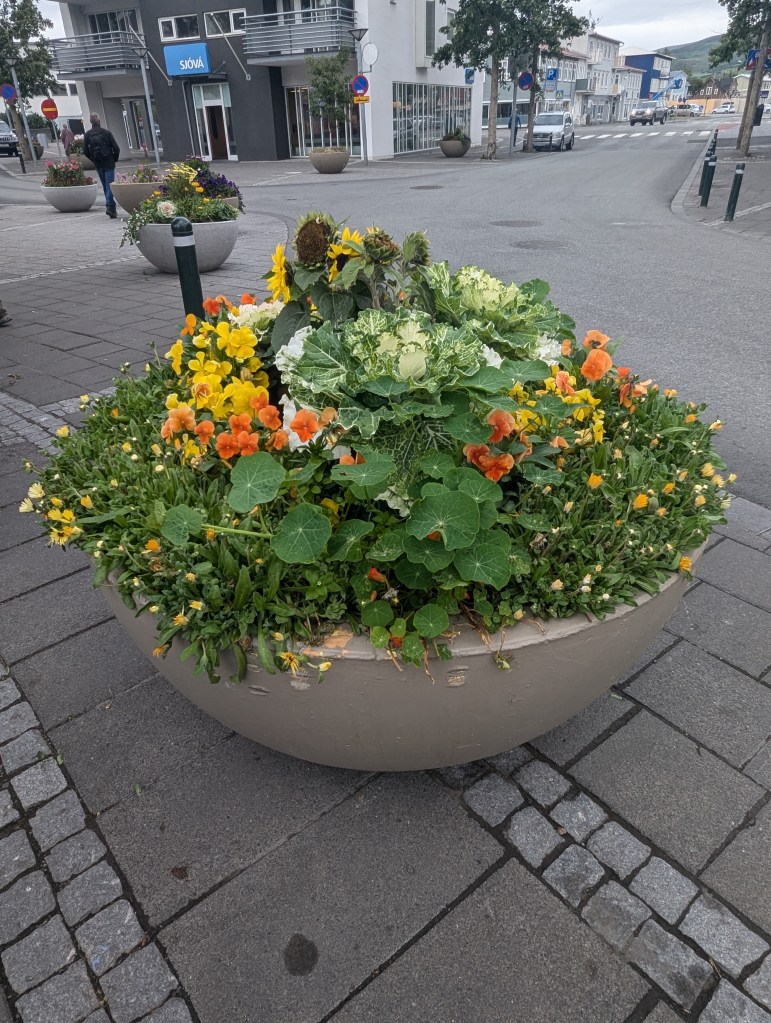
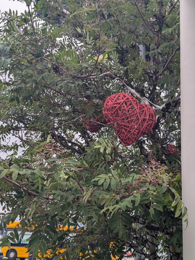
With the long daylight hours, the annuals are all huge. But what is most striking in Akureyri are the hearts: from the one in the main square above, to the streetlights

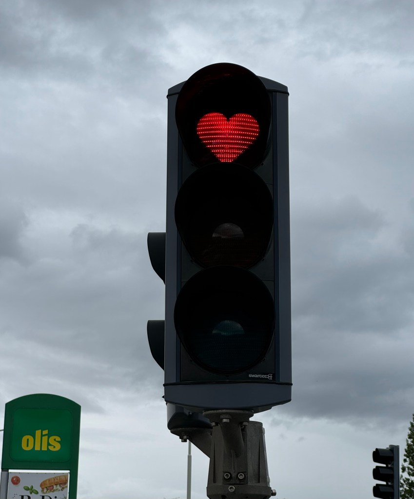
and even just random decorations in the trees.

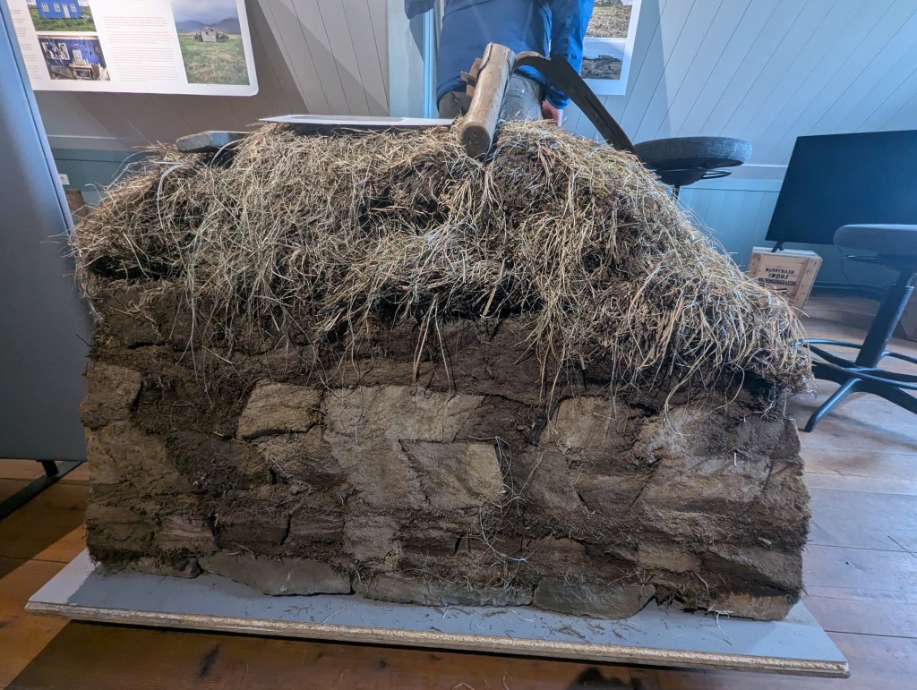
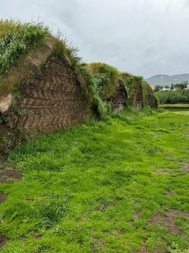
After spending the morning in Akureyri it was time to travel on further north and west. Along the way, mostly on the southern ring road, we had been seeing buildings that appeared to be built right into and under the ground. Very curious, I had looked them up and found that they are called turf houses. Historically, Iceland has very scarce home building materials. The rock is mostly volcanic, which is not sturdy for large structures. There are few trees native to the island, mostly just Aspens and Birch, neither of which are home sturdy. Icelanders developed a technique of building homes from turf. Turf homes are not stable over long periods of time; they need to be mostly replaced every decade or so. This explains why despite being continuously inhabited since the 10th century, Iceland lacks the majestic old buildings of Europe. With newer building materials, and the ability to ship them in, turf homes have fallen out of vogue. The few that remain are used mostly for farm animals or storage of feed or equipment for farm use. But a few turf homes are now maintained as museums. I was itching to visit one, and we were about to make that happen.

Glaumbær House Museum

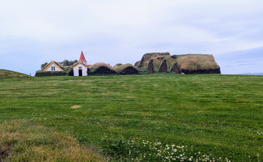
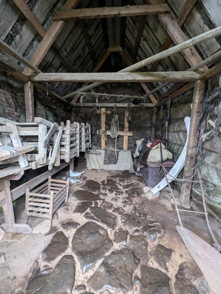
Glaumbær House Museum is actually a total of 13 buildings all joined through passageways. The farm site dates back to the 10th century, but the buildings only to the mid-17th century. The newest addition was added in the mid-18th century, and it has been maintained as a museum since the mid-19th century.

The walls of a turf home are built up in layers, usually at angles for stability.

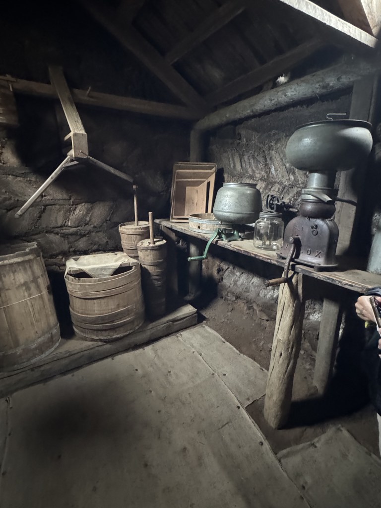
The side buildings of the complex include stables, storage, and a smithy’s workspace.

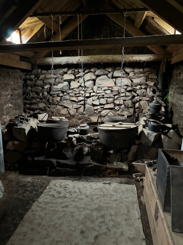
The central buildings include a kitchen

a couple of pantries,

and bedrooms,

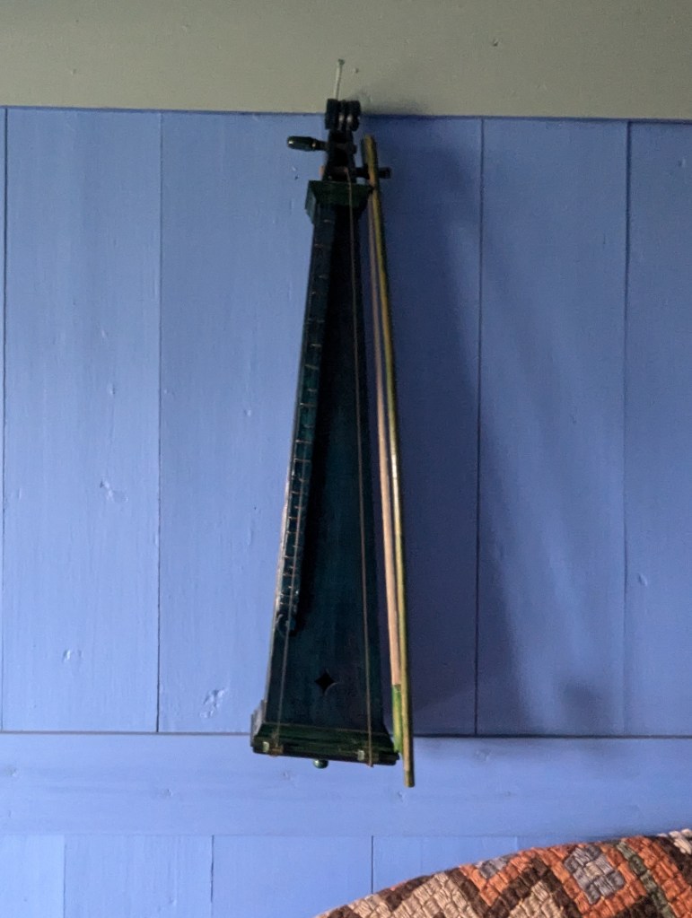
It is interesting the amount of comforts these early Icelanders had including musical instruments.

2 string instrument with bow

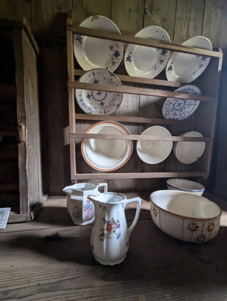
and some fine porcelains

But at their core, they are a hardworking group of people from spinning wool

to farming. Despite their isolation, travel was sometimes necessary in the winter.

notice the cross country skies hanging in the rafters above

Even the horse’s shoes have spikes for winter work and travel.

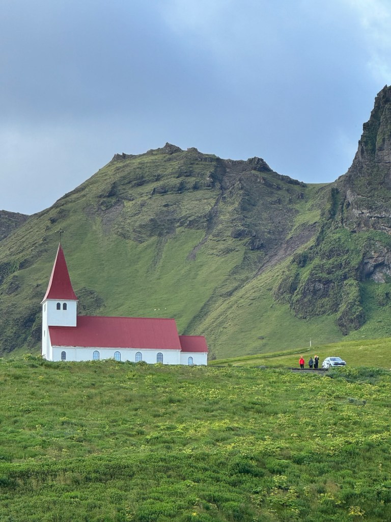
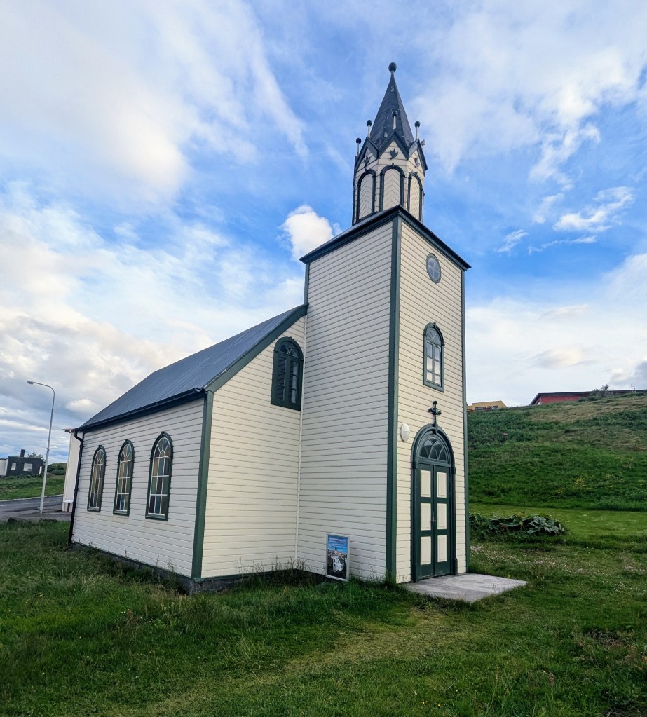
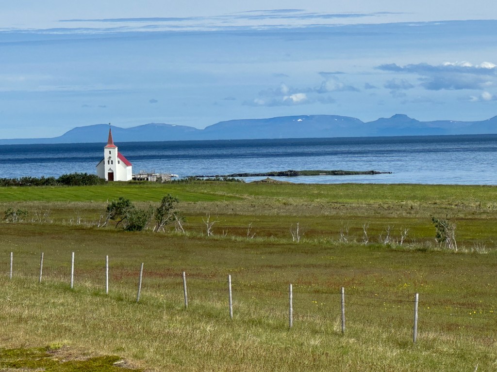
Having exhausted our curiosity about the turf houses, it was time to move on. We were headed to Blönduós but decided to take the long way and stopped in the cute port town of Sauðárkrókur for some fish and chips. We stayed the night at the Blönduós Hotel, which was charming and had some gorgeous views.

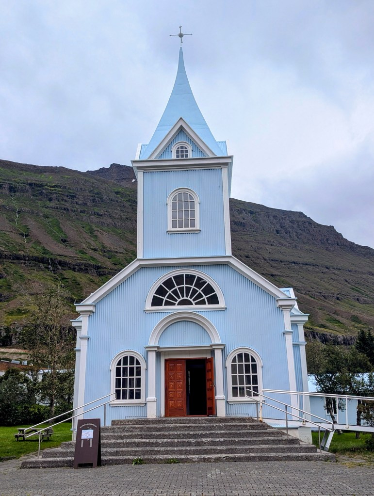
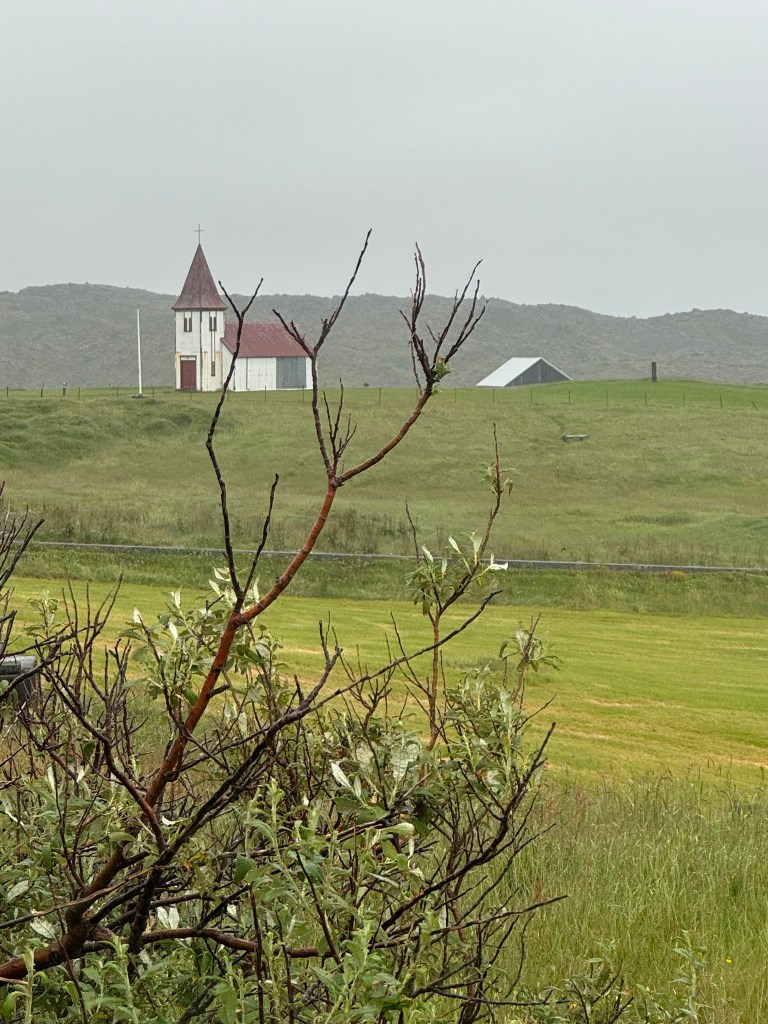
It was situated right next to a photogenic church.

And we finally managed to stay up late enough for the beginnings of a sunset, which were now more than an hour earlier (about 11:30 pm) than they had been when we first arrived in Iceland over a week prior.

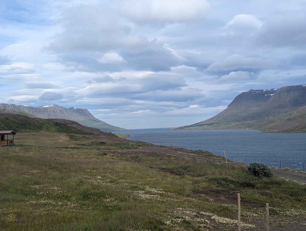
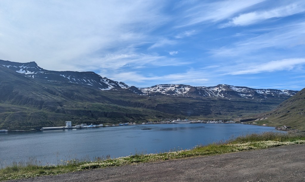
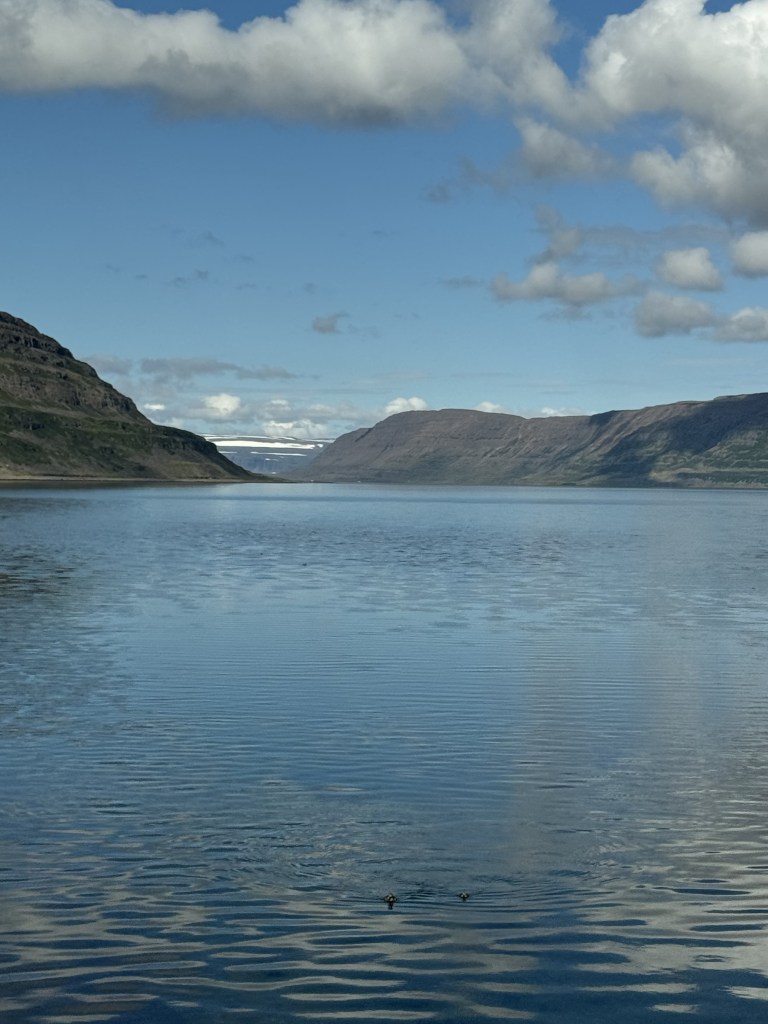
It was time to venture into the West Fjords, destination: Ísafjörður, a 5-6 hour drive. Today was to be all about the journey. After our wheel-gripping drive on 95 in the east, we asked route advice from the hotel receptionist. Google maps was taking us on route 60, which is the route we would need to take in a few days to head south. We wanted to consider route 61, which weaves in and out of the fjords, but were afraid of the risk. She kind of reassured us that although route 60 is the way most Icelanders would choose (more on this later), route 61 is indeed the much more scenic route, would avoid redundancy, and is perfectly safe with roads in decent shape. So off we went. Indeed the journey was spectacular.

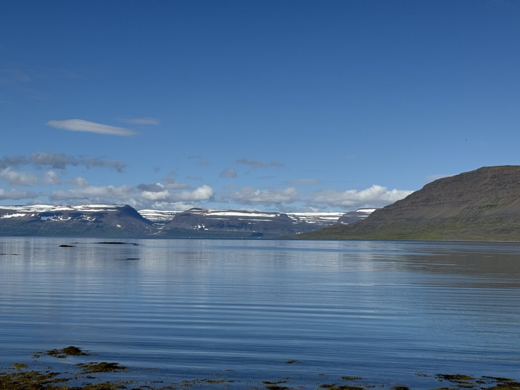
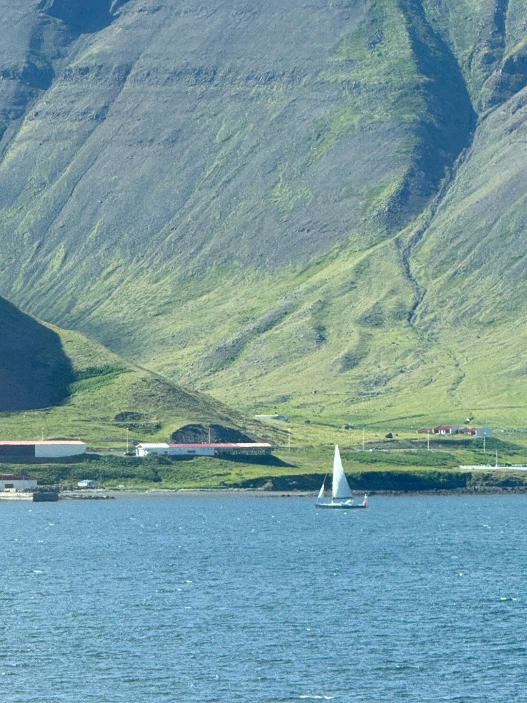
It was a long beautiful day. In retrospect, we were very lucky to have sunshine for our drive through the fjords. We awoke, the next morning, in Ísafjörður to pouring rain. After a hearty breakfast at the Torg Hotel, we strolled around town. It is a popular tourist destination; there were 4 cruise ships docked for the day. Additionally, there are many sailboats in the harbor.

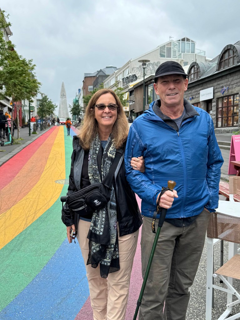
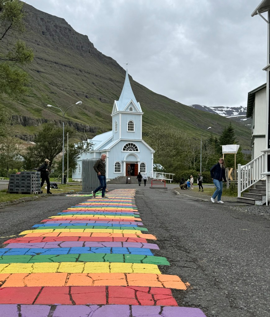
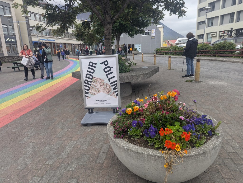
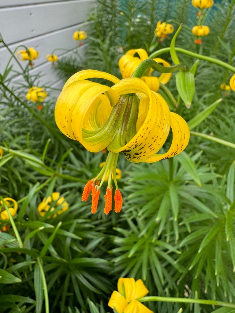
The town has the now familiar rainbow street with planted containers.

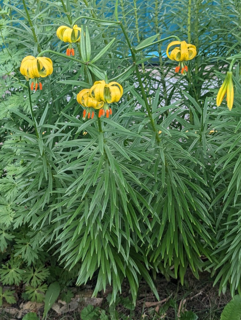
and this new-to-us variety of lily

As the rain worsened, we headed to the Arctic Fox Museum. There we learned that the arctic fox was the first land mammal to inhabit Iceland, arriving on ice floats about 1,000 years before the Vikings. In addition to exhibits about their history, adaptability, food, and habitat, there are some rescue foxes, so cute, in pens in the back.

The rain was even steadier and colder than ever, so we called the sightseeing quits for the day, went back to the hotel restaurant, ate, drank, and played cards the rest of the day.

The morning brought less rain but still heavy fog. Alas, we had a ferry to catch, so off we went. We left Ísafjörður on route 60 through the tunnel which is about 6 km long, carved out of the mountain, very dark, and for most of its length only one lane wide with pullovers to allow for oncoming cars. Talk about a white knuckle drive! We were all happy Eric was doing the driving. So glad at this point that our trip into town was via the fjords!

We had time before our ferry to stop at the Dynjandi bílastæði, a group of 6 successive waterfalls. As a group, they make up the largest waterfall in the West Fjords. Dynjandi means thunderous, which is evident from the second one is out of the car.

All 6 cannot be seen at once, so we hiked up along the falls for a better look.

to just below the top 2 falls.

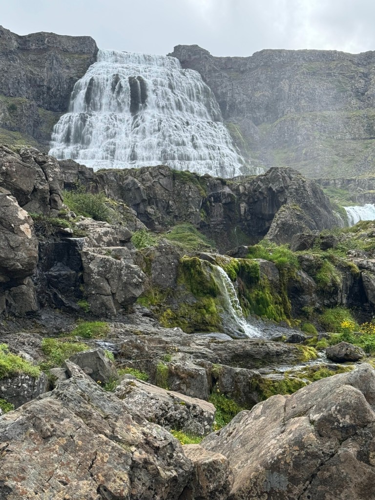
But time would not allow us to go further.

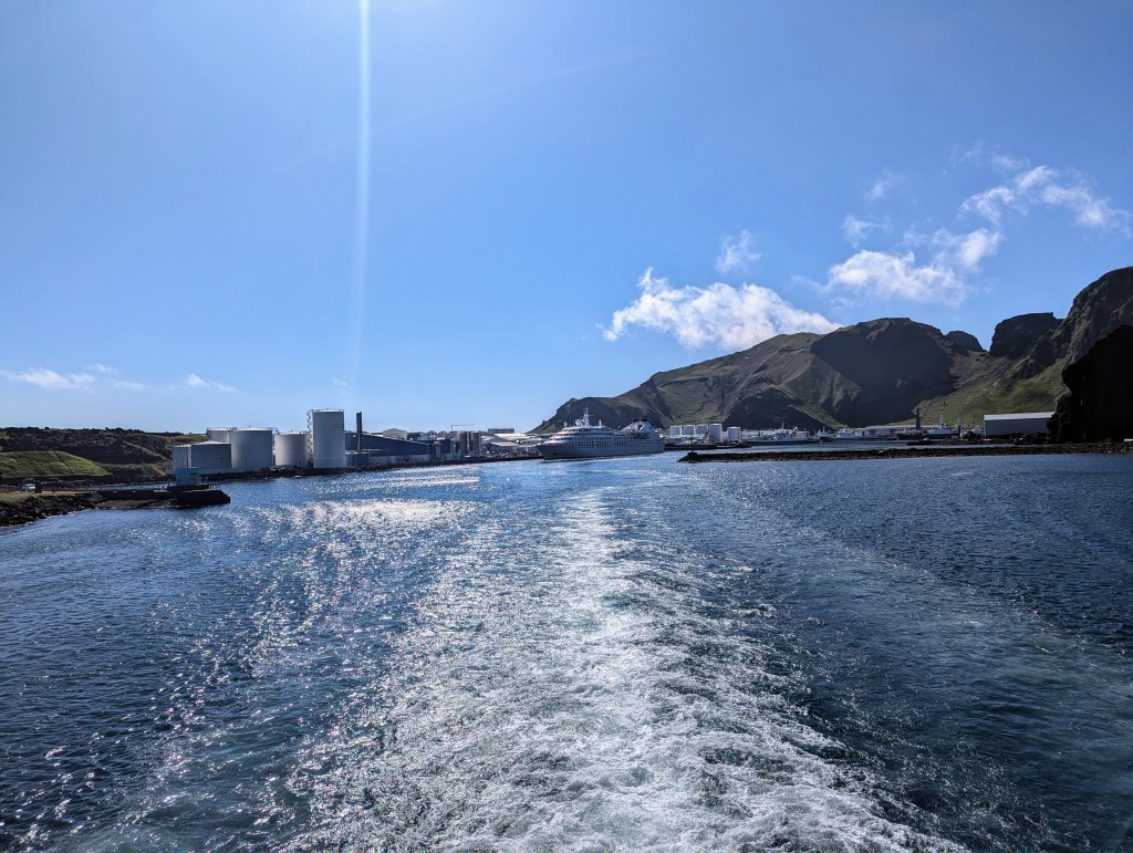
So back into the car we clambered in the fog and made our way on route 60 up over a mostly single lane, still under construction, barely drivable road in the dense fog, hard to see the car in front of you! And this was the route most Icelanders would have chosen from Blönduós!? We were so glad we had chosen the sunny fjord-hugging scenic route 61. We made it to Breidafjörður Bay in time for the ferry, phew, and had a relaxing if foggy journey across to Stykkishólmur on the Snæfellsnes peninsula.

Our AirBnb host had warned us there would be no grocery store nearby, so we stopped in Breidafjörður for groceries. Throughout Iceland is a chain of supermarkets called Bonus.

Then, because one can never see too many waterfalls, we stopped for pictures at Kirkjufellsfoss.

Kirkjufellsfoss

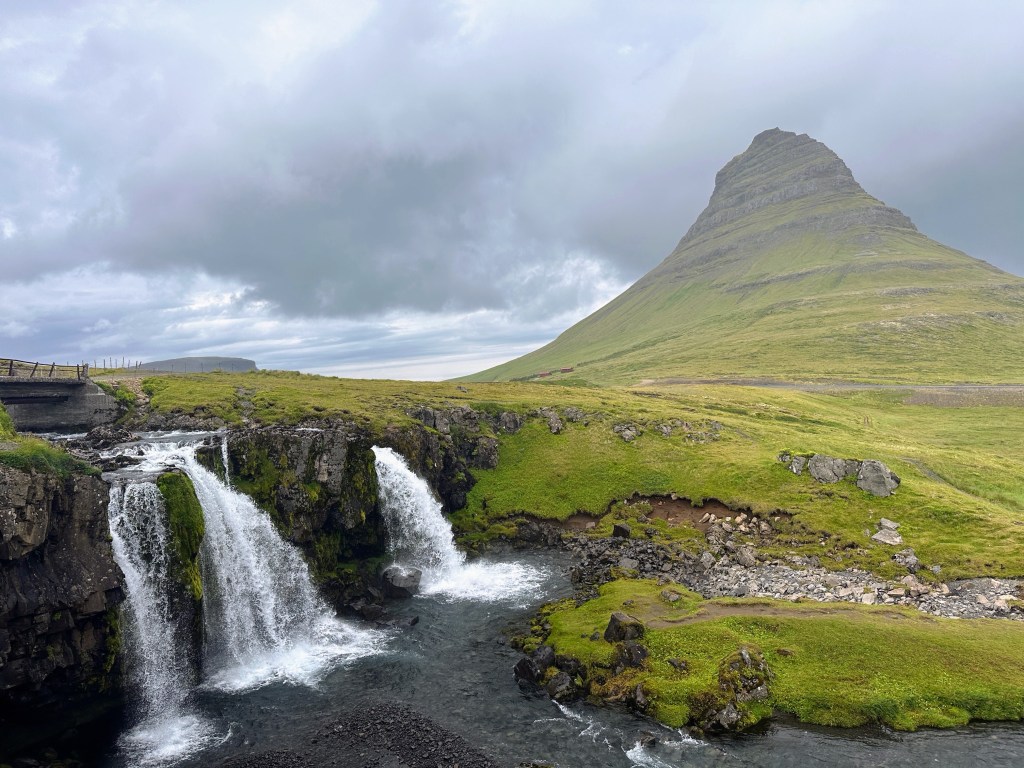
Kirkjufellsfoss is one of the most photographed waterfalls in Iceland. The river Kirkjufellsá runs down from the volcano Helgrindur and has three waterfalls in it, all called Kirkjufellsfoss. Its name translates to “Church Mountain Falls,” and this small, enchanting waterfall is only 16 feet high. The waterfall’s beauty forms a stunning visual as it captures Mt. Kirkjufell from an angle that makes it seem triangular shaped. This is part of why it was used as “arrowhead mountain” in the television series Game of Thrones. We hiked to the bottom despite the pretty steady rain.

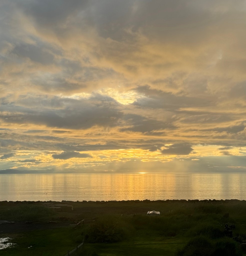
We found our AirBnb in Hellnar but quickly ventured out to the nearby Fosshotel for a warm and yummy dinner. Much later the rain and fog lifted enough for some pictures of the amazing views from our home.

In the morning we ventured out despite the heavy winds and steady rain. Our afternoon whale watching trip had been cancelled due to the storms, so we set out to explore the Snæfellsnes Peninsula.

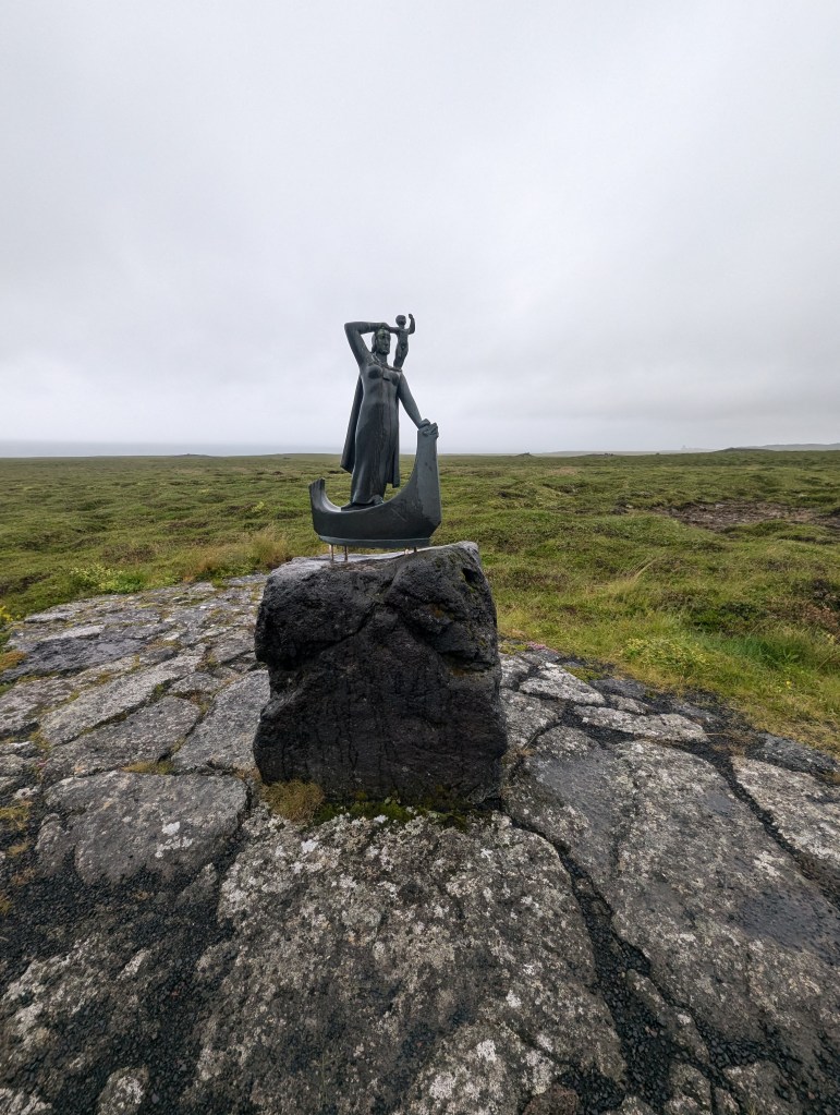
Our first stop was Laugarbrekka. Here, in her birthplace in 980, is a statue of Guðríður Þorbjarnardóttir, wife of Þorfinnur Karlsefni Þórdarson, who gave birth to a son in about 1004, during their stay in Vinland during one of Guðríður’s 8 voyages to North America! This son, Snorri Þorfinnsson was the first child of European descent to be born in North America. The statute shows Snorri is on Guðríður’s shoulders.

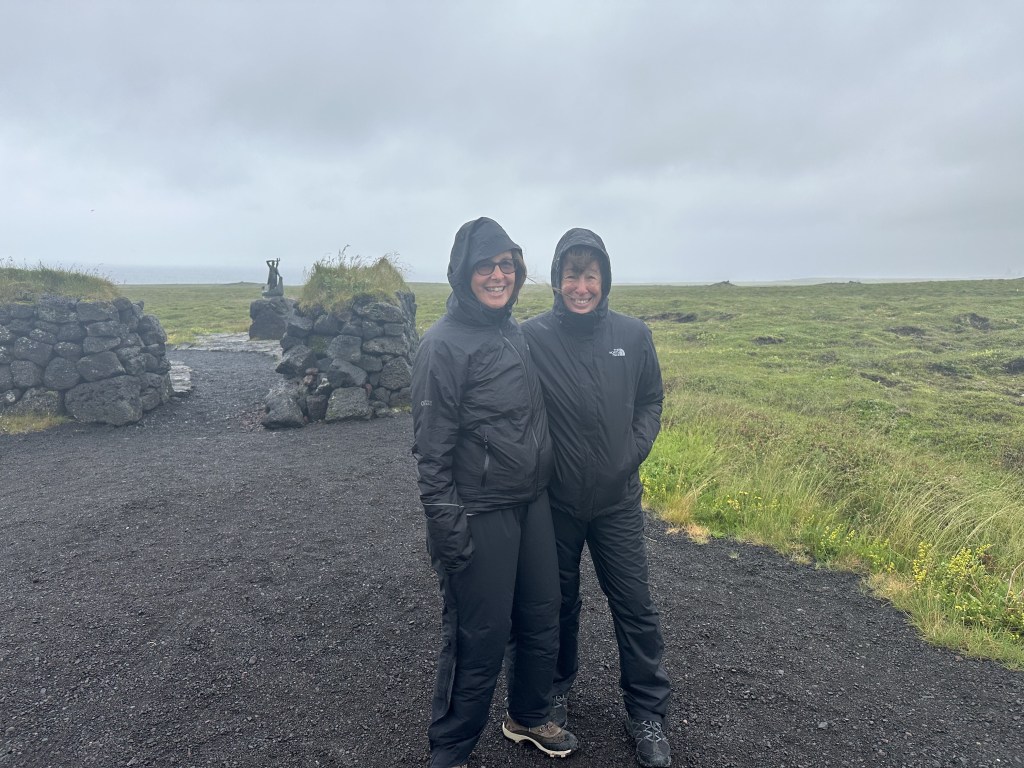
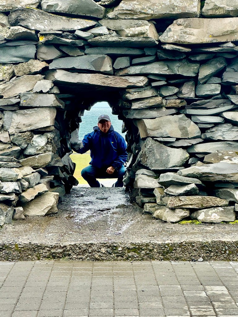
The following photo shows the actual small size of the statue, which can be seen in the background. But it also shows how we dressed from head to toe for the weather!

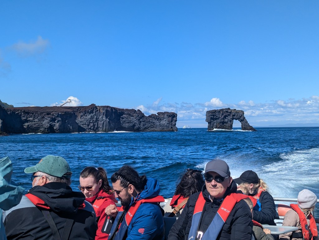
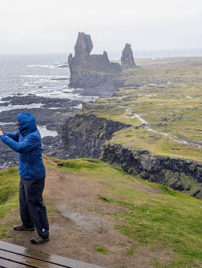
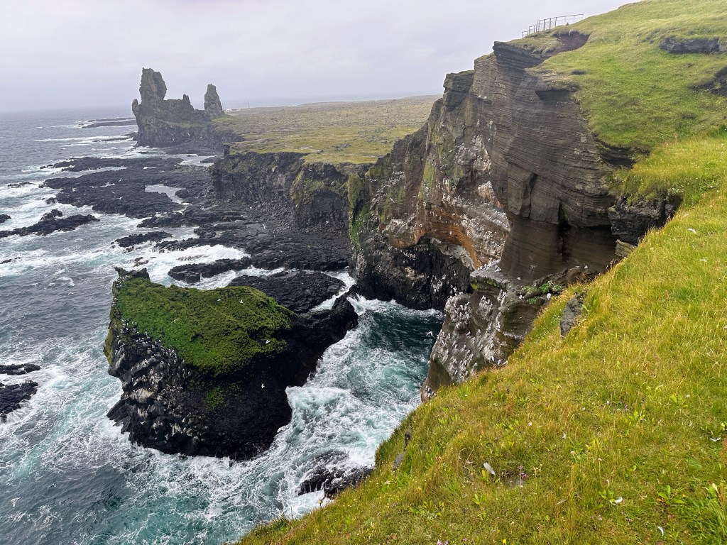
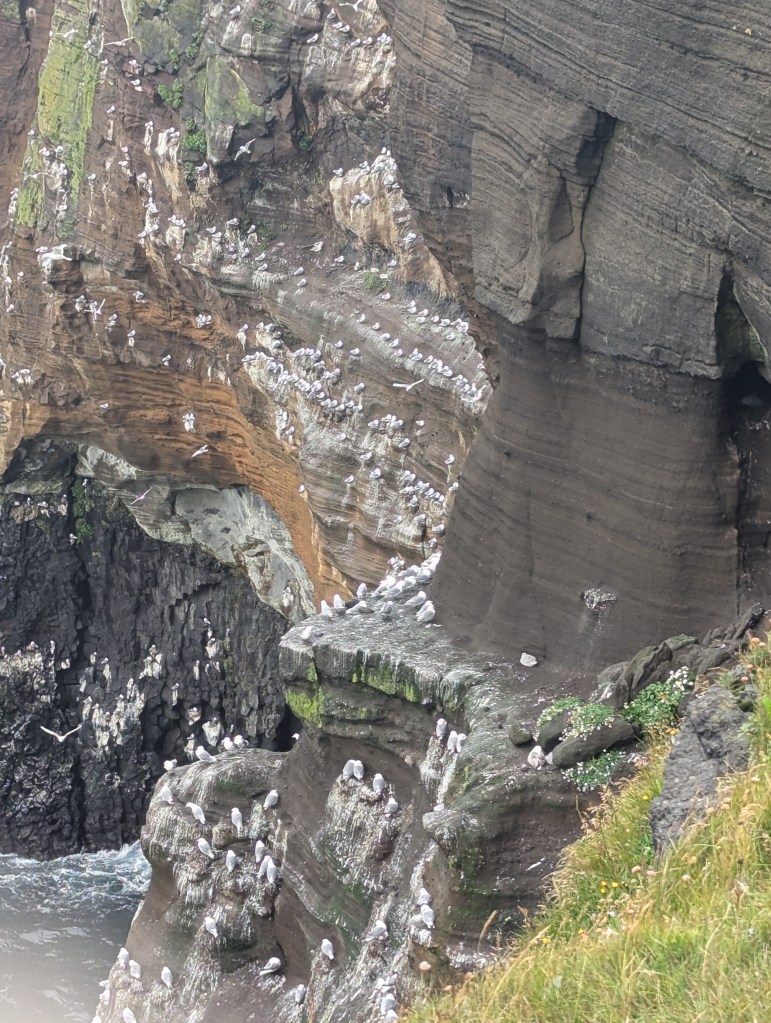
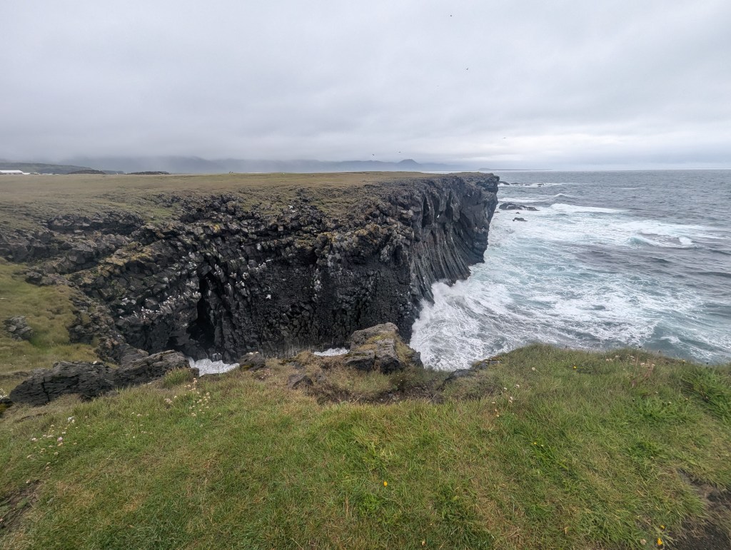
We traveled along the south of the Snæfellsnes peninsula until we reached the Þúfubjarg cliffs with their view of Lóndrangar: 2 volcanic plugs.

view of Lóndrangar n background

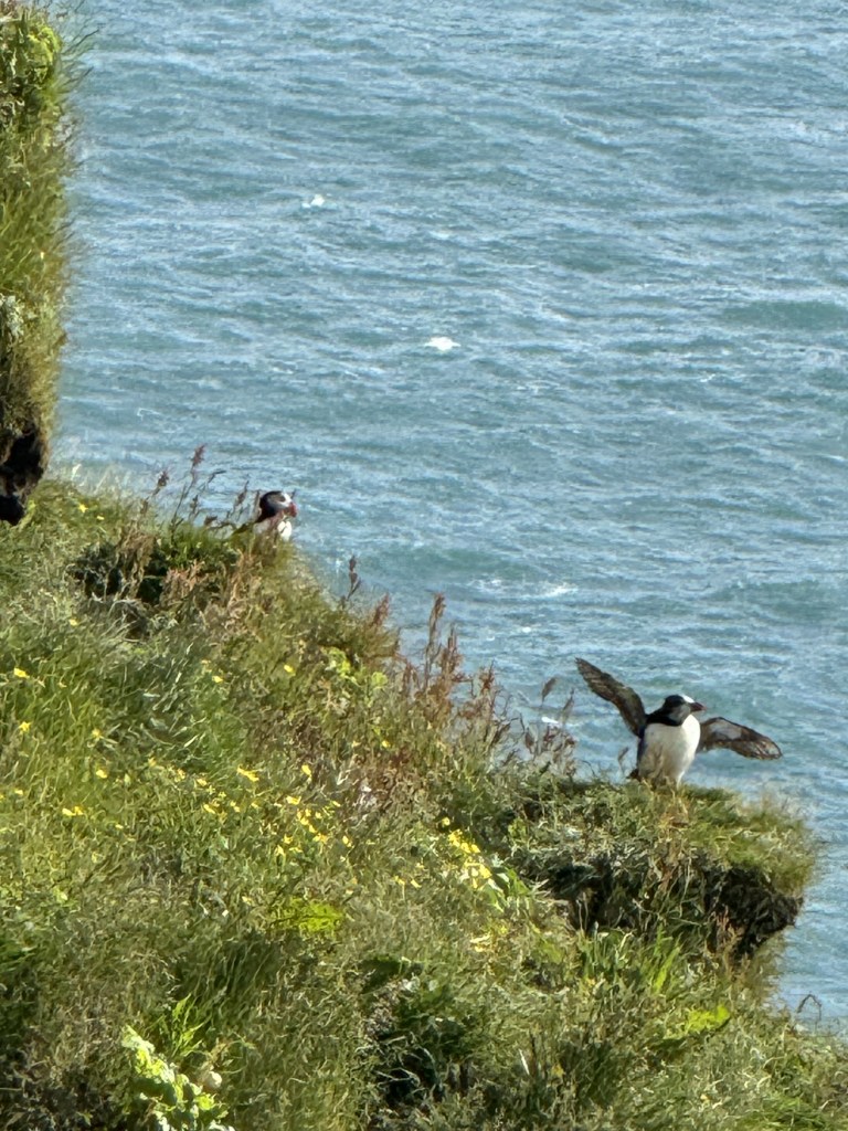
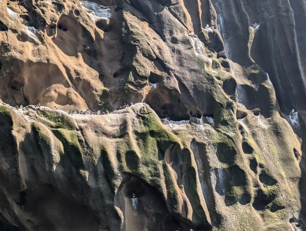
The Þúfubjarg cliffs are themselves beautiful and full of nesting birds.

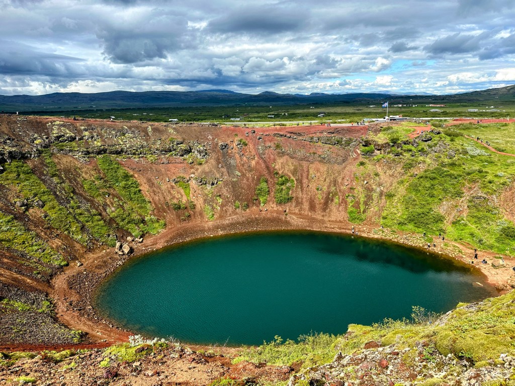
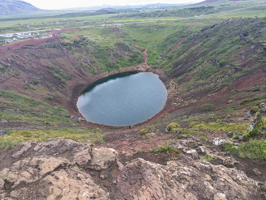
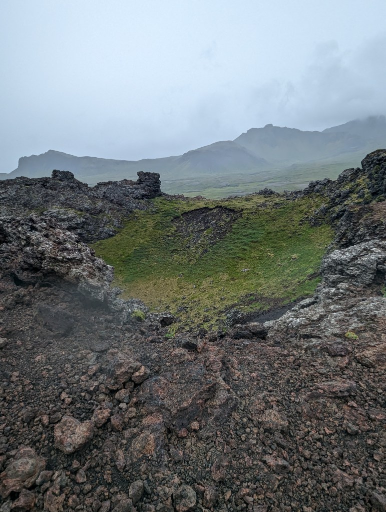
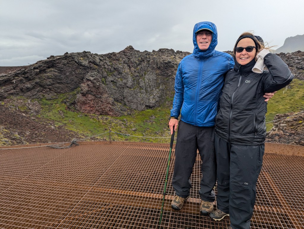
We drove around to and hiked up to the Saxhóll Crater. Compared to the Kerið Crater we had seen in the Golden Circle, the many steps in the heavy wind made this one not worth the effort.

We drove around the peninsula a bit more, but ultimately decided to give up on the day. In the evening we ventured out to Arnarstapi to a cute place for dinner of fish and chips and beer.

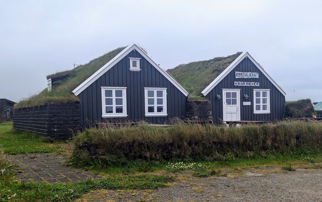
In the morning, the sun was trying to peak through the fog. We headed back to Arnarstapi to take pictures of the big stone structure of Bárður Snæfellsás. It was made by the Icelandic sculptor, Ragnar Kjartansson and was unveiled in 1985.

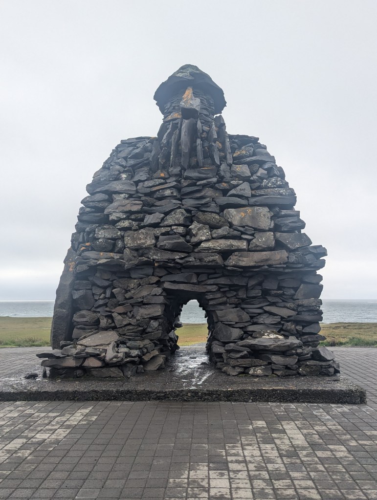
Bárður Snæfellsás was the settler of this area, half a troll, and half a man, but his mother was human. He came to Iceland in the 9th century and gave the peninsula its name, Snjófellsnes peninsula, but both words “snær” and “snjór” mean snow in Icelandic.

Beyond the statue are gorgeous cliffs filled with birds. This pathway connects the two tiny towns of Arnarstapi and Hellnar, and in good weather is probably a beautiful hike.

We ventured down to the beautiful natural harbor of Arnarstapi with its extraordinary columnar basalt and cliff formations.

The grounds are covered with cranebills

and succulents

As we left the Snæfellsnes Peninsula, the sun finally made a showing. So we decided to stop, where else, but at some more falls. First stop: Glannifoss. Glanni is a stunning waterfall in Nordura river. The locals believe it to be the dwelling place for elves and trolls. It was a short hike in from the parking lot, which is shared with the local golf course.

Glannifoss

Next stop: Hraunfossar and Barnafoss. Just when we thought we had seen enough waterfalls, we found these to be so very unique, it was more than worth the stop. Hraunfossar means Lava Falls. Water seems to magically appear from the lava.

panoramic view of Hraunfossar

However, it is actually a clear spring surging through lava. The lava field that Hraunfossar trickles through flowed from an eruption of one of the volcanoes lying under the nearby glacier of Langjökull, the second largest ice-cap in Iceland. The waterfalls pour into the Hvítá river from ledges of less porous rock in the lava.

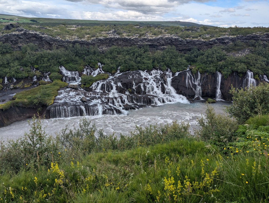
Looking back at it from upstream, the water seems to appear from the middle of the lava with no river above.

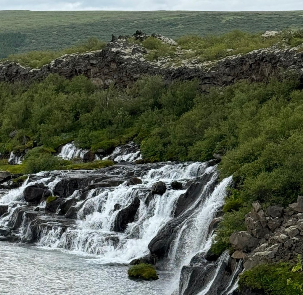
Upstream on the river is Barnafoss, “Child Falls,” and legend has it that one day two boys were left home while their parents went to church, but they got bored and decide to follow. When taking a shortcut, the two boys tried crossing the falls over a natural stone bridge but fell in and drowned. The mother of the boys cursed the bridge and shortly after it was destroyed by an earthquake.

Barnafoss

As we headed back to the parking lot, we could not resist a last group selfie.

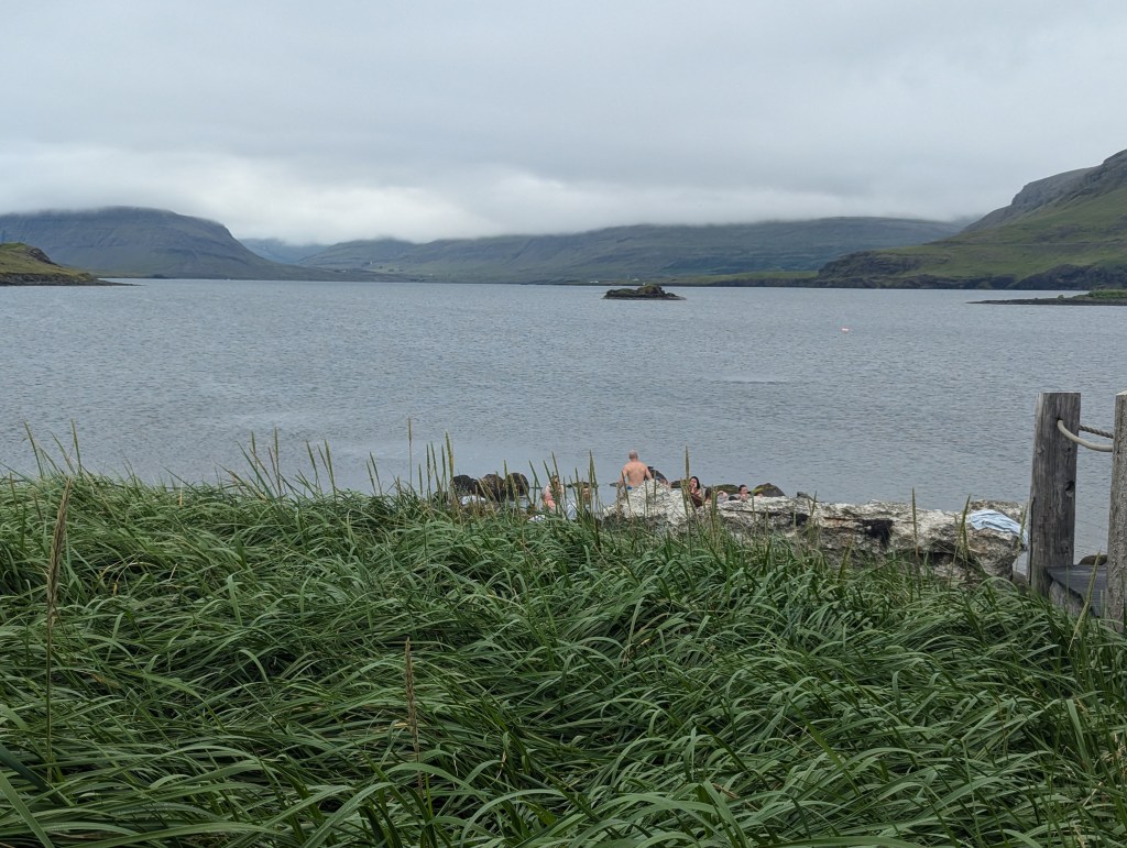
It was time to check into our last AirBnb (and accommodation) of the trip. To our delight we were booked on a horse farm with its own natural hot springs!

view looking left from behind the AirBnb
view looking the other way

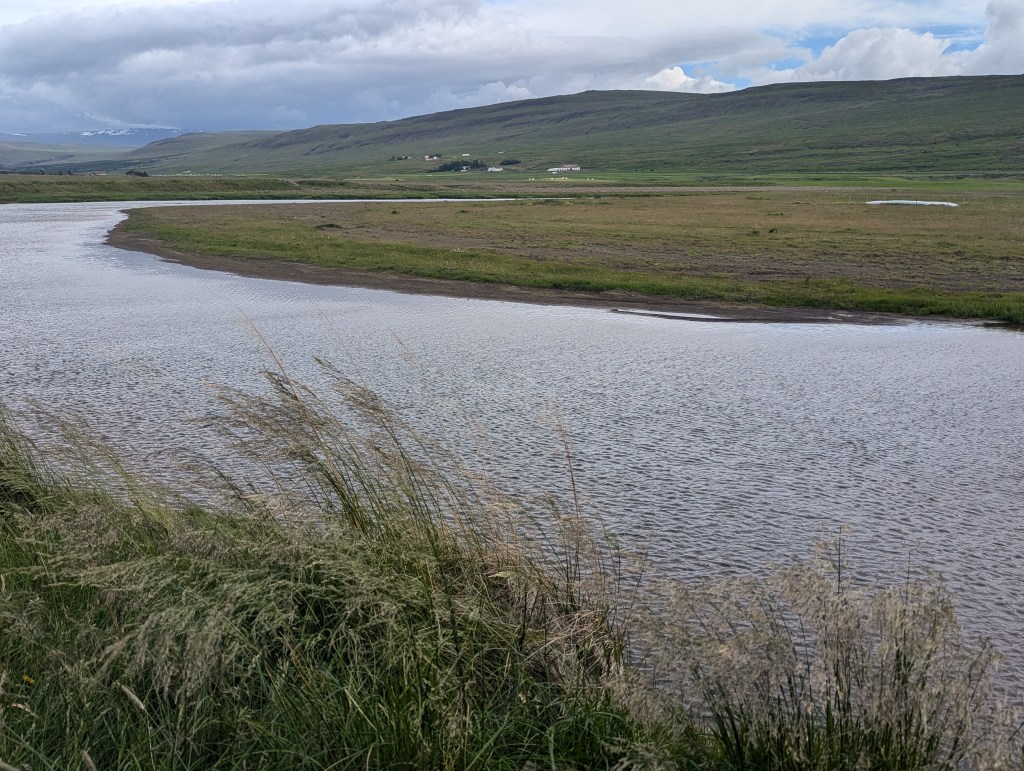
A hot spring can be seen in the distant bend in the river.

The host happened to be there and explained she runs the farm, and she breeds and trains her horses for show. In addition to our home, she has turned the old silo into a unique 1 BR AirBnb.

the barn is forward and to the right. Behind and to the left is the “Tower,” an AirBnb

But the most fun part: she took us into the paddock and introduced us to a 2 day-old foal!

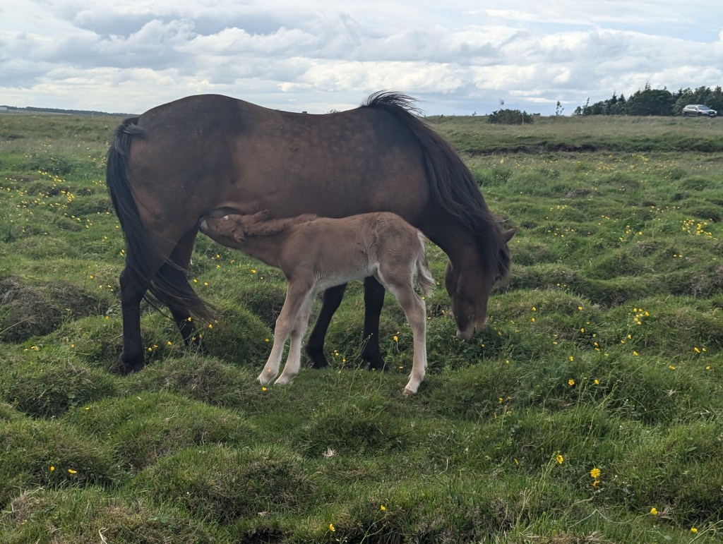
I could barely drag Carol from the horses.

The final morning we headed out early. We had booked a final hot springs stop on the way to the airport.

Hvammsvik Retreat and Hot Springs

The eight geothermal pools are surrounded by rocks and nestled in the hills over 1200 acres of beautiful nature (but picture taking is discouraged).

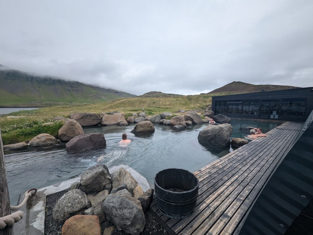
This pool is right on the ocean’s edge.

After a luxurious soak and a hot shower, we were off to the airport for the journey home.

Iceland Week 1: July 16-23

We flew to Reykjavik with friends Jeff and Carol and reached our AirBnb around midnight. Our host graciously met us at that late hour and aided us in finding our parking garage. We woke up surprisingly early considering the jetlag, and headed to the BRAUÐ & CO. BAKERY, featured on Feeding Phil. As he suggested, we bought cinnamon buns and happy marriage cake, and we were not disappointed.

Despite the rain, we headed out to the Blue Lagoon. Due to the cost and crowds, we had decided not to book a reservation for the hot springs, but wanted to see the site. The recent volcanic activity in the area caused some road closures and detours, but we arrived nonetheless.

Of note, we took a group selfie at every site for the 2 weeks we were together. I will include only a few here.

outside the spa swimming is not allowed

After walking around outside, we peeked in.

Blue Lagoon Spa

We then drove back into Reykjavik, had our first expensive lunch of Icelandic street food: fish & chips, fish stew with rye bread, and bisque, totaling for the 4 of us over $100, wow for street food. We then strolled up the Rainbow Street toward the church.

Hallgrímskirkja, a Lutheran church, the largest in Iceland

The statue in front is of Leif Ericson (ca. 970 – ca. 1020) who is regarded as the first European to land in North America nearly 500 years before Christopher Columbus. According to the Sagas of Icelanders, he established a Norse settlement at Vinland, tentatively identified with the Norse L’Anse aux Meadows on the northern tip of Newfoundland in modern-day Canada.

Leif Erikson

Inside the church we found austere surroundings with a huge organ.

The Concert Organ in Hallgrímskirkja was built by the Johannes Klais organ factory in Bonn, Germany and is the largest musical instrument in Iceland.

We then rode the elevator to the top of the bell tower to take in the views of Reykjavik, which were striking despite the rain and fog.

After leaving the church, we strolled around in the drizzle and enjoyed the colorful homes and businesses that enhance the city’s decor.

We continued down to the waterfront and visited the arts center: Harpa, which opened in 2011.  The building features a distinctive colored glass facade inspired by the basalt landscape of Iceland.

Before heading back to our AirBnb, we could not resist stopping by the Phallological Museum.

We did not go inside, however, deciding that all we needed to see was at the entrance.

The next morning we set out to tour the Golden Circle. First stop was Þingvellir National Park (pronounced Thingviller). Þingvellir National Park is a unique site in Iceland as it’s both historically significant as well as being a geological wonder. It has the honor of being the first established national park in Iceland and the only one receiving UNESCO status. It is a place where dramatic geology meets a millennium of fascinating history. Here, visitors to Þingvellir can discover the roots of this island’s formation and how the Icelandic settlers formed their leaderless society. The park’s unique geology comes from its location between the North American and Eurasian tectonic plates, which create the rift valley that runs through Iceland. Iceland is the only country where this valley, the Mid-Atlantic Ridge, can be seen above sea level. Nowhere is it more visible than in the park’s unique geology, which comes from its location between the North American and Eurasian tectonic plates, which create the rift valley that runs through Iceland. Iceland is the only country where this valley, the Mid-Atlantic Ridge, can be seen above sea level. Nowhere is it more visible than in Þingvellir National Park.

No single place epitomizes the history of Iceland and the Icelandic nation better than Þingvellir by the river Öxará. At Þingvellir – literally “Assembly Plains” – the Alþing general assembly was established around 930 and continued to convene there until 1798. Major events in the history of Iceland have taken place at Þingvellir and therefore the place is held in high esteem by all Icelanders. Today Þingvellir is a protected national shrine. According to the law, passed in 1928, the protected area shall always be the property of the Icelandic nation, under the preservation of the Alþing.

The square in the foreground is part of the foundation for the original tribal meeting grounds in 930

On our way to the next site, we stopped at a working farm for lunch and had, of course, burgers.

Then we were off to our first geysers of the trip. They are to be found in the town of Geysir, for which they were named, derived from the Icelandic word geysa, which means “to go quickly forward.” The most famous there is the Strokkur Geyser, which spurts steam about 50-60 feet into the air about every 10 minutes but lasts only a few seconds, requiring one to be fast with the camera click.

Strokkur Geyser

In this geothermal area, there are several hot pools and smaller geysers too.

Our Golden Circle tour continued onward to the Gullfoss (foss is Icelandic for waterfalls).

On average 100,000 liters of glacial water from the river Hvítá plunge 31 meters into the Gullfossgljúfur canyon every second.

We walked all around this magnificent waterfall, taking it in from every angle.

Next we headed to our accommodations for the night: the Varmi Guest House, where our host was most amiable and upgraded Jeff and Carol’s rooms for the night. We were quite comfortable after our exhausting day.

In the morning, we headed slightly back to see the Kerið Crater, which we had passed the prior evening, but were too tired to climb. We were so happy we made the trip back; the crater was truly spectacular to see.

Kerid Crater

Kerið is approximately three thousand years old, making it roughly half the age of most volcanic calderas found in Iceland. This is the major reason as to why Kerið’s slopes are red in colour, rather than a volcanic black; the iron deposits are, geologically speaking, fresh. Kerið is approximately 55 metres (180 feet) deep, 170 metres (558 feet) wide and 270 meters (886 feet) in circumference. It is possible to take a path right to the crater’s edge, to fully encircle it, and to descend down to the pristine waters of the crater lake. We walked all the way around.

Then it was back into the car, grateful for our fist day of mostly sunshine, and drove along the southern portion of the ring road. We spotted some spectacular falls off to the left, and decided to make a stop.

Seljalandsfoss

Seljalandsfoss originates at the Eyjafjallajökull (jökull is Icelandic for glacier), which is relatively small glacier as they go in Iceland.

Eyjafjallajökull is currently famous for being the volcano which erupted in 2010 spewing huge amounts of ash into the air and disrupting air traffic

There we also noticed for the first time the flies swarming an Angelica plant, which is both a pollinator in Iceland and also historically used by Icelanders for medicinal purposes.

After hiking around the falls for a bit, we hopped back into the car and continued easterly along the southern ring road. We headed for Skógafoss. The drive was spectacular, and the fields are so lush and green we could not stop admiring all the breathtaking views out the car windows. We fist stopped for lunch at the hotel of the same name right by the falls. After lunch we hiked down to the falls for a look.

The Skógafoss is one of the biggest waterfalls in the country, with a width of 82 feet and a drop of 200 ft.

Next stop along our southern route was Sólheimajökull, no thanks to Google maps, which tried to lead us astray. Luckily with our better instincts (that road looked too rough for our rental car) and with the help of Rick Steves’ downloaded Iceland Guide, we found the parking lot. Sólheimajökull is popular with tourists due to it’s relative proximity to the road and thereby ease of access. It was to be our first somewhat upclose glacier.

Sólheimajökull is an outlier glacier of the larger Mýrdalsjökull which lies atop the Katla caldera.

The “dirty” appearance is from decades of movement down along the volcanic mountains while picking up rocks and debris.

Then we went on to our final site of the day: Dyrhólaey Lighthouse, which was built in 1910.

Dyrhólaey Lighthouse

From the peninsula atop which sits the lighthouse, we were able to look down onto the black sand beach.

Dyrhólaey literally means “the hill island with the door hole.” Looking out, we could appreciate its name.

We saw our first puffin.

And finally we headed into Vik for the night. There we checked into the Vik Apartments and had a delicious dinner at Suður near the church on the hill.


The next morning we set out super early on our sunniest and warmest day so far, which was fortunate because we were scheduled for a ferry ride. to the home of one of the largest puffin colonies in the world. We left the car behind in Landeyjahöfn and boarded Herjólfur (The Ferry) to Heimaey, the only inhabited island in the cluster of otherwise uninhabited Westman Islands (Vestmannaeyjar in Icelandic), which takes around 35-40 minutes one way. As we journeyed across, we were treated to views of Eyjafjallajökull (the ice capped volcano).

As we entered the Heimaey Harbor, we noted that even the ferries here in Iceland are electric. An aside note: 85% of energy consumed in Iceland is renewable (100% of electricity, the remaining to run the non electric vehicles), a remarkable and laudable number. Over 70% of the renewable energy comes from hydropower, most of the remaining from geothermal.

Heimaey Harbor

We strolled into town for a self guided walking tour. We were treated to several murals,

and some cute fun street art.

and, of course, a puffin bar.

We learned that there was a huge volcanic eruption in 1973 that started on January 23rd and lasted until July 3rd. Most of the residents evacuated to the mainland. The lava nearly buried the town. There was only one death reported, but several homes were lost. The pole below marks the height of the ash when Heimaey Island was deemed safe enough for the residents to return.

The advancing lava had consumed many homes. Blátindur, shown below, was a home originally built around 1910 and was destroyed except for the one wall, which could be seen sticking out of the mass of lava and rock. The locals have preserved it a a remembrance of how scary was that cold night in January.

Blátindur

We climbed up the mountain behind Blátindur to see the memorials to the homes consumed during the eruption, many of them 40-50 feet below.

From the top of the ’73 lava mountain we had a beautiful view of the harbor.

We visited the local historical museum and learned more about the ’73 eruption and also about the pirate raid of Heimaey in 1627. We also learned a lot about the local history and culture of fishing, preserving, and marketing the catch. The fishing industry, very hard work, was an entire family affair including women and small children. We also learned about the music, art and culture of Heimaey. Then it was time for lunch and our afternoon boat tour.

Again, we were so happy for the warm, sunny day we had for this excursion. Our guide on the boat told us lots of local stories including ones of the ’73 volcanic eruption and also expanded on stories we had learned about the 1627 pirate raid. She also told us about puffin rescue. Apparently puffins mate for life. After nesting during the summer months, burrowing into the grounds around the cliffs and laying a single egg, the adults migrate to a warmer climate for the winter and leave the pufflings (baby puffins) to fend for themselves. When they emerge from their burrows in the autumn months, the pufflings are confused by the lights in Vestmannaeyjar and wander into town. Their dense bones, which make for good diving, are too heavy for their tiny wings, making flight at this young age impossible. Normally they would leap off cliffs into the water below. They would die of starvation if left on their own. The locals collect the puffins, nurse and feed them until they are deemed by a local vet to be able to survive on their own. The pufflings are then tossed off cliffs to sail to the waters below. As we toured around on the boat hundreds of puffins were swarming the skies above and around us. Unfortunately, they are so tiny, they are tough to catch in a picture. In the picture below, all the little white dots and most in the air are puffins.

Other birds in the area include razorbills, common murres, petrels, and fulmars. The pictures do not even come close to capturing the magnificence of these bird colonies.

Sheep also dot the top of the islands. They are hauled up there by cranes on boats inside of a body wrap. Their purpose is to keep the grass short enough for the pufflings to be able to emerge from their burrows in the fall. A few houses can be seen dotting the islands. Historically they were hunting cabins (bird hunting is now no longer legal). They are now used as “man caves.” The one below (on the left) is called “the loneliest house in the world.”

Our boat entered a little cave, which was beautiful and had amazing acoustics.

Once back in the harbor, it was time to jump back onto our ferry and head back to the mainland.

On the way we were treated to a rainbow over Eyjafjallajökull.

In the morning we headed toward Skaftafell National Park, which since 2008 has been part of Vatnajökull National Park. We were still on the southern part of the ring road, but the landscapes changed significantly from the lush greens we had been seeing to the browns of rocks.

Along the way we stopped to take photos of more glaciers. Hvannadalshnjúkur is a peak on the northwestern rim of the summit crater of the Öræfajökull (glacier covered volcano) in Vatnajökull National Park. Its summit is the highest point in the country. Unfortunately, due to the fog, we could not see the peak, but we did see the edges of the glacier.

We entered Skaftafell and parked just as the rain was stopping. We hiked up to Svartifoss, making photo stops along the way.

And viewing the smaller falls on the trail. Time to comment: there are approximately 10,000 waterfalls in Iceland!

After about an hour’s hike, we made it to Svartifoss.

Svartifoss

Ice-cold meltwater from Svínafellsjökull feeds the famous Svartifoss. The waterfall tumbles down 80 ft over a cliff, which is bordered on both sides by tall black basalt columns, (which refers back to the image of Harpa in Reykjavik). It resembles pipes of a giant organ, which is where the waterfall gets its name.

Basalt is a volcanic rock formed from the superheated magma that emerges as lava during an eruption. Hexagonal basalt rocks form as lava cools and contracts, creating shapes that minimize stress and surface area, with hexagons being the most efficient pattern. Basalt volcanic rock has a special geometrical shape due to this change in composition. In volcanic rocks, straight and regular columnar fractures are known as a colonnade.

These basalt pillars and hexagonal rock formations you see have a special feature called columnar jointing. This is what gives each basalt column their unmistakable hexagonal shape and makes them so neat to look at. Columnar jointing has also been found in planets like Mars. With time and the elements, the columns crack and fall.

As we climbed back into the car, the rain started back up. We were so lucky to have had the reprieve during our hike! We drove to the nearby Fosshotel, our most luxurious digs of the trip. There we relaxed in the outdoor hot tub with glacier views before enjoying a gourmet meal.

Vatnajökull (2110 m) is the largest glacier in Iceland and it’s also the largest glacier mass in Europe. It covers an area of roughly between 8100 sq. km and 8300 sq. km, and it’s about 1000 m thick at its thickest point. Its average thickness is 400 – 500 m, and the total ice volume of Vatnajokull is probably in the vicinity of 3300 cubic km.

Vatnajökull

The next morning the weather had again turned cloudy and windy!! It was to be our longest day of driving thus far. Our first stop, still along the southern ring road, was Jökulsárlón, a large glacial lake in southern part of Vatnajökull National Park. Situated at the head of the Breiðamerkurjökull glacier, it developed into a lake after the glacier started receding from the edge of the Atlantic ocean. The lake has grown since then at varying rates because of melting of the glaciers. The glacial front is now about 5.0 mi away from the ocean’s edge and the lake covers an area of about 6.9 sq mi. In 2009 it was reported to be the deepest lake in Iceland, at over 932 ft. The size of the lake has increased fourfold since the 1970s.

Breiðamerkurjökull in the background

As the glacier breaks into the lake, icebergs are formed, flow, and break apart. Wish I could upload the videos.

panorama of Jökulsárlón

Words cannot describe, nor pictures capture, neither the intensity and variety of blues…

…nor nature’s sculpted beauty.

Did I mention the wind? In the picture below, Carol and I are laughing hysterically as we try to hold each other from blowing off the overlook.

We did not need to be told the safety warnings below.

Ultimately the icebergs float under the bridge and out into the open ocean.

All that excitement, and we were less than a half hour into our 4-5 hour drive! Once again Google maps led us in a direction I would avoid if doing this trip again. We were headed for Seyðisfjörður, and were routed via route 95, which appeared to be a shortcut from the ring road. But alas, it was a dirt road over some desolate driving terrain, and we ultimately intersected back to the ring road anyway, not worth the 20-30 minutes saved. We crossed the ring road in Egilsstaðir, drove up over a mountain, and arrived in Seyðisfjörður in the late afternoon hungry and tired. We were treated to a cute little town nestled at the mouth of the Fjarðará River and at the innermost point of the fjord of the same name as the town.

Originally a fishing village, it is known for its cute historic buildings.

Seyðisfjörður was the recipient of the first telegraph cable in 1906, was the site of the country’s first hydroelectric plant built via a dam in 1913, and was a base for British and American soldiers in WWII. Today the town’s major economy is tourism.

We strolled around the local shops.

Then we headed into the local bar for an early dinner.

Then we headed to our AirBnb, which was just outside of town in the most beautiful setting.

With a gorgeous view of the fjord.

And another view of the harbor. We awoke in the morning to a cruise ship at dock.