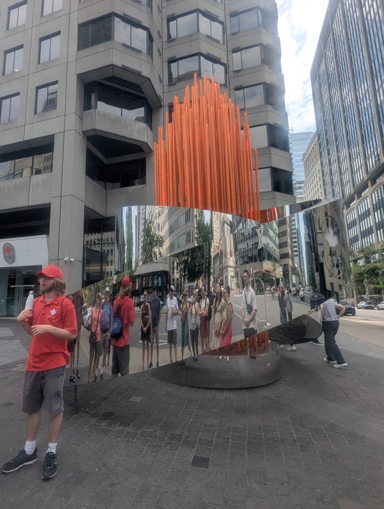
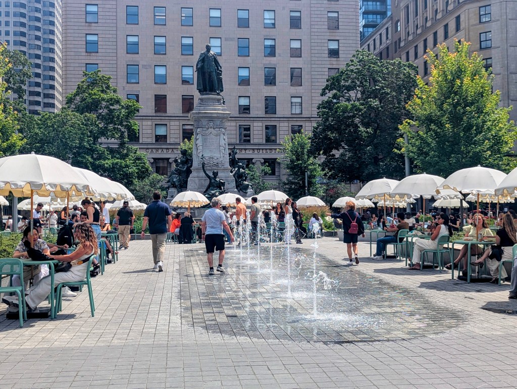
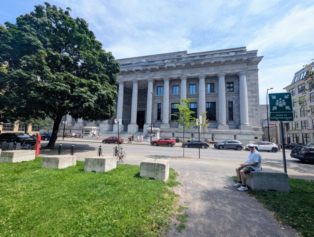
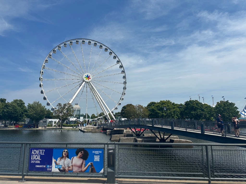
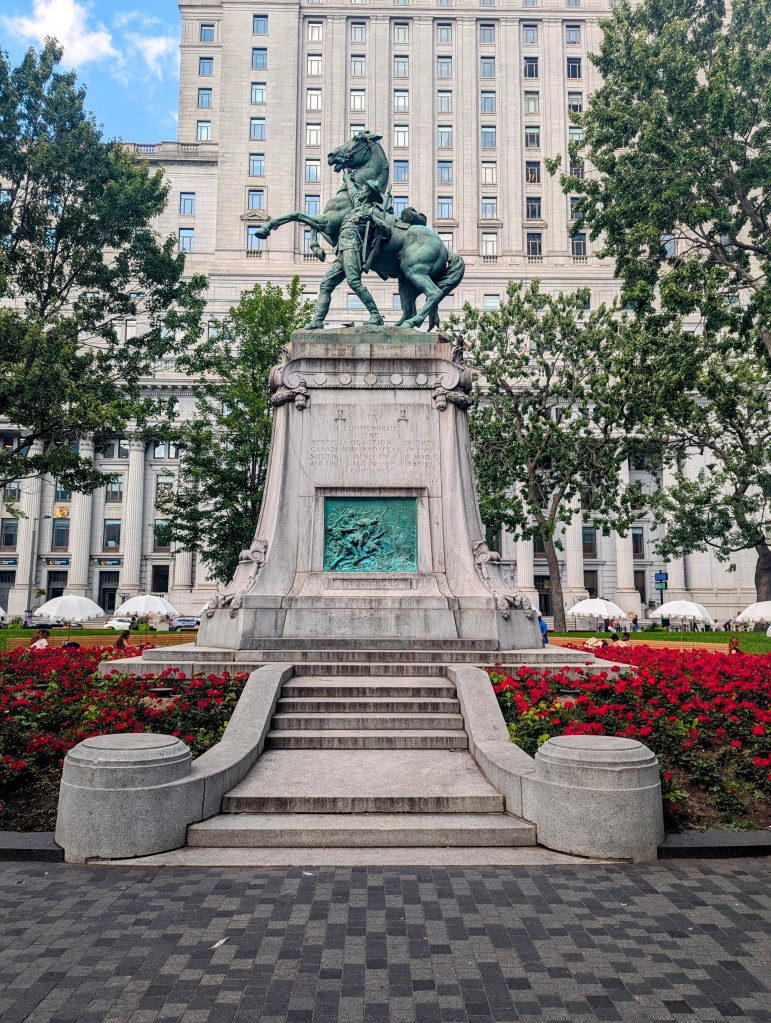
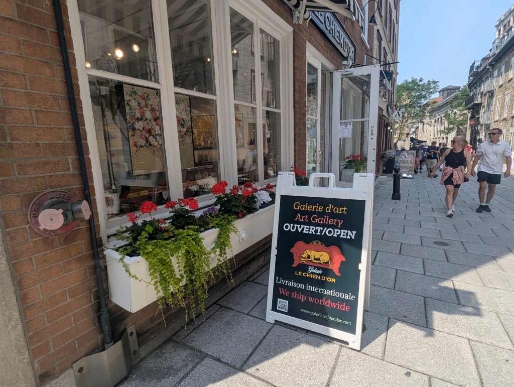
As part of our cross country trip this year we visited Canada. First we visited my brother in Ontario before heading to Montreal. There we checked into Hotel Cantile Suites which was centrally located. It had been a very long drive so we had dinner and relaxed, saving the touring for the next day. First thing in the morning we headed out to our walking tour which met in Dorchester Square by the Sir Wilfrid Laurier Memorial. Alex was already telling the group that Laurier (1841-1919) was the seventh prime minister of Canada from 1896 to 1911 and the first French Canadian prime minister. His 15-year tenure remains the longest uninterrupted term of office among Canadian prime ministers and his nearly 45 years of service in the House of Commons is a record for the House. Laurier is best known for his compromises between English and French Canada.
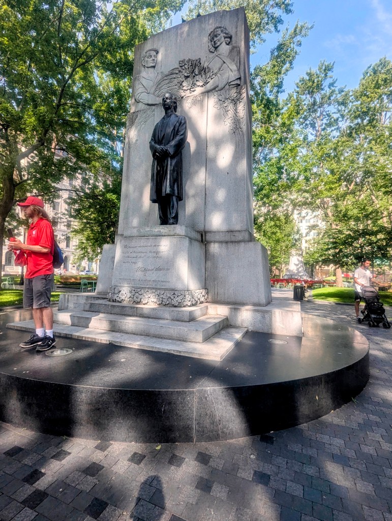
The back side of the monument, sculpted by Joseph-Émile Brunet and erected in 1953, is a granite relief depicting the provinces created and united under Laurier’s administrations. The monument faces towards the United States, reflecting Laurier’s support for early free trade and a continental economic orientation.

We walked past Windsor Station, currently an office building but formerly the city’s Canadian Pacific Railway station; It served as the headquarters of CPR from 1889 to 1996,

on our way to Centre Belle (Bell Center), the Canadiens’ hockey arena, which opened in 1996. With a seating capacity of 21,105, Bell Centre is the second largest ice hockey arena in the world after SKA Arena in St. Petersburg, Russia.
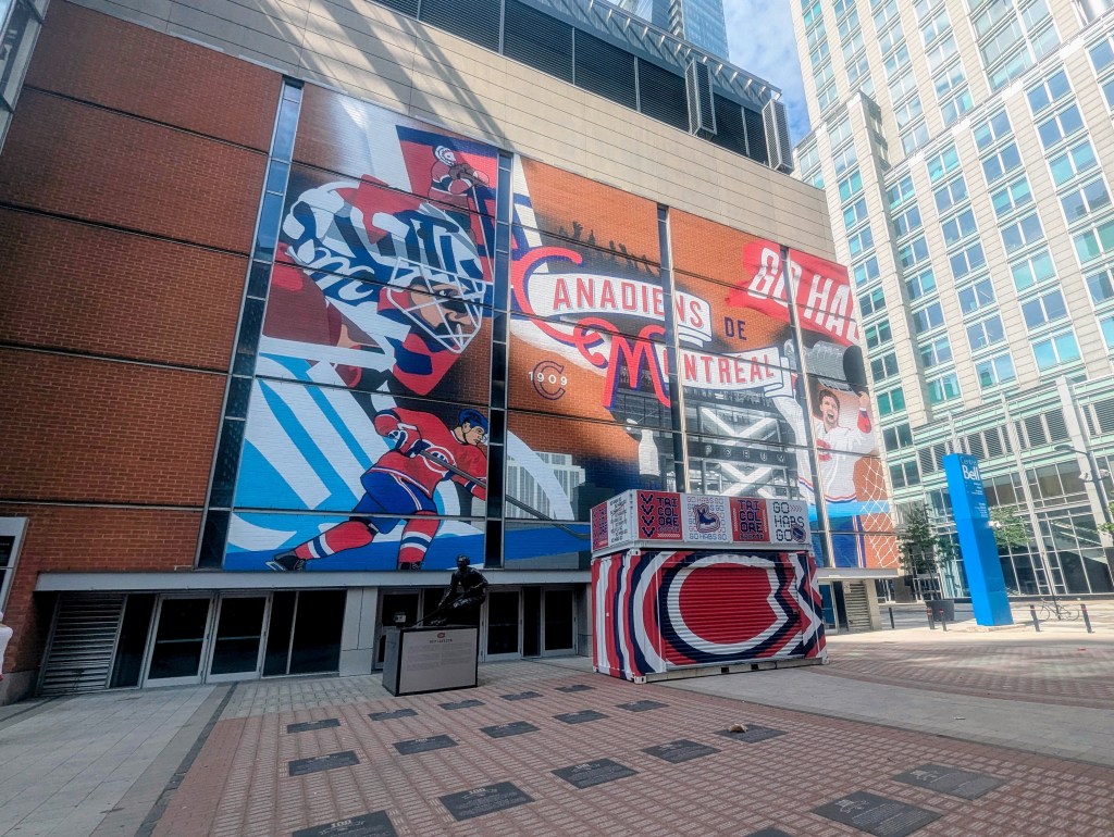
Other sports and entertainment events occur at the Centre Belle, but hockey is by far the most popular with games consistently sold out since October 2005.
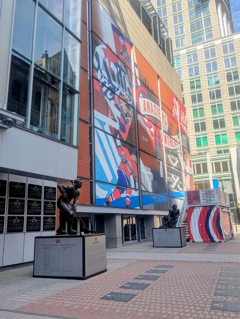
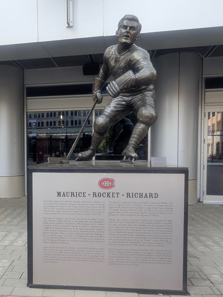
Joseph Henri Maurice “Rocket” Richard (1921-2000) played all of his 18 seasons for the Canadiens. He was the first player in NHL history to score 50 goals in one season (1944-45), and the first to reach 500 career goals. But what Richard is most remembered for was giving French Canadians a spiritual lift during the “dark times” of French suppression; he was a cultural icon among Quebec’s francophone population. The Richard Riot was a riot on March 17, 1955 in Montreal. Following a violent altercation on March 13 in which Richard hit a linesman, Richard was suspended for the remainder of the season. Montreal fans protested that the suspension was too severe; the team’s largely Francophone fan base claimed the length of the suspension was motivated by Richard’s French Canadian ethnicity. The riot became a spark for change.
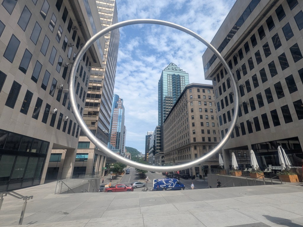
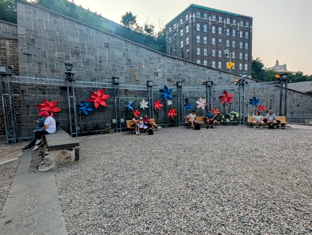
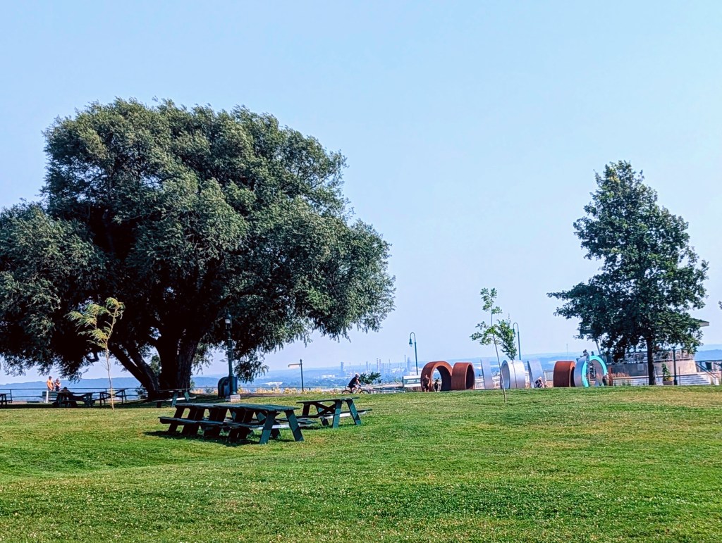
Next Alex took us to Place Ville Marie to see L’Anneau (The Ring) erected in 2022. L’Anneau is the largest steel sculpture in Montreal spanning 98 ft in diameter and weighing approximately 51,000 lbs. It cost over 5 million dollars because it is heated to prevent snow buildup, and has vibration dampers to prevent damage during high winds or earthquakes. It symbolizes the connection between Montreal, Place Ville Marie, its residents, and visitors. Mount Royal, the city’s namesake, can be seen through L’Anneau.
The Olympic games were first hosted in Canada in 1976. The stadiums built for the events were not paid off until 2006. The games were controversial that year because the Olympic committee made the decision to boycott South Africa due to apartheid.

In the Olympic Park stands The Monument to the Ancient Flame. The monument commemorates the 1976 Summer Olympics during which the Olympic flame experienced a memorable moment when an official briefly re-lit it with a cigarette lighter after it was doused by rain.
Square Victoria (Victoria Square) forms an integral component of the city’s urban public transit system and constitutes a ‘prestige address’ for the international face of the city.
The original Paris Metro entrance was donated by the Paris transport authority (RATP) to commemorate the collaboration of Parisian engineers in the construction of the Montreal metro. This iconic Art Nouveau entrance was installed in 1967, the 100 year anniversary of independence, and is a lasting symbol of international cooperation. Alex explained that this metro stop connects underground to a large system of underground shops and stops. (more on this later)

In the center of Victoria Square sits the Monument à la reine Victoria (Queen Victoria Monument) unveiled in 1872 by Lord Dufferin, shortly after the confederation (more on him in Quebec City).

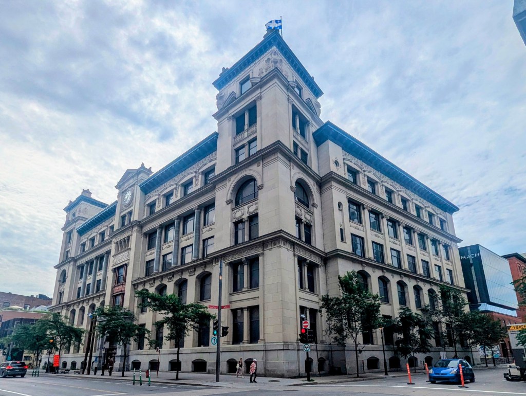
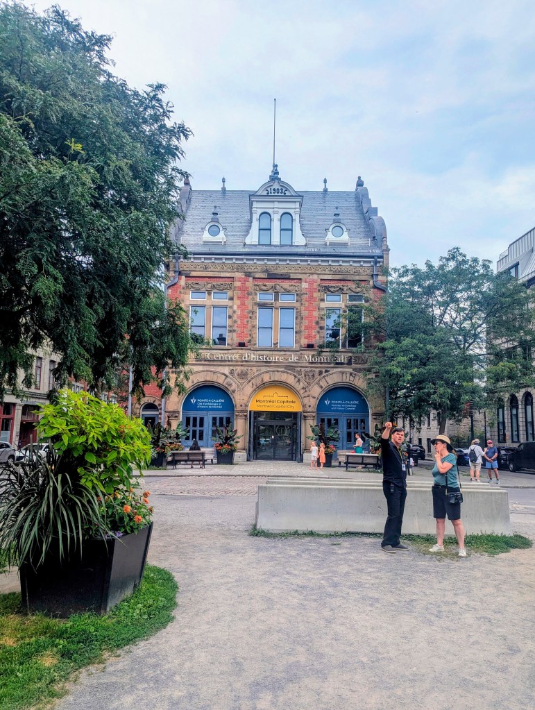
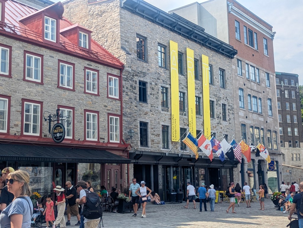
Alex explained that Old Montreal was mostly built between 1820 and 1880. Since buildings must have a façade in keeping with that style, which was mostly Anglo influenced like this impressive building The Gran Tronc (Grand Trunk) Railway, which established its North American headquarters in Montreal and operated an extensive network across Quebec, Ontario, and the northeastern United States. This historic building opened in 1902.
Before 1840 there were two Canadas: Upper Canada was mostly English while Lower Canada was mostly French. In 1837 there were rebellions in both Canadas after which Canada became united. The Parliament was fist in Kingston, which burned down during a rebellion. The second Parliament was in Montreal 1844-1849 but was also burned down by a rebellion. The Parliament was moved to Ottawa by Queen Victoria and now remains there.
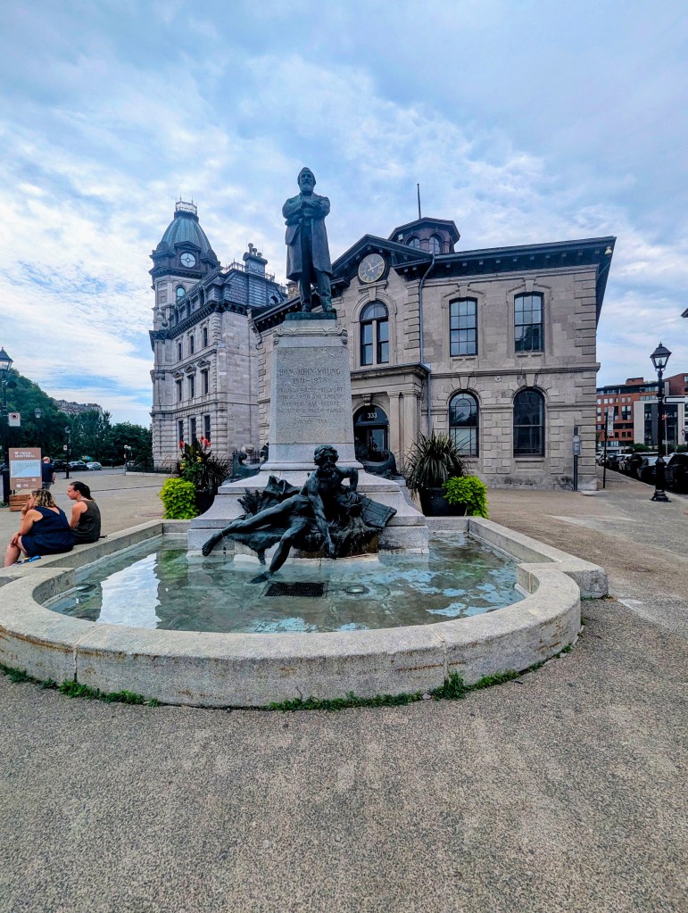
This monument-fountain honors John Young (1811-1878), the first Chairman of the Port Commission of Montreal, known for his significant contributions to the development and enlargement of the port. First erected in 1908, the monument was moved to its current location on rue de la Commune at Saint-Pierre in 1997.
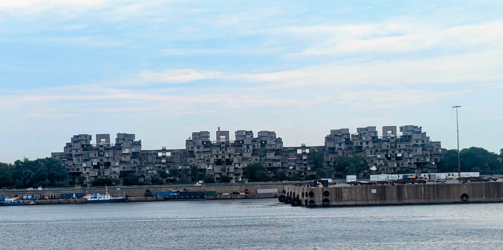
The 1967 International and Universal Exposition, commonly known as Expo 67, was a world’s fair held in Montreal from April 28 to October 29, 1967, Canada’s centennial year. Building projects for the fair included reclaimed land to enlarge an island on which to to build Habitat 67, one of the few remaining buildings from the fair.
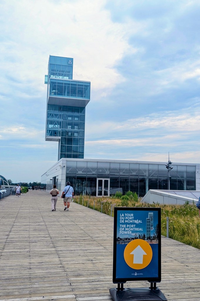
The metro and the pier were also part of the fair building project. The historic Convoyeurs Tower in the city’s Old Port., shown in the middle below, is now a bungee jump.

Major League’s 1969 expansion, the Montreal Expos (now the Washington Nationals), was named in tribute to this event.
On its third day the fair broke a record single day attendance record at the time with over 500 thousand visitors. Now the fairgrounds are beautiful parks.

A fife and drum corp practiced across the pond.

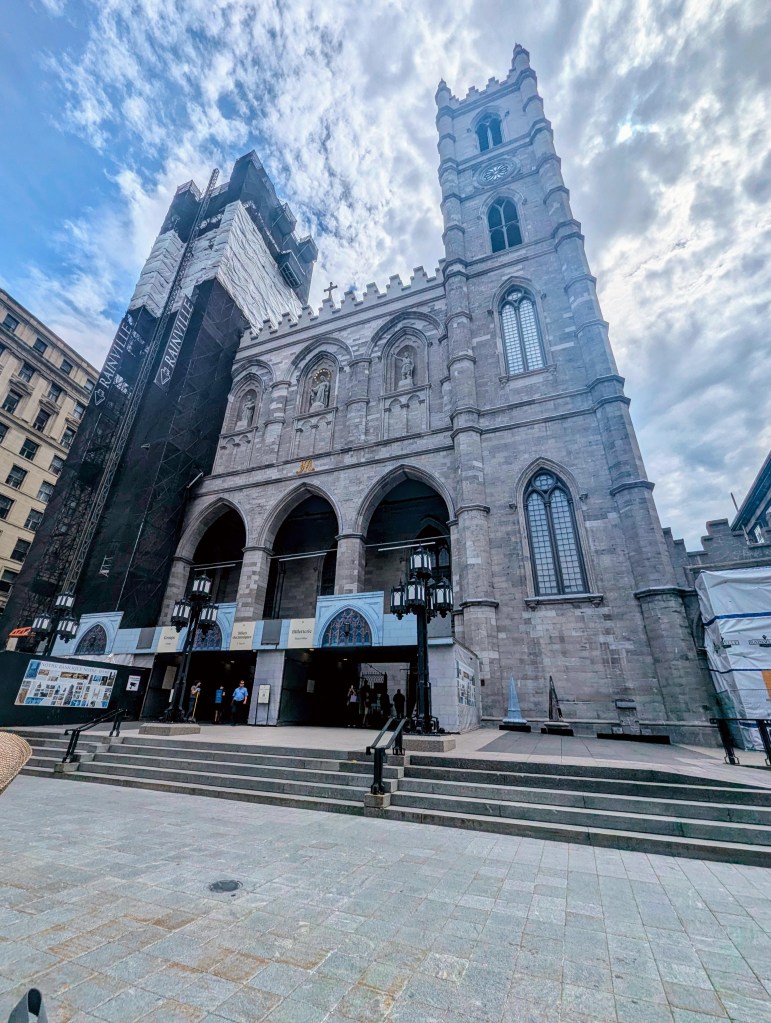
Basilique Notre-Dame de Montréal (Notre-Dame Basilica of Montreal) has been on this site since 1672, the current basilica completed in the 1840s. In 1982 it was ordained by Pope John Paul II. The stained glass is historic; we did not get a chance to go inside. It is now used for important events like state funerals. Celine Dion was married here.
In the Place d’Armes, the square in front of the basilica, is a 2013 privately owned art installation Les deux snobs (The Two Snobs). The diptych evokes, with humor, the cultural discords that used to prevail between the English: Le Carlin Anglais (The English Pug)
and Le Caniche Français (The French Poodle).

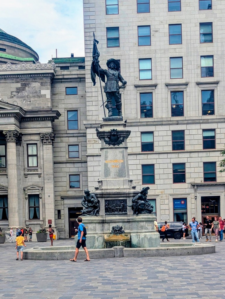
Also in in Place d’Armes is the Maisonneuve Monument. Sculpted by Louis-Philippe Hébert and unveiled in 1895, it commemorates Paul de Chomedey, Sieur de Maisonneuve, who founded Montreal (originally Fort Ville-Marie) in 1642. He was a Catholic zealot.
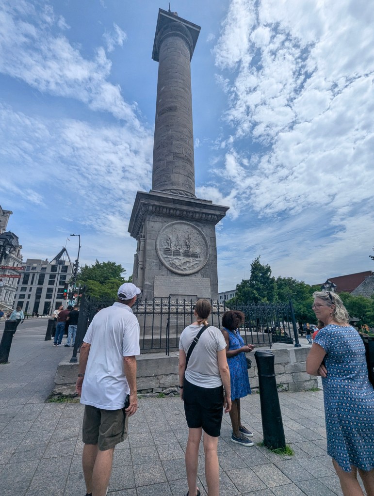
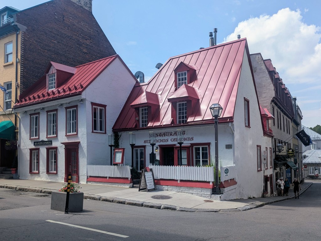
Our next square visited was Place Jacques-Cartier (Jacques Cartier Square) which was originally a private garden for a chateau. When the chateau burned down the owner was convinced to donate the land. The broad, divided street slopes steeply downhill from City Hall and Rue de Notre Dame to the waterfront and port. In the summer it is lined with Parisian-style cafes and bistros; at Christmas it is lined on both sides with lit trees. Alex claimed it to be the maple syrup capital of the world.
Colonne Nelson (Nelson’s Column) erected in 1809 in Place Jacques-Cartier is dedicated to the memory of Admiral Horatio Nelson (1758-1805), following his death at the Battle of Trafalgar. Built to honor both Nelson’s memory and his victory over Napoleon’s fleet, it is the city’s oldest monument and the oldest war monument in Canada.
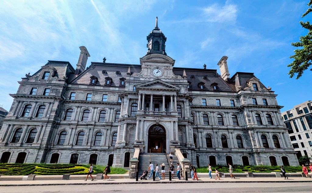
The five-story Hôtel de Ville de Montréal (Montreal City Hall) was built between 1872 and 1878 in the Second Empire style.
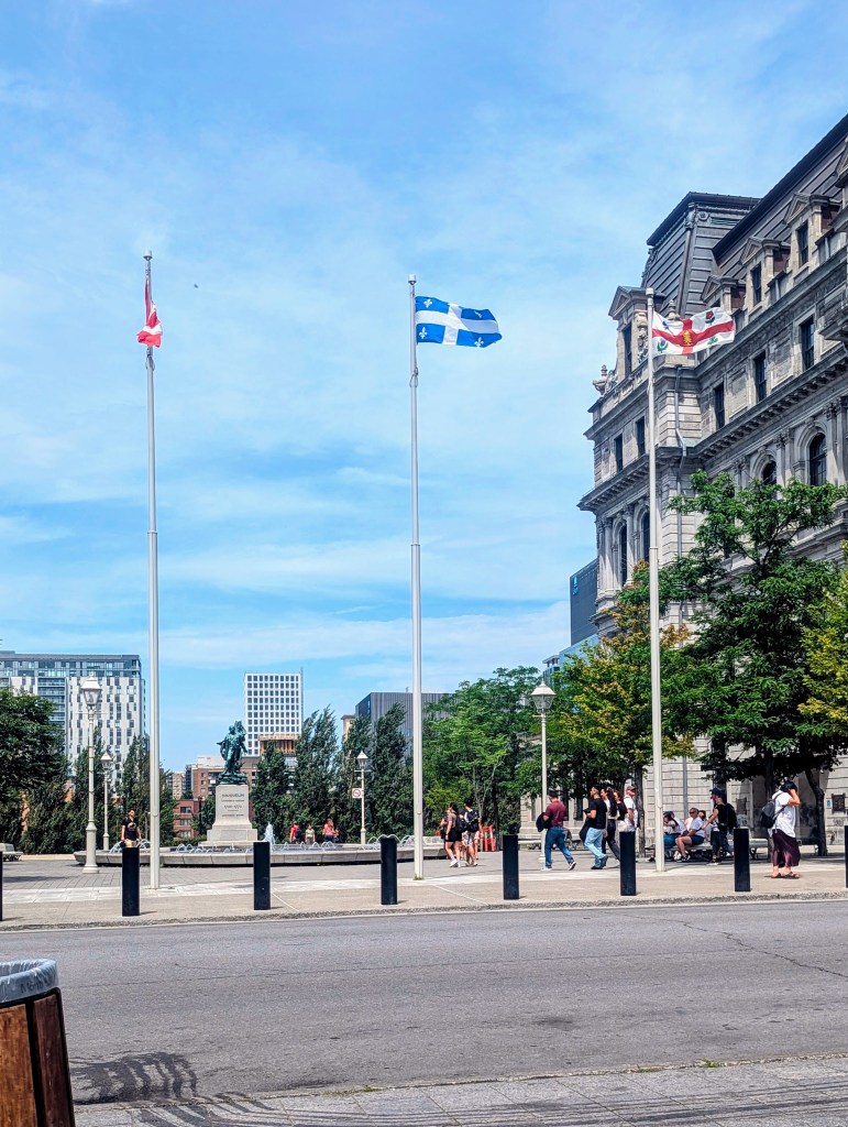
Next to City Hall are the three flags of Montreal: Canadian National flag (left) a red maple leaf on a white field between two red stripes; the Flag of Quebec Province (center), known as the “Fleurdelisé” featuring a white cross on a blue background with four white fleurs-de-lis.; and the Flag of Montreal (right) which bears five symbols to recognize the city’s founding peoples: the white pine for the Indigenous presence, the fleur-de-lis for the French, the rose for the English, the thistle for the Scottish, and the clover for the Irish.
As we left Place Jacques-Cartier Alex pointed out the Hydro-Québec Building, which houses the headquarters of the major electricity supplier for Quebec Province as well as upper New York State. The hydropower is generated from the Lawrence River..

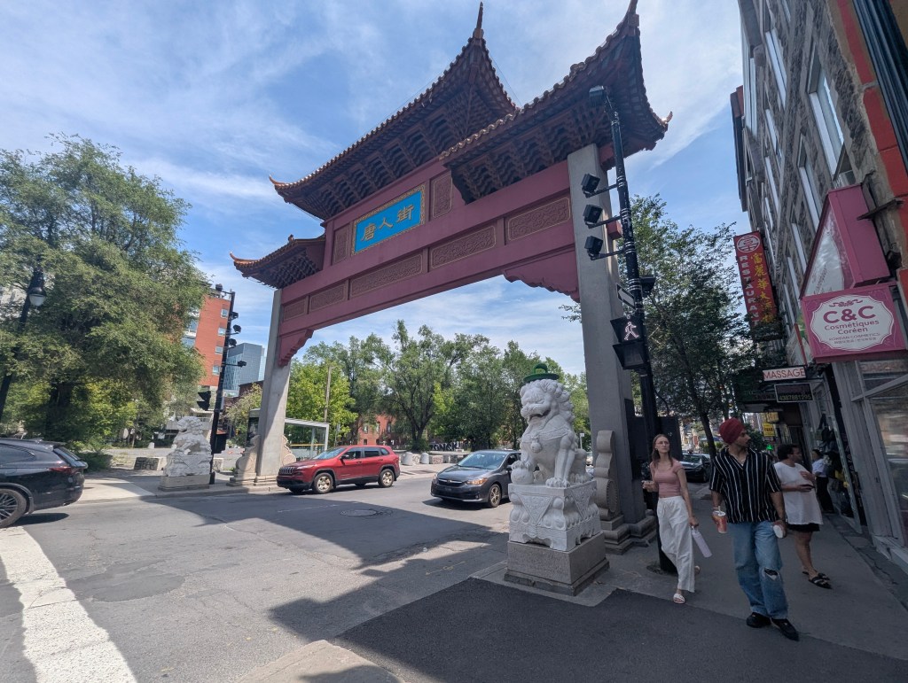
Next we entered Quartier Chinois (Chinatown). The area had previously been a Jewish neighborhood in the mid to late 19th century. The first Chinese immigrant arrived in Montreal in 1877. As others followed, they moved into this neighborhood because it was close to the growing railway, for which many of them worked. The Chinese immigrants also opened laundromats and restaurants. The area became known as Quartier Chinois (Chinatown) in 1902. The Paifang Gates were a gift from Shanghai in 1999. At a total of four, Montreal’s Chinatown features the most paifang gates of any Chinatown in Canada. They symbolize a fortunate and auspicious entryway into the vibrant cultural and commercial district.

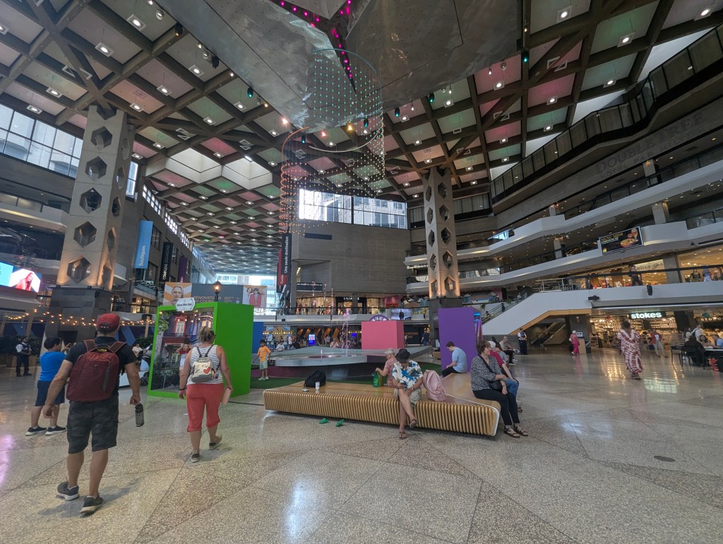
Alex took us into the underground city. First he showed us the map but explained how difficult it is to follow, especially because it does not say where we are on the map.
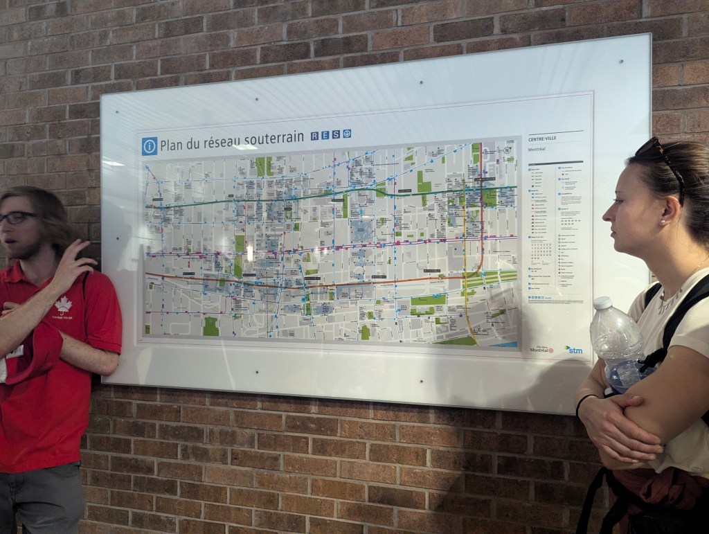
Montreal’s La ville souterraine (Underground City), or RESO (French for network), is a vast (largest in the world), interconnected network of over 19 miles of tunnels and passageways linking shopping centers, hotels, office buildings, and transit hubs beneath the downtown area, serving as a year-round urban hub and a shelter from extreme weather. As many as 500,000 visitors a day can find shopping, dining, entertainment, and access various buildings through over 190 exterior points, making it a unique and must-see part of the city. It was designed in the 1960s by Boston architect Vincent Ponte.
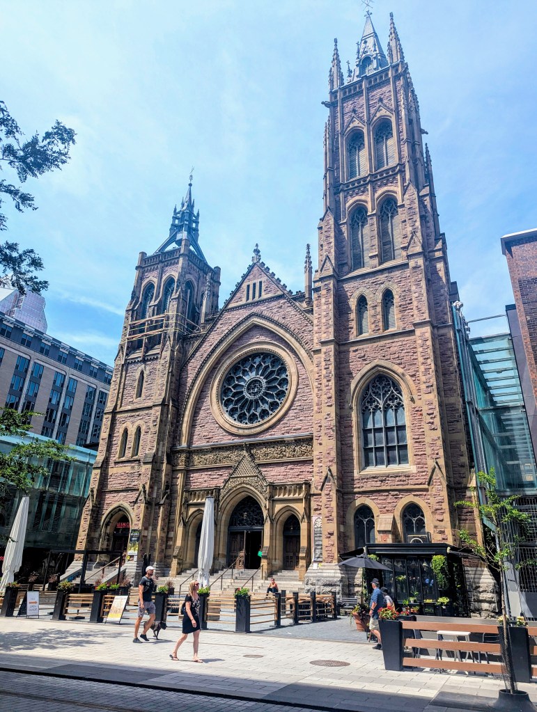
We emerged from RESO at St. James United Church. Built in 1889 it is a prominent example of High Victorian Gothic Revival architecture, featuring two tall towers and a large rose window.
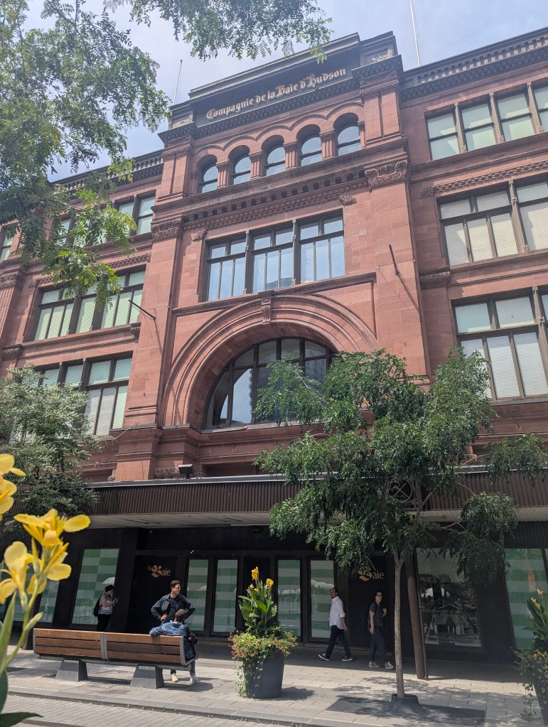
As we walked by The Hudson Bay Company Alex explained that it is an historic Canadian retail company initially focused on the fur trade. It is considered the oldest company in North America with its roots tracing back to a Royal Charter granted in 1670.
Before leaving us Alex gave us this last trivia tidbit: “Canada” means “village” or “settlement” and is derived from the St. Lawrence Iroquoian word kanata. In 1535 Indigenous inhabitants used this word to direct the French explorer Jacques Cartier to the village of Stadacona (present-day Quebec City), and Cartier subsequently used “Canada” to refer to the village and its surrounding area, a name that eventually expanded to encompass the entire country.
With the tour completed, we went back to Chinatown for a late lunch. We found another Paifang Gate. This one featured stone statues of lions, called Shishi, traditional symbols that stand guard at the entrance to the neighborhood,
After lunch we retraced some of our steps of the morning and went back toward the waterfront. Along the way we passed Hommage à Marguerite Bourgeoys sculpture, an outdoor 1988 sculpture and memorial depicting the founder of the Congregation of Notre Dame of Montreal of the same name .

We passed the la Cour d’appel du Québec (Quebec Court of Appeals). Founded in 1849, it is the highest judicial court in Quebec, Canada.
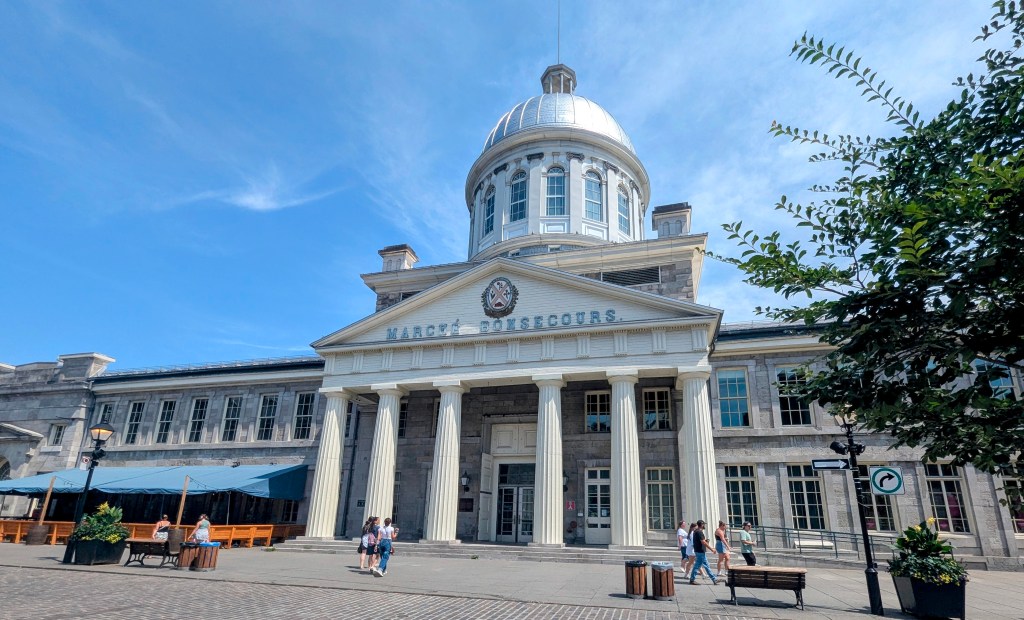
Once back on the waterfront we visited the Marché Bonsecours (Bonsecours Market), a two-story domed public market. It opened in 1847 and for more than 100 years it was the main public market in the Montreal area. It also briefly accommodated the Parliament of United Canada for one session in 1849. We went inside, but due to the lateness of the day, the stalls were mostly closed.
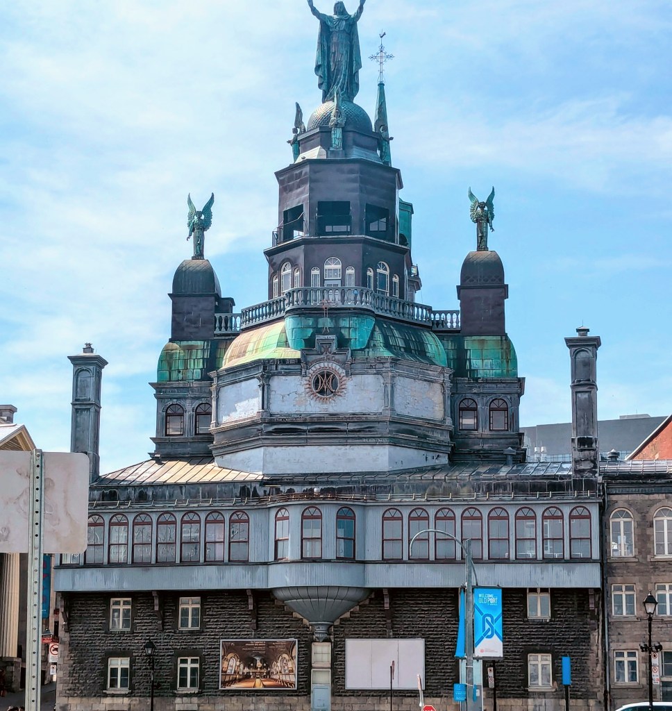
Next to the market was an interesting church: Chapelle Notre-Dame-de-Bon-Secours (Our Lady of Good Help). One of the oldest churches in Montreal, it was built in 1771 over the ruins of an earlier chapel.
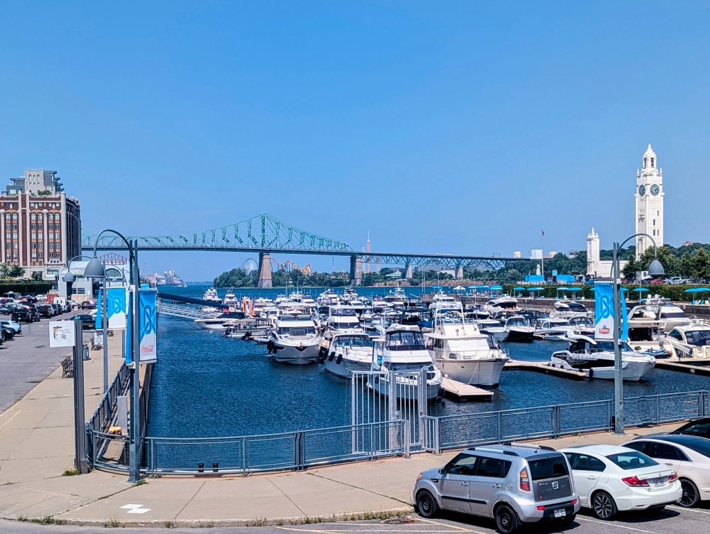
We trekked around the port for the rest of the afternoon.
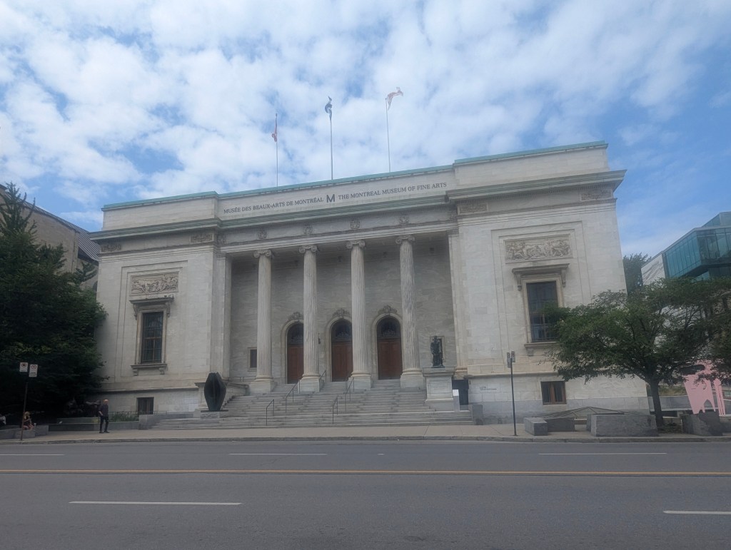
The following day we spent some time visiting the Musée des Beaux-Arts de Montréal (Museum of Fine Arts). Founded in 1860, it is the oldest art museum in Canada.
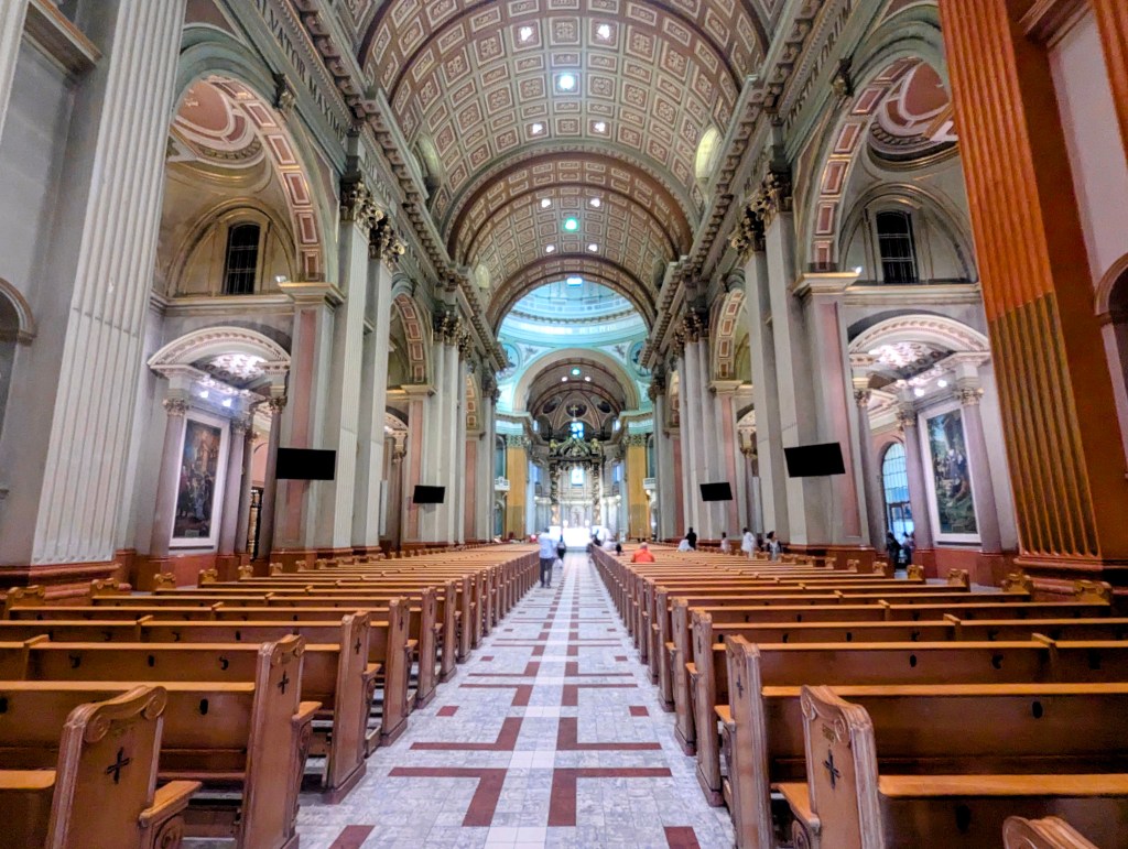
We also visited Basilique Cathédrale Marie Reine du Monde (Mary, Queen of the World Basilica). The church was consecrated in 1894 as Saint James Cathedral. At the time it was the largest church in Quebec. It was made a minor basilica in 1919 by Pope Benedict XV then rededicated in 1955 to Mary, Queen of the World by Pope Pius XII. In imitation of the statues of the 12 apostles on the façade of St. Peter’s in Rome, the cathedral is topped by statues of the patron saints of 13 parishes of Montreal that donated toward the cathedral,

The walls and floors are made of marble imported from Italy and feature several mosaics. The bronze plaque above the altar depicts St. Peter’s Basilica in Rome.
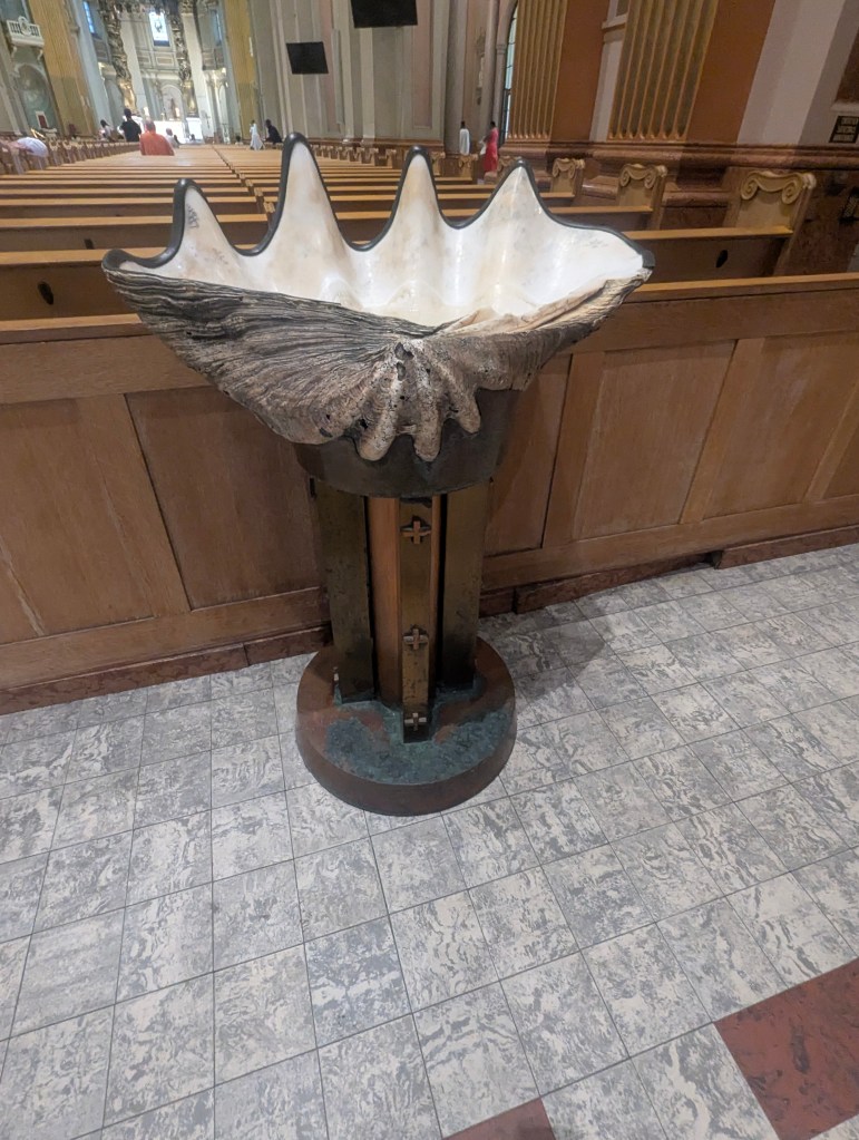
I was particularly struck by the baptismal font.
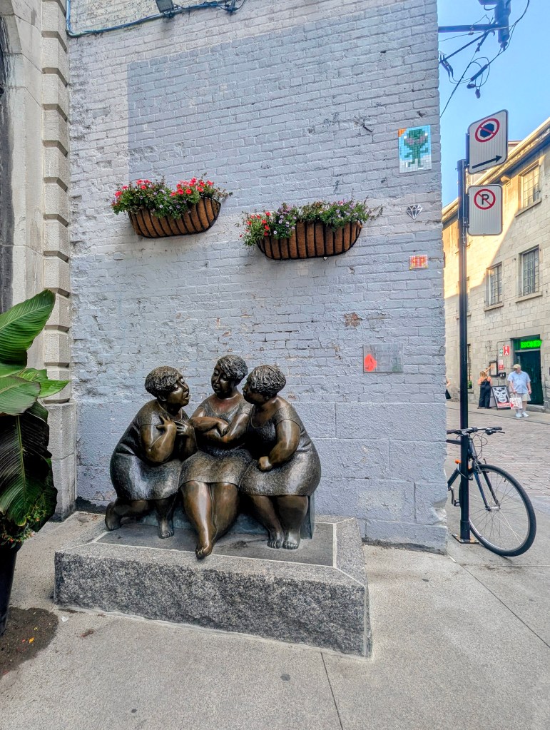
Once more we headed back toward the waterfront. We passed Les Chuchoteuses (The Gossipers), a bronze sculpture by Rose-Aimée Bélanger installed in 2002.
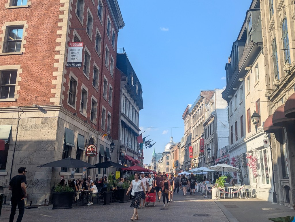
By then it was evening. We stopped on Rue Sait-Paul (Saint Paul Street), Montreal’s oldest street, a historic cobblestone street known for its European feel, charming shops, art galleries, and historic architecture. We sat, ate, drank, and peopled watched for hours.
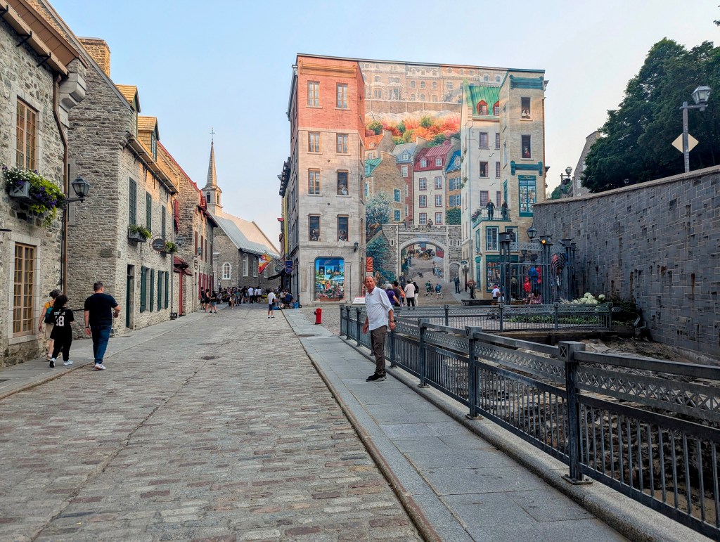
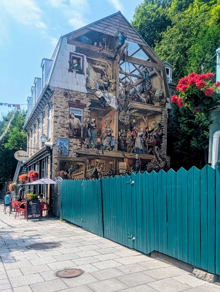
In the morning we made our way to Quebec City. There we stayed in Hotel 71, right in the heart of the Old City. After checking in we explored on our own for the rest of the afternoon. We immediately found the old city ruins in front of the large city mural. (more on the mural later) It was the location of Samuel de Champlain’s first settlement in 1608.
Archaeological remains from earlier structures have been uncovered here.

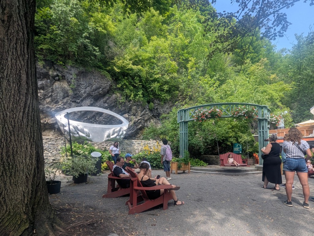
There is also a cute little park for a rest.
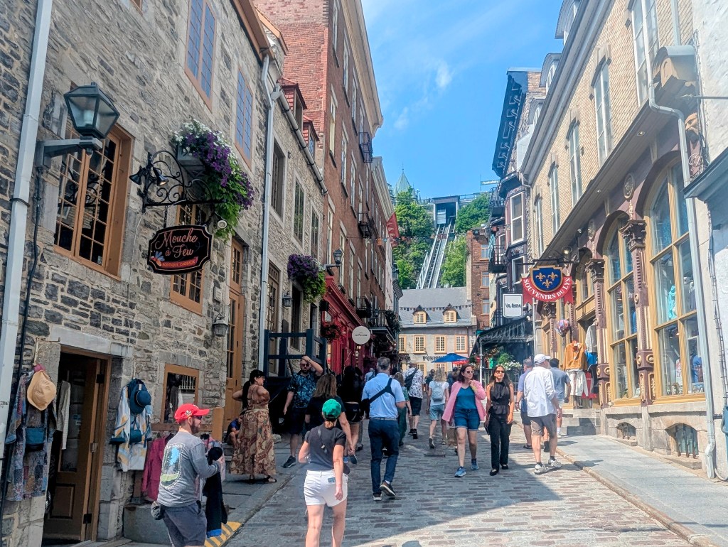
We wandered around the lower city noting restaurants, souvenir and toy shops,
before we climbed the steep hill next to the mural
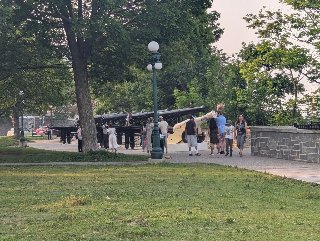
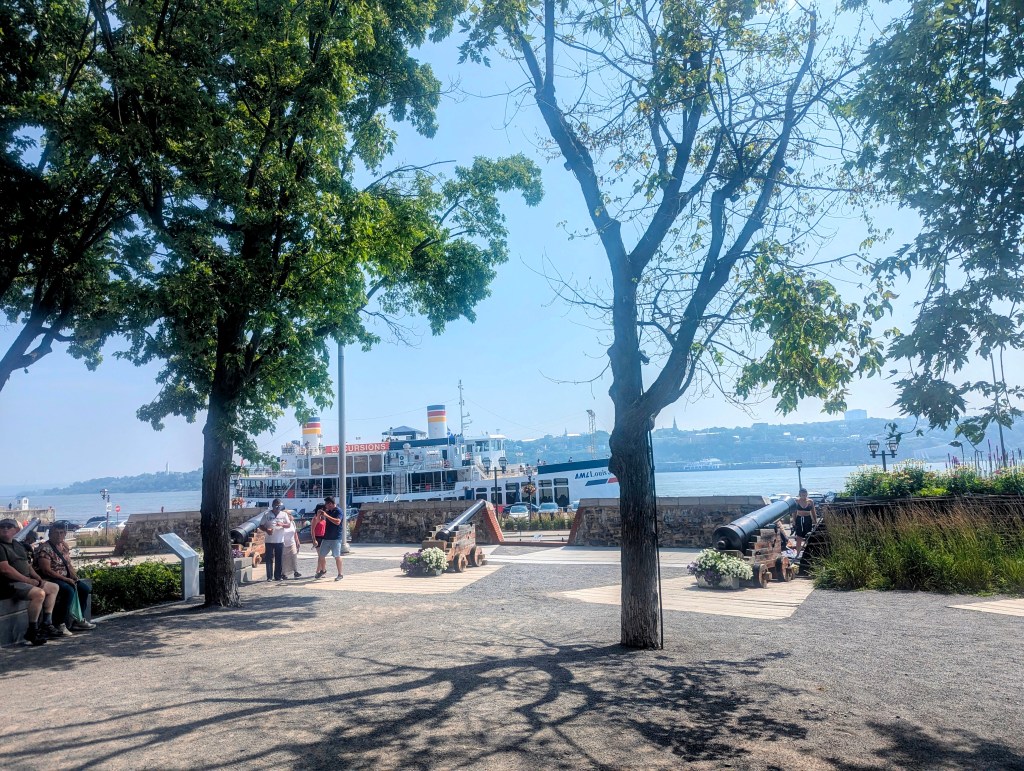
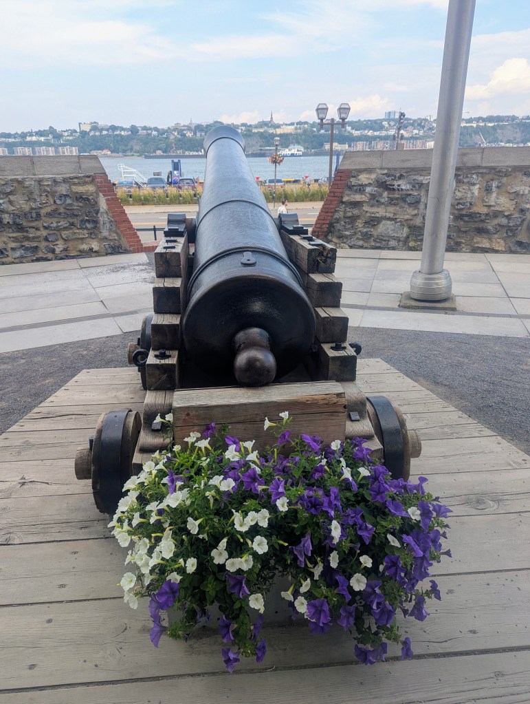
to the park at the top: Parc Montmorency (Montmorency Park). The historical significance of the park is that the site was home to the first Parliaments of Lower Canada, Canada East, and Quebec from 1791 to 1883 when it was destroyed in a fire. (The second Parliament was in Montreal, which we had seen, the third and current is in Ottawa.) In 1894 the city opened ithe space as Parc Frontenac. It was recognized as a national park in 1949. Large cannons lining the wall speak to the site’s historical military role as a defensive battery.
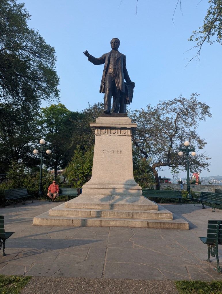
In the center is a statue of George-Étienne Cartier (1814-1873), Prime Minister of United Provinces of Canada and Father of Confederation. He was considered to have “discovered” the Lawrence River.
From there we had a great view of the Saint Lawrence River below.

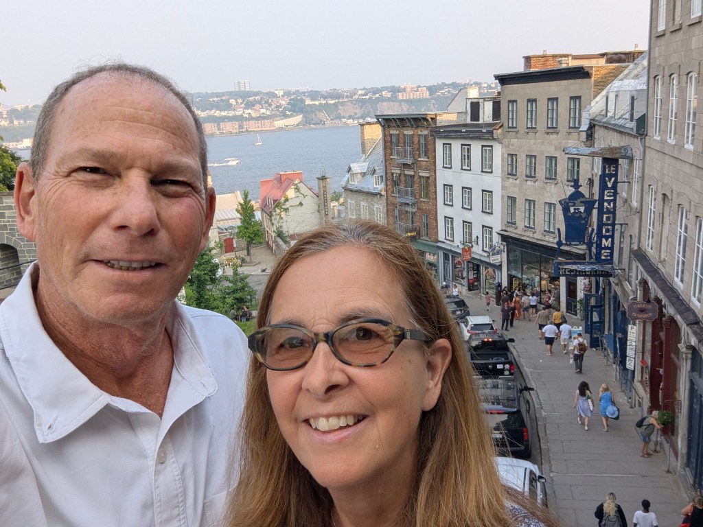
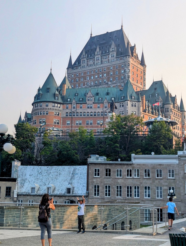
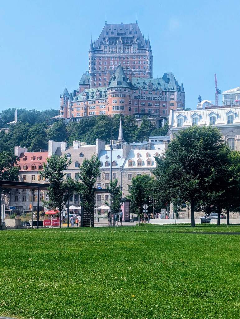
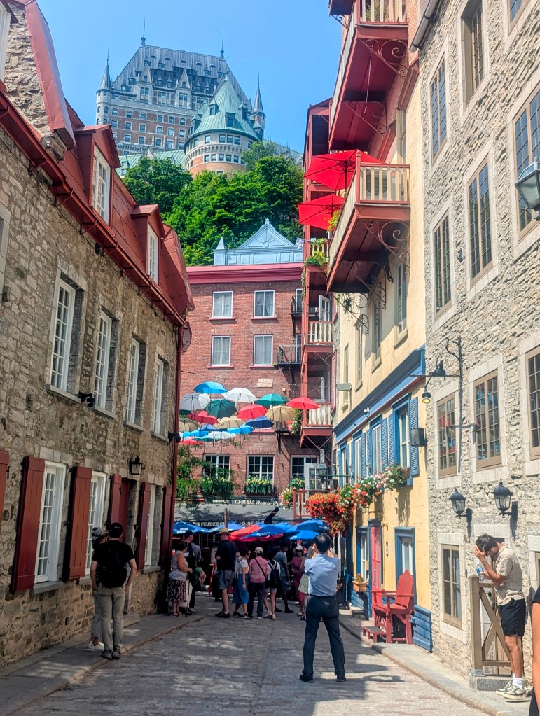
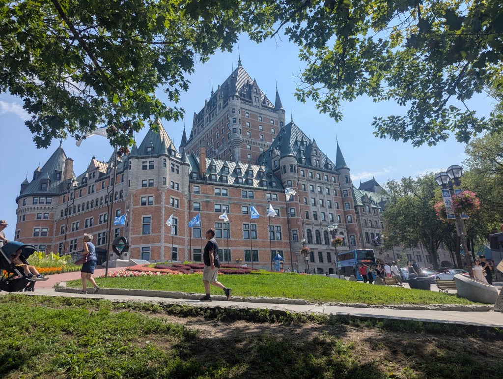
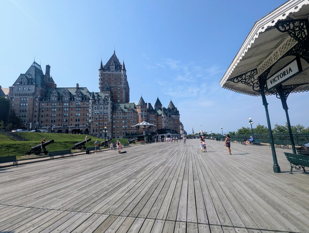
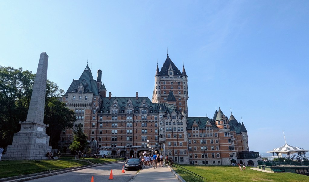
From the park we also had a great view of Quebec City’s iconic Fairmont Le Château Frontenac, commonly referred to as the Château Frontenac. Opened in 1893, the Chateauesque-styled building has 18 floors; its 262-foot height is augmented by its 177 foot ground elevation. It was one of the first of Canada’s grand railway hotels, and was designated a National Historic site of Canada in 1981.
From Parc Montmorency we continued our upward climb past the The Louis S. St-Laurent Building. Built between 1872 and 1873, this building originally housed the city’s central post office, and nowadays is used for government offices.

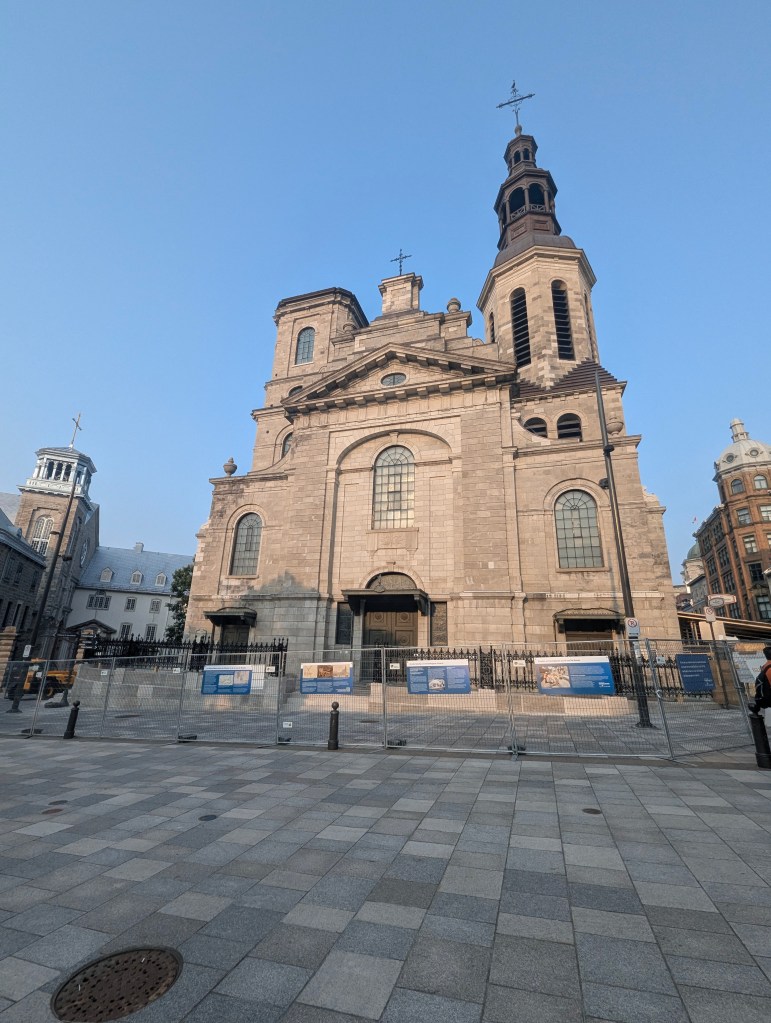
We continued to upper Old City to Notre-Dame de Québec Basilica-Cathedral (Our Lady of Quebec City). Built first in 1647 , it is the oldest church in Canada and was the first church in Canada to be elevated to the rank of minor basilica, by Pope Pius IX in 1874. It has twice been destroyed by fire, most recently in 1927, and has been rebuilt.
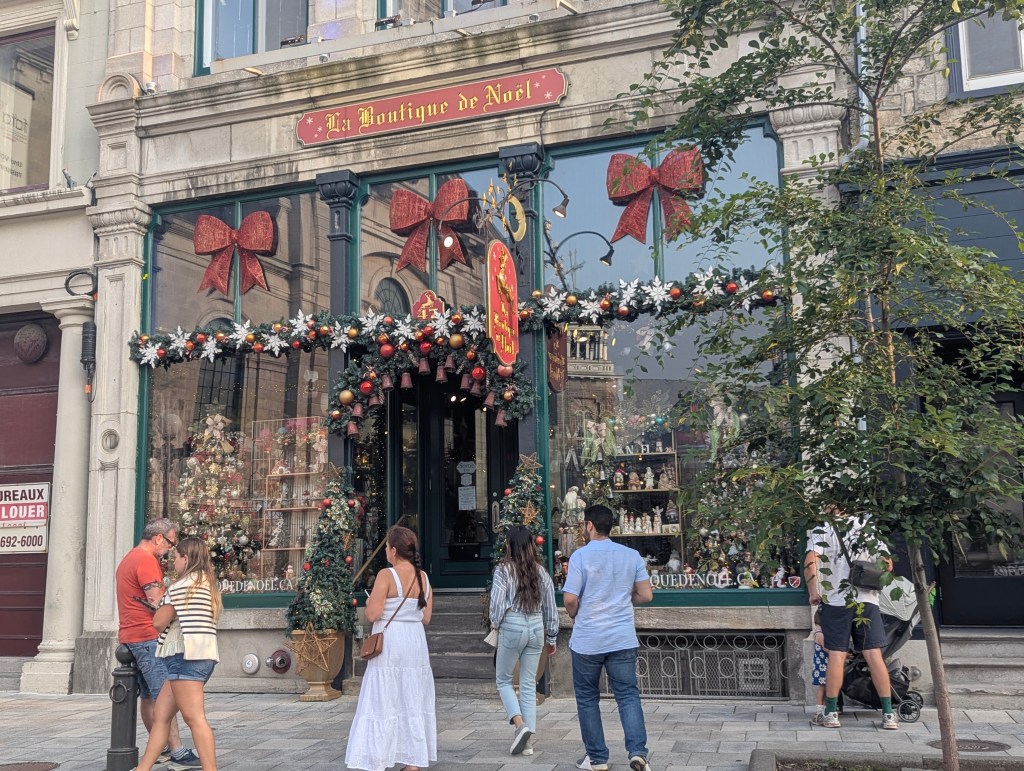
Across from the cathedral is a lovely little year-round Christmas shop.
We continued past Hôtel de ville de Québec (City Hall of Quebec City) which was inaugurated on September 15, 1896.
At the top of the Old City sits La porte Saint-Jean (The Saint-Jean Gate), one of the entry points through the fortified walls of Old Québec. These fortifications were initially built by the French in 1690 to protect the city from British invasion and were later rebuilt by the British after they captured Québec City in 1759. During the American siege of Quebec in 1775, American militiamen regularly approached the Saint-Jean Gate to try and persuade the local population to join their cause. The gate is a significant landmark, reflecting the city’s military history and its evolution over centuries.

Finally we stopped for dinner at Beclub Restaurant.

After dinner we meandered through the streets admiring works by street artists.

We hung out for a bit in Place d’Armes, established between 1640 and 1648. During the French Regime, this square was known as Grande Place, and its most prominent structural neighbour was Château Saint-Louis, the permanent residence of the governors of New France. Military parades were held by the French army here until 1760, when the colony changed hands. From then on, similar activities were carried out in this square by British troops. During the construction of the Citadelle in the 1830s, military activities ceased to be held at Place d’Armes, which became a public park in about 1865. In the middle of Place d’Armes, stands Monument de la Foi (Monument of Faith). This Gothic-style fountain and monument commemorate the 300th anniversary of the arrival of the Récollet missionaries in 1615, who were the first missionaries in Quebec.

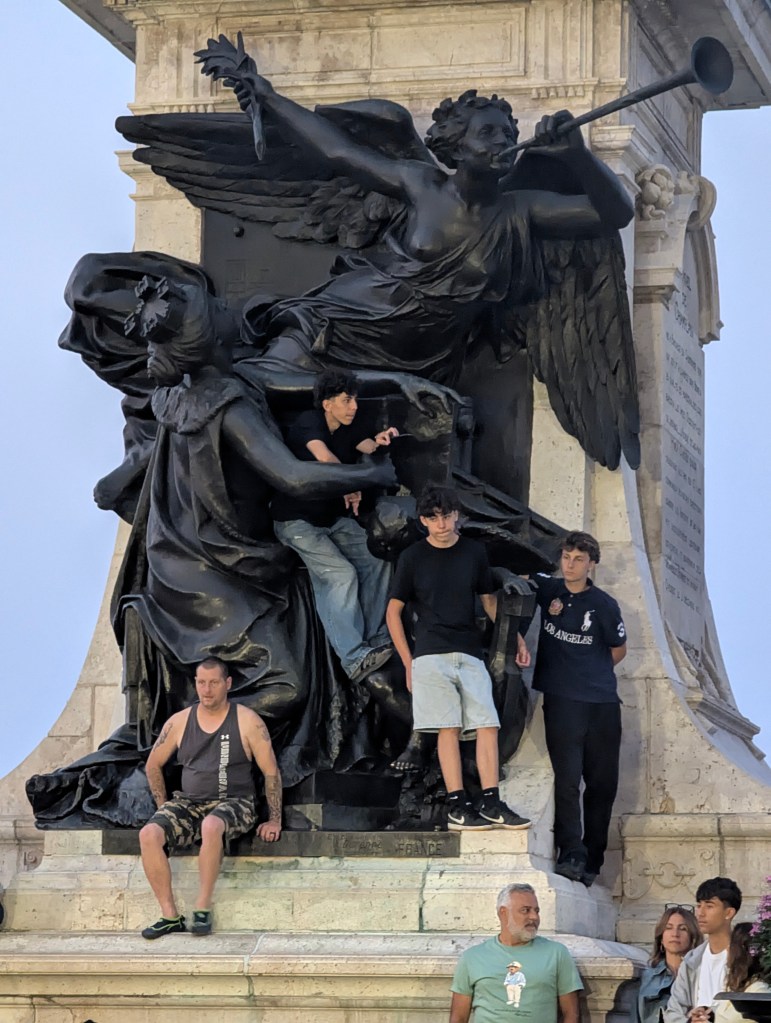
A street performer was entertaining a crowd on Dufferin Terrace in front of a monument dedicated to Samuel de Champlain, the founder of Québec City, the governor of New France, and the first European to explore the Great Lakes.
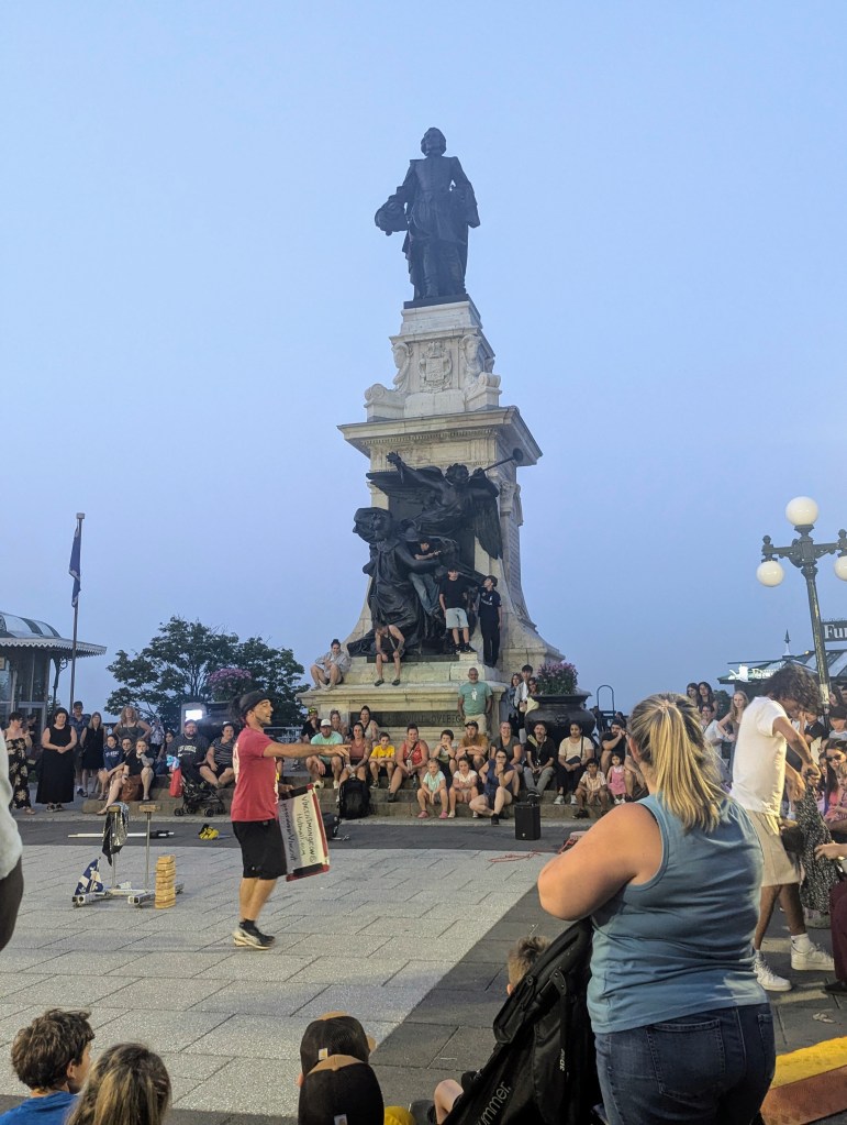
These young men had the best view.
We spent the morning on the water front parks where we had the best views of the Le Château Frontenac.

We hung out for a bit in Batterie Royale (the Royal Battery), a historical site built in 1691 and named after King Louis XIV, who funded its construction. It was built as part of Quebec City’s defensive system and was used by French soldiers during the 1759 siege. Unearthed during archaeological excavations, the Battery was restored in 1977 and officially reopened the following year. It features four stone walls, 14 embrasures, and reproductions of cannons, offering a glimpse into the city’s military history.
We then meandered through the streets of the Petit Champlain district, known for its European charm and historic architecture. The pedestrian tram up to Dufferin Terrace can be seen at the end of the street.
On Rue du Petit-Champlain, at the foot of the cliff below Dufferin Terrace, is a little dog park Parc Félix-Leclerc dedicated to Félix Leclerc who is known for his late 1930s Radio-Canada productions of plays and music.
On the side of a restaurant, the Fresque du Petit-Champlain mural depicts a working class neighborhood of a previous era in Quebec City including elements of trade and port life.
And from almost every street, the impressive Chateau can be seen looming above.
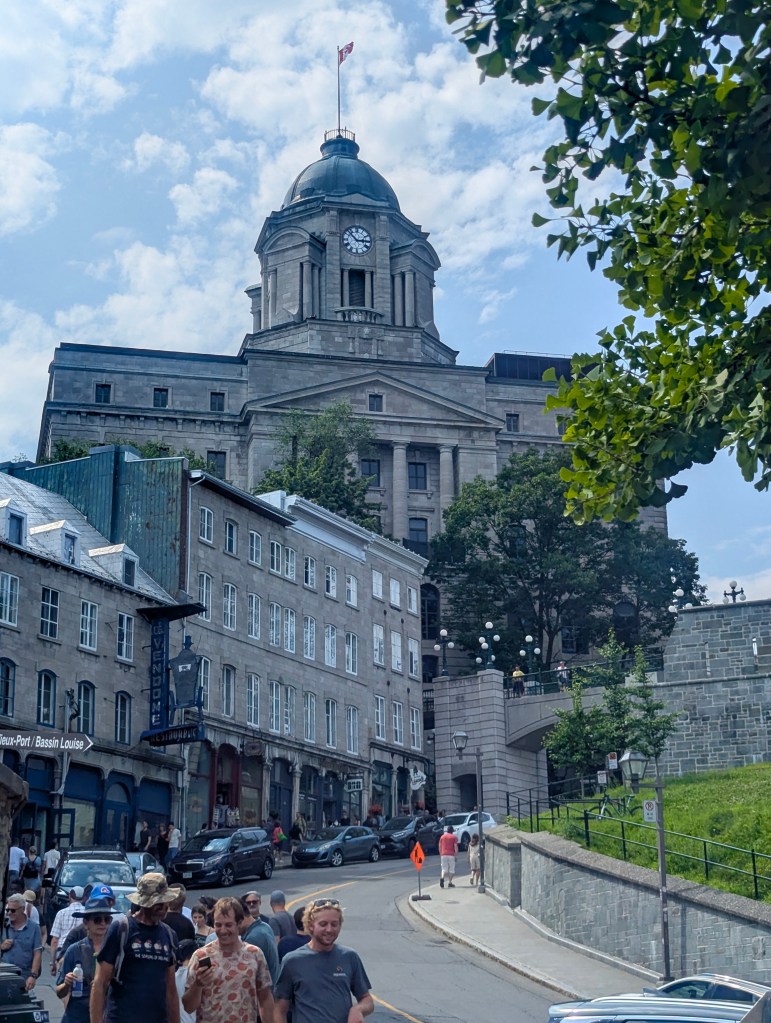
In the afternoon we had a scheduled walking tour of the Old City with Jean-Simon of his own company: Urban Horizons. Jean-Simon started with background information: the city was founded in 1608 by Samuel Champlain for the purpose of fur trade, especially for furs of beavers. It is the oldest established French city in North America and is the only city in North America besides Mexico City to have been enclosed by walls. Quebec means “where the river narrows,” referring to the narrowing of the Lawrence River as it enters the continent. From Quebec the traders had control of all ships needing access to Montreal, the great lakes, and most of North America. In 1763 Quebec became an English colony, but the population continued to speak French. The Hôtel du Parlement du Québec (Parliament Building of Quebec), built in 1886 on a prior cricket field, was inspired by Le Louvre in Paris. The central tower was dedicated to Cartier.
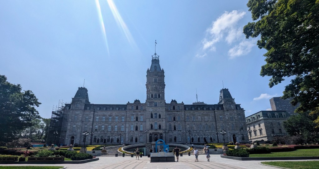
Standing in front of the Parliament building is the majestic Fontaine de Tourny (Tourny Fountain) adorned with numerous figures and boasting 43 water jets. It was originally created by French sculptor Mathurin Moreau and received a gold medal at the 1855 Paris World’s Fair. After the fair it was moved to and remained in Bordeaux until 1960 when it was disassembled, to make room for parking lots, and placed into warehouses. The fountain was a gift to the City of Québec by La Maison Simons, a local family retail business, to mark the city’s 400th anniversary. The cost to buy the fountain: $1; the shipping and reassembling cost: $5,000,000.

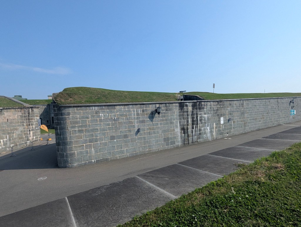
Jean-Simon talked about the Fortifications de Québec (ramparts of Quebec City). It is a city wall that surrounds the western end of Old Quebec’s Upper Town. The ramparts date back to the 17th century and have undergone a succession of modifications and improvements throughout their history. In the late 19th century many wanted the gates torn down because they were too narrow for modern vehicles but instead, they were rebuilt with wider gates. The city walls extend 2.9 mi and includes 5 gates, with the upper (southern) portions of the ramparts forming a part of the Citadelle of Quebec (Quebec Citadel), still with an active military.

The Roosevelt and Churchill Monument, busts of Franklin D. Roosevelt and Winston Churchill, is a tribute to the wartime alliance between the two leaders and commemorates the Quebec Conferences held during World War II. The first Quebec Conference in 1943 involved Roosevelt and Churchill discussing strategy for the war, including the invasion of France.

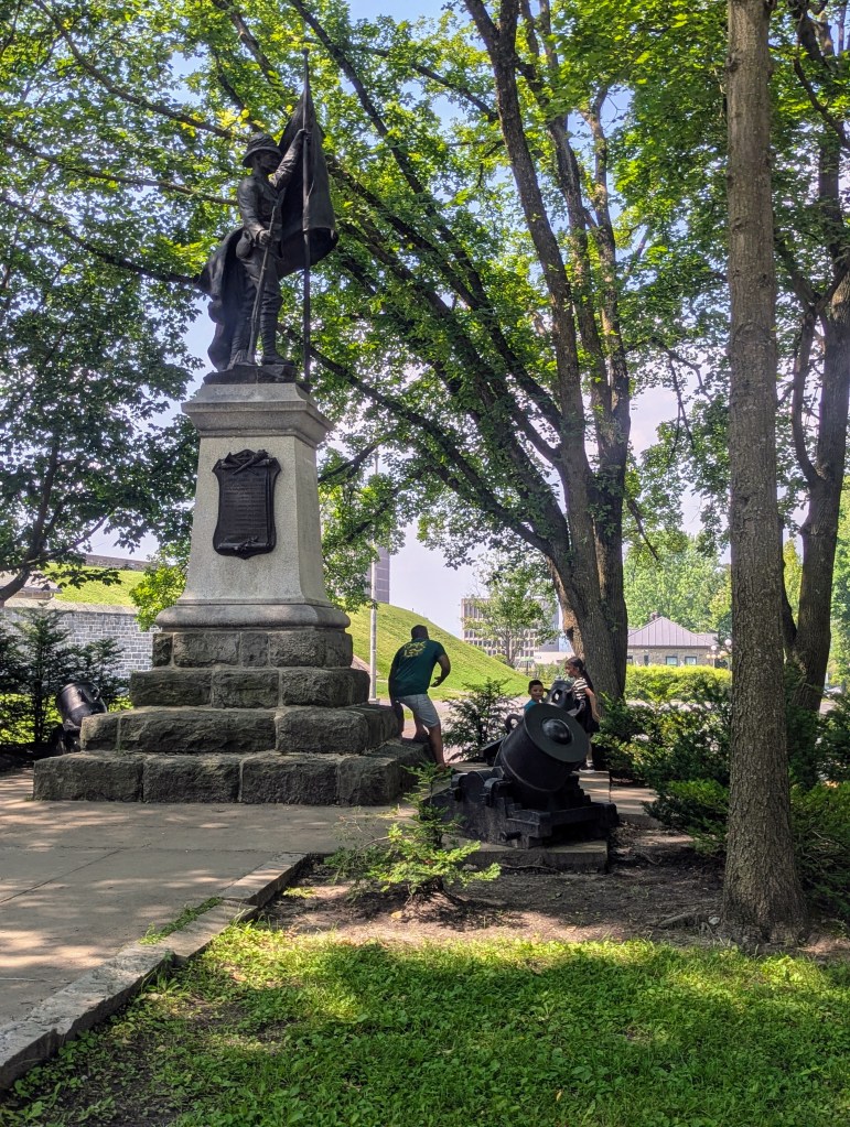
The Boer War Memorial was unveiled on 15 August 1905. It was dedicated to all Quebecois who were killed in action during the Boer War. This memorial was erected on the site of departure of the first Canadian contingent for South Africa, on 30 October 1899.
The Monastère des Ursulines de Québec (Ursuline Monastery of Quebec City), founded in 1639, is the oldest institution of learning for women in North America. It was originally founded by a group of Roman Catholic nuns to convert local indigenous children. But now all schools in Quebec Province are secular.
Jean-Simon regaled us with an anecdote about the battle of 1759 when the British took over the city. The British had arrived in the middle of the night with cannons. The French were taken by surprise; the battle only lasted 20 minutes. French Governor Montcalm was buried in a cannon hole in the floor of the chapel of the monastery. The nuns kept the secret of his burial place until it was discovered in 2001.
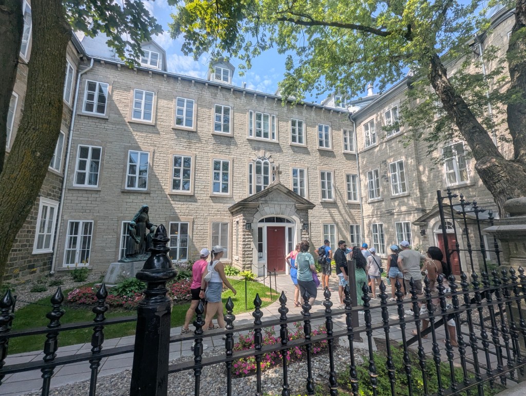
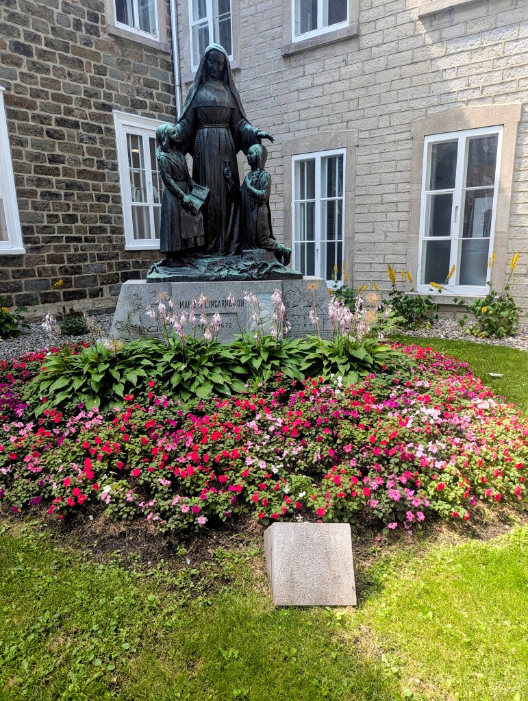
The monastery was established under the leadership of Mother (now Saint) Marie of the Incarnation (1599–1672). She was a widow with a son living in France to whom she wrote many letters which preserve a recorded history of life at the monastery at that time.
Jean-Simon pointed out Restaurant Maison Jaquet, originally a home completed in 1676, making it one of the oldest houses in Quebec. He explained the steepness of the roof is necessary in a city that receives 11.5 feet of snow every year. Roofs were historically red so they could be seen from a distance when the city was blanketed in snow.
The tour stopped on Dufferin Terrace. Jean-Simon talked briefly about the statue there of Samuel de Champlain (1574-1635), founder of the city. He had arrived here with 30 men, only eight of whom survived the winter. No one knows what he actually looked like; the statue, and all other “likenesses” of him are all based on some one else.
Jean-Simon also filled us in on some of the history of the Château Frontenac which, built in 1893, has always been a hotel. The towers were added in 1924. The final section was added in 1993 and included a pool and a spa to allow the hotel to maintain its 5 star status.
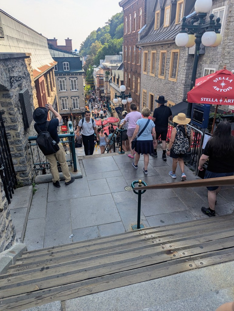
We followed the steep hill down toward the lower city. As we descended the steps, Jean-Simon informed us they had been coined the “breakneck stairs” by drunken soldiers.
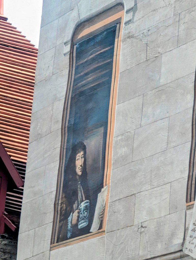
We stopped in front of La Fresque des Québécois (The Mural of Quebec), a large-scale trompe-l’oeil mural completed in 1999 by a collaboration of both French and Canadian artists. The mural is painted on the side of Soumande House on Notre-Dame Street and depicts scenes and figures from Quebec’s history. In addition, all four seasons of the year are depicted from winter on top to spring on the bottom.

In addition to depicting cultural communities, such as the Indigenous people and the French, Irish, and British settlers,
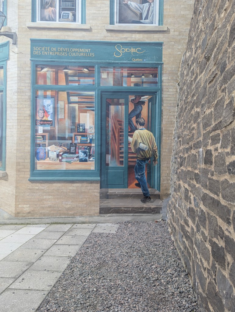
the mural also depicts historically significant figures like the Ursaline nuns

and Samuel de Champlain, shown in a green jacket and holding his hat with a large white feather. Louis Fréchette, a prominent 19th-century poet, journalist, and translator.
At this point Jean-Simon explained more of Quebec’s history. Between 1663 and 1673 approximately 800 young women were sent from France to New France (Quebec) by King Louis XIV to address a severe male-to-female population imbalance and boost the colony’s growth. The 800 women were dubbed the Filles du Roi (“Daughters of the King”). These women were provided with free passage and a dowry to marry French settlers, and they played a vital demographic role, with most French Canadians today tracing their ancestry to at least one Fille du Roi.
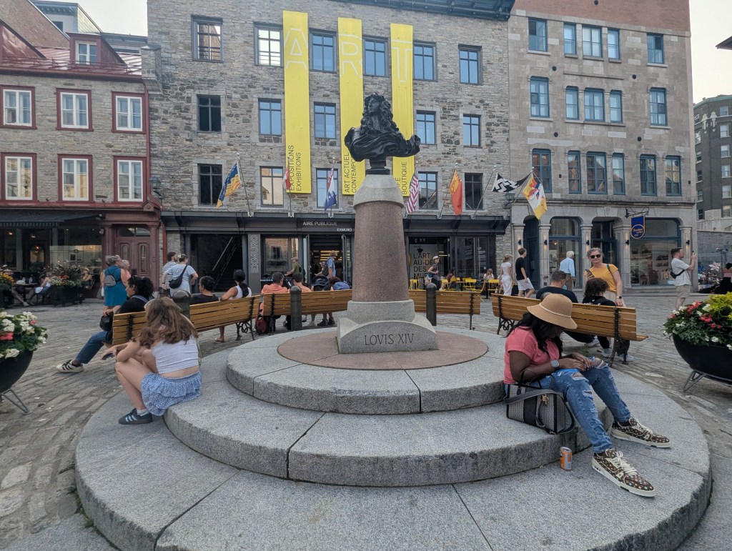
We then found ourselves in Place Royale where Samuel de Champlain founded the City of Québec in 1608.
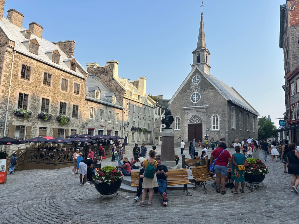
In the center is a bust of Louis XIV who, as we learned above, helped populate the new French colony.
In the back of the square is the Église Notre-Dame-des-Victoires (Our Lady of Victories), the oldest church in Canada built in stone and retaining the original stones, it is one of the oldest churches in all of North America. Construction was started in 1687 on the site of Champlain’s habitation and was completed in 1723. Jean-Simon told us that this is where a scene toward the end of Leonardo Dicaprio’s “Catch Me if You Can” movie was shot. (We watched it that night, and it was!)
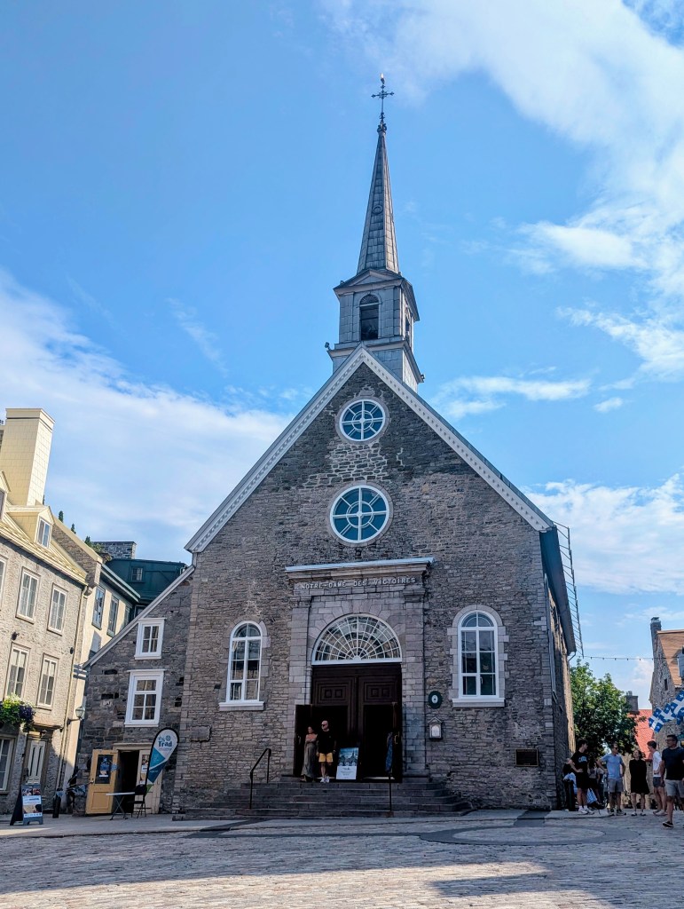
Jean-Simon explained that the church received the name Notre-Dame-de-la-Victoire (Our Lady of Victory) following two battles in which the English were defeated: first in 1690, when Governor Louis de Buade de Frontenac famously declared “I will answer you with the mouths of my cannons,” a refusal to surrender when facing a British attack led by William Phips (which was, by the way, a bluff), then again in 1711, when the attacking British fleet was sunk in a storm. In 1775 the Americans attacked to try and pull Canadians into their war with England, but they failed, and this was the last attack on Quebec City.

In the late 18th century Napolean placed an embargo on wood from Scandanavia to England, which made the economy here in Quebec soar. Homes, businesses, and shops opened around the city. In time the economy failed and a large number of building fell into ruin but now with tourism are starting to be restored, preserving the historic architecture.
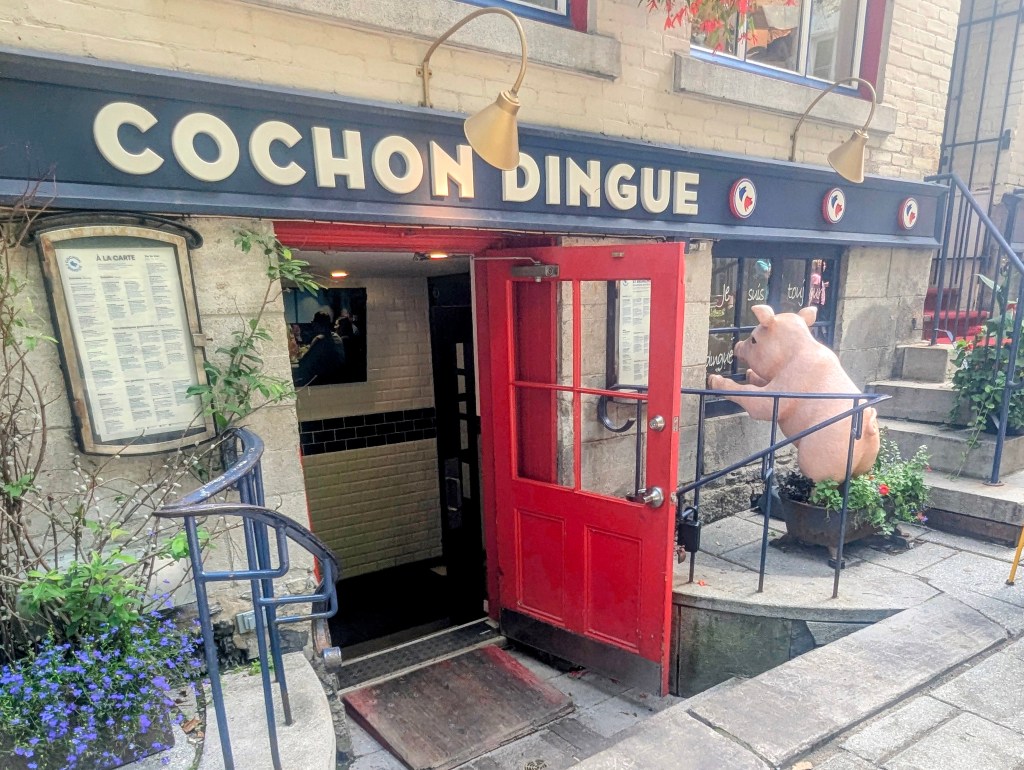
Jean-Simon had recommended microbrewery Archibald for a beer, which advice we followed

before heading to Cochon Dingue (Crazy Pig) for a delicious dinner.
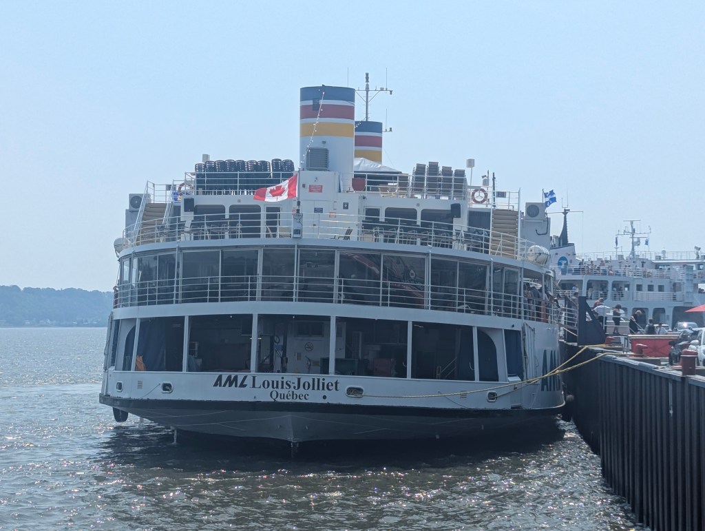
The next day we decided to head out onto the Lawrence River.
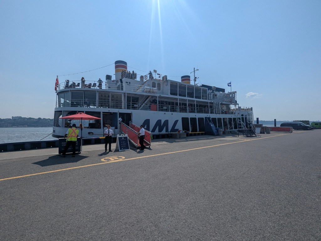
Our boat for the morning was Louis Jolliet, named for Louis Jolliet who was born in Quebec in 1645 and became an explorer in North America.
As we pulled away from the dock the guide explained that this is one of the largest estuaries in the world. The water is brackish and the tides are generally 6-9 feet except in the spring with the snow melt, when the tides can become as large as 18 feet. The St. Lawrence River is about 2300 miles long extending to the Great Lakes and has 16 locks along the way, 7 of which are in Montreal. The estuary is rich in krill; marine animals feed here, migrate to the Caribbean to breed, then return. At certain times of year beluga whales and dolphins can be seen in these waters. The Quebec region of the river is shallow, only about 18-24 feet deep in most places, which saved it from submarine U boats during World War II. Quebec City itself is less than a half mile from the Atlantic Ocean, which is why there is a strong naval presence here; the red boats are naval. The seaway was inaugurated in 1929, after dredging 86 million tons of soil, with the presence of President Eisenhower, the Canadian prime minister, and Queen Elizabeth II all present.
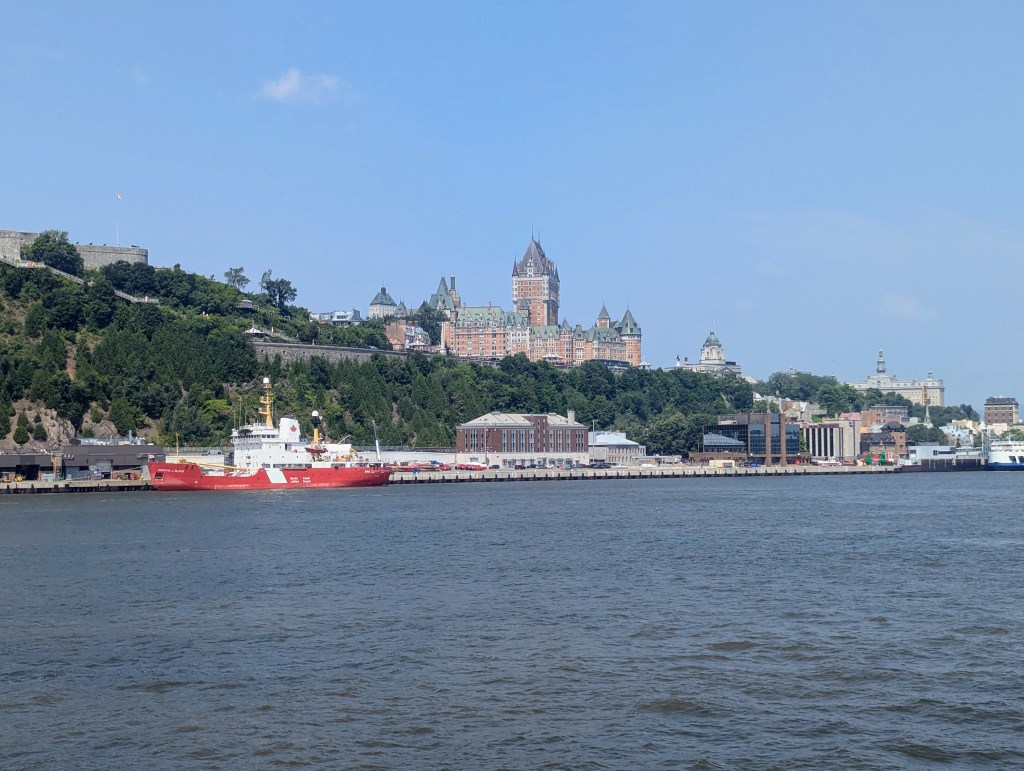
As we headed up the Lawrence River we had picture-perfect views of the city.

We passed Davies Shipbuilding yard. Founded in 1825, they have built over 700 ships. Our Louis Jolliet had been built there in 1938 as a war ship but was converted to a cruise ship in 1977. Today they continue building everything from icebreakers to warships for use by NATO, which is for what the white one in the yard currently will be used.
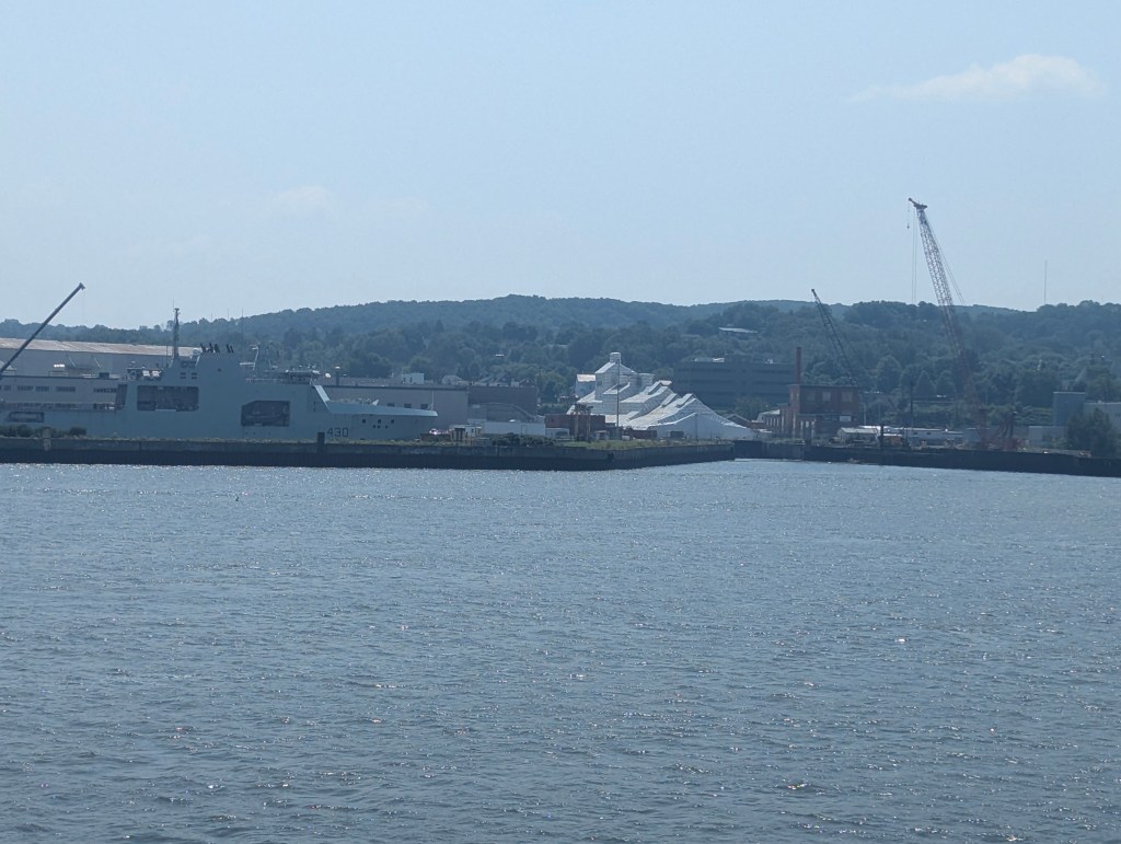
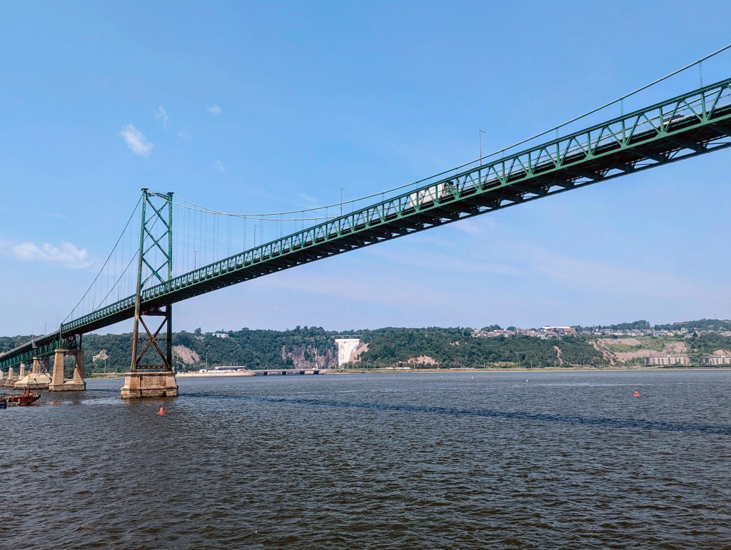
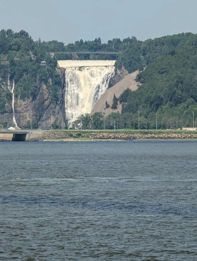
Davies is on an island called Île-d’Orléans (Orleans Island). This picturesque island is a popular destination known for its agriculture, scenic beauty, historical sites, and culinary delights; 90% of the land on the island is agriculture. We did not stop. Instead we travelled further under the Île d’Orléans Bridge where we had our best views of the waterfalls.
The larger waterfall is called Montmorency Falls which, at 272.3 high, it is a full 98.4′ taller than Niagara Falls. In the winter the spray freezes and accumulates at the base forming a heap of ice the locals call the “sugar loaf.” The smaller waterfall to the left is called the Bridal Veil Falls. The legend is that a bride whose fiance was killed in World War II jumped to her death from the top, but her veil became caught on the rocks.
After leaving the boat we walked around the lower city for a bit. Amongst the many restaurants and many, many art galleries
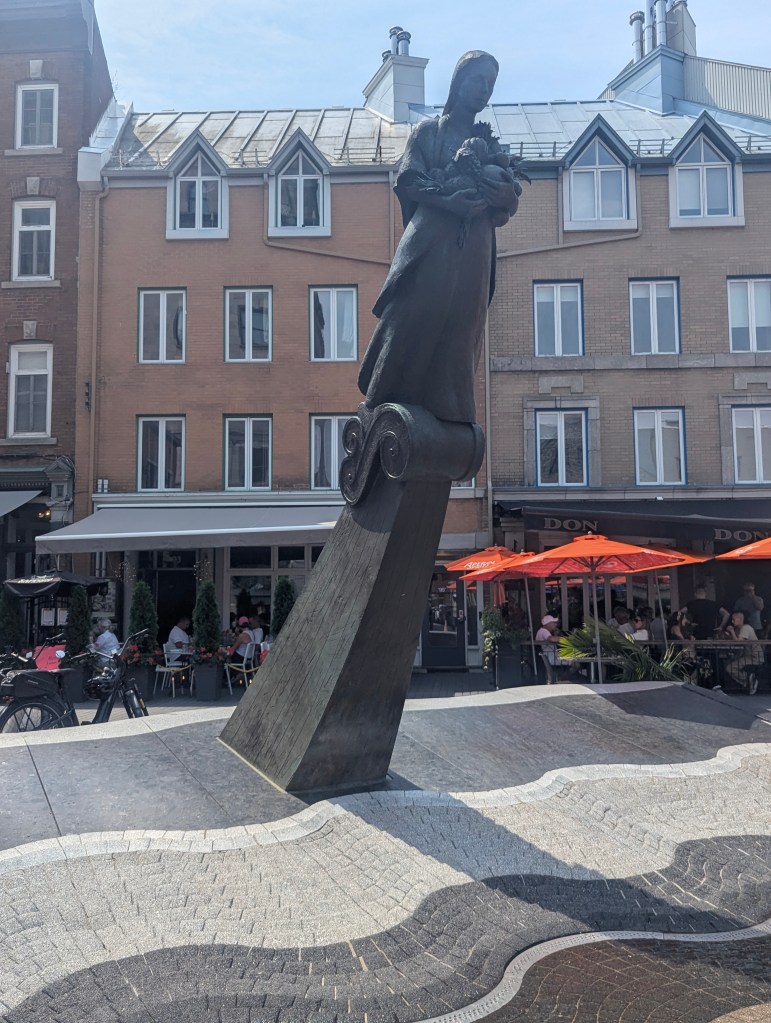
sits La Vivrière (The Foodcrops), a bronze fountain sculpture which commemorates the 50th anniversary of the founding of the Food and Agriculture Organization (FAO) of the United Nations, which was established in Quebec City in 1945. La Vivrière depicts a woman carrying food from various continents, symbolizing the fight against hunger.
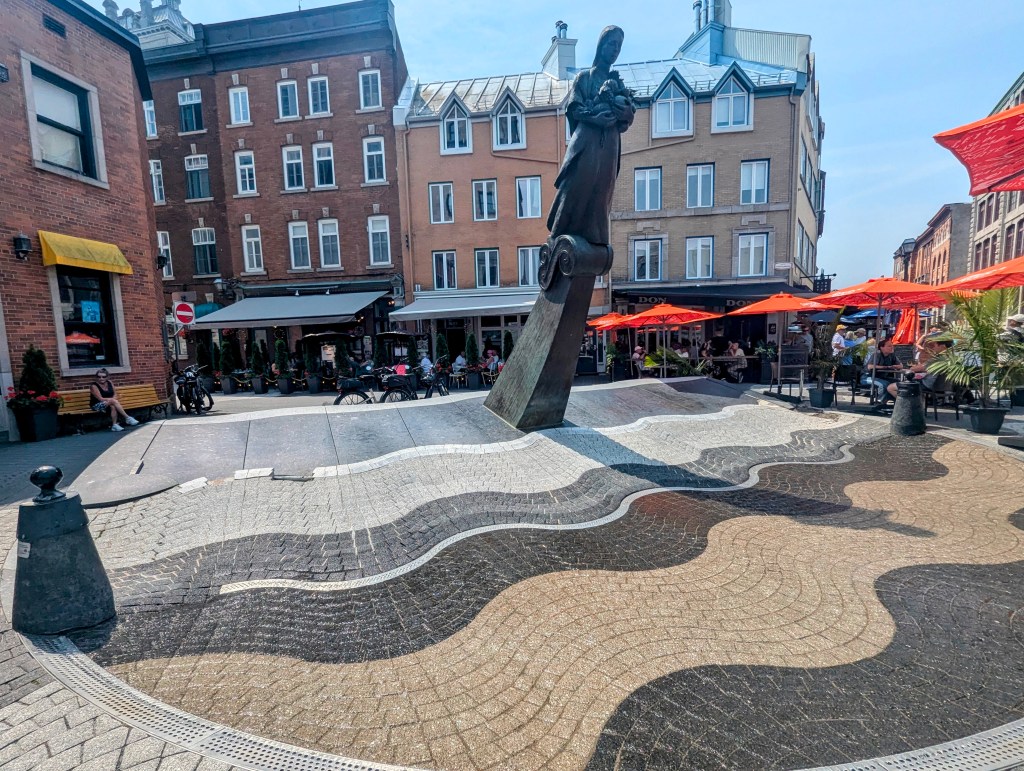
The sculpture evokes a ship figurehead, and the wave pattern in the surrounding brickwork represents the historic shoreline of the St. Lawrence River.
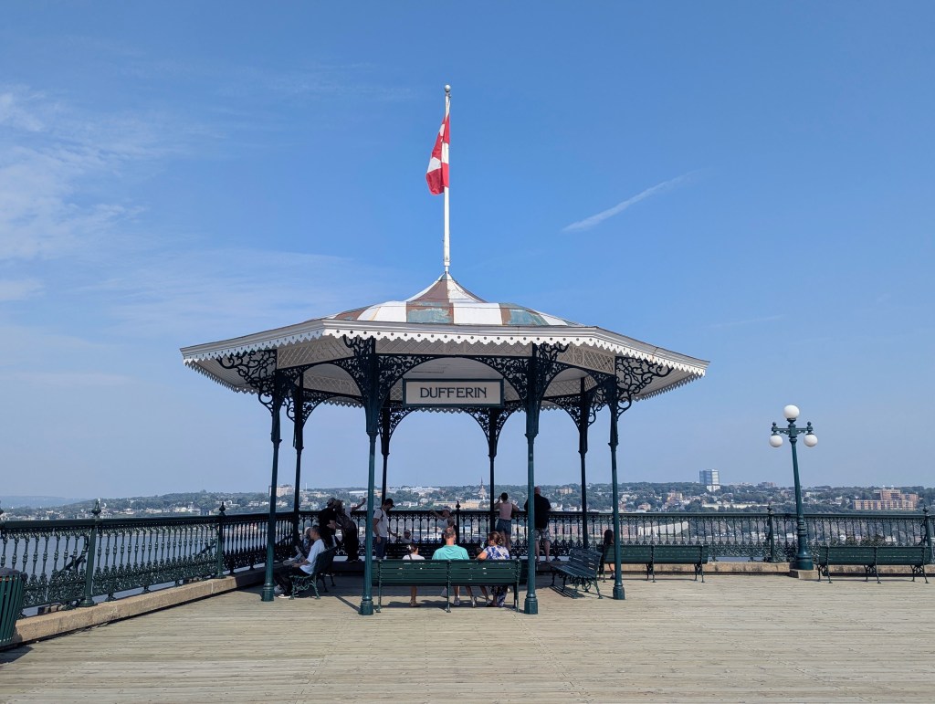
We then once more climbed the steep path to the upper city. We meandered about the Terrasse Dufferin (Dufferin Terrace), a boardwalk that overlooks the St. Lawrence River. It wraps around the Château Frontenac before climbing toward the Citadelle.
The boardwalk features six gazebos.
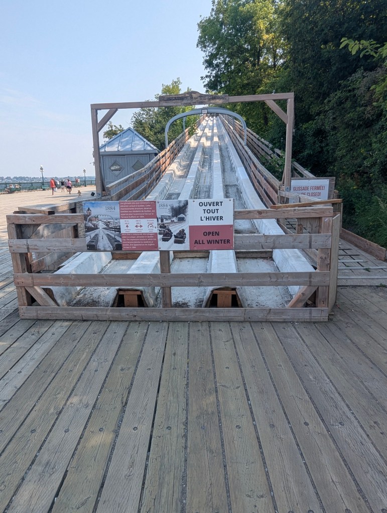
On the south end of the terrasse is a 490 ft ramp or Terrasse Dufferin Slides (c. 1898) used annually as a toboggan run during the Carnaval de Québec (Quebec Winter Carnival).
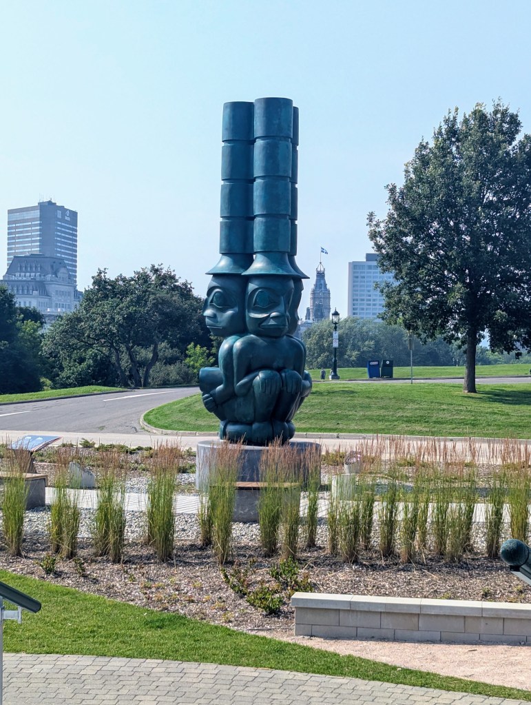
We hiked all the way to Cap Diamant, Plains of Abraham, featuring works by First Nations artists. The location on Cap Diamant is a significant initiative by the National Battlefields Commission, showcasing a new space for art and dialogue.
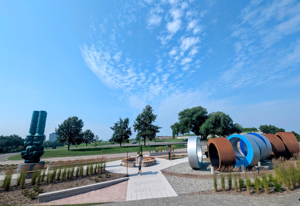
Les trois sentinelles (The Three Watchmen) is a monumental bronze sculpture by Haida artist James Hart. The three figures, traditionally positioned atop totem poles in Haida villages, represent legendary guardians who watch for danger from both the physical and spiritual realms.
We walked across the Plaines d’Abraham (Plains of Abraham), an historic area established on 17 March 1908. The land is the site of the Battle of the Plains of Abraham, which took place on 13 September 1759. The park is today used by 4 million visitors and tourists annually for sports, relaxation, outdoor concerts, and festivals.
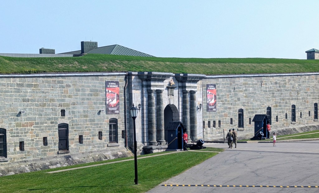
We reached the top of Cap Diamant: the Citadille. Citadelle de Québec (The Citadelle of Quebec) is an active military installation and the secondary official residence of the Governor of Central Canada. The strategic importance of Cap Diamant was recognized by the French as early as 1608. Several defensive fortifications were built on the site first by the French and then by the British after their conquest of New France. The modern citadel was built from 1820 to 1850, in an effort to secure Quebec City against a potential American attack. The British used the citadel until 1871, when they formally handed the property over to the Canadian government
It is hard to see from these pictures, but we are looking down onto the entrance.
As we walked past and down the other side, looking back we could appreciate how buried the Citadel is.

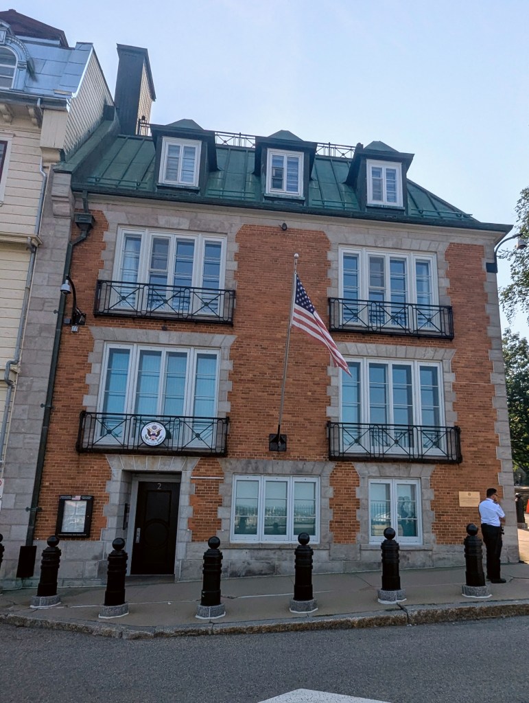
Proceeding down the hill back toward the upper city, we passed the US Consulate.
We approached the Chateau Frontenac from the side. The obelisk to the left below is the Wolfe-Montcalm Monument located in Governors’ Garden. Unveiled in 1828, it commemorates the British General James Wolfe and the French General Louis-Joseph de Montcalm, both of whom died during the Battle of the Plains of Abraham in 1759. The inscription on the monument’s top plaque, translated, reads: “Their courage brought them the same end, the same fame; posterity, the same monument”. The monument is the oldest in Quebec City and the second-oldest war monument in Canada.
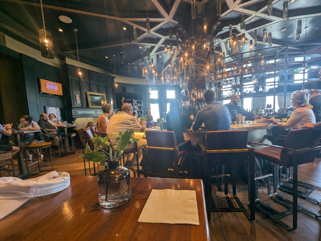
After taking photos of the Chateau for the last few days, we decided to enter the foyer
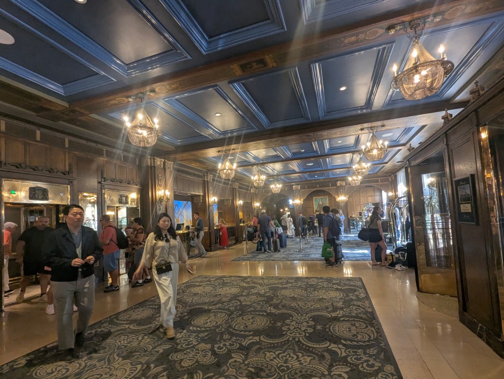
and made our way to the bar, where we sat and drank and enjoyed the view until it was time for dinner.
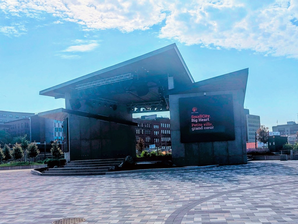
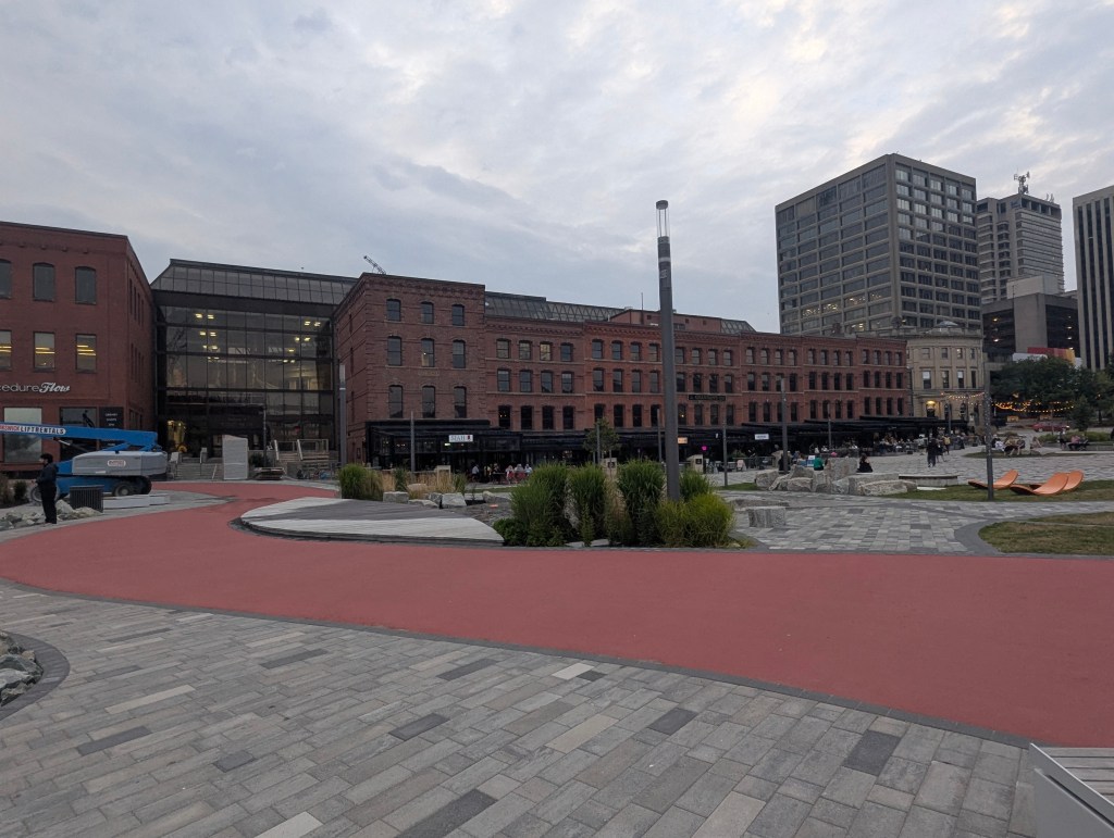
The next day’s drive was over 7 hours to reach our well located St. John Hilton in Saint John, New Brunswick. Saint-Jean (Saint John) is a seaport city located on the Bay of Fundy. It is Canada’s oldest incorporated city, established by royal charter on May 18, 1785, during the reign of King George III. Although tired, we dragged ourselves out to the Marketplace for a light dinner at the Saint John Ale House where we enjoyed local specialties including grilled scallops and a lobster roll.
Across from the Marketplace was an amphitheater in which a band was playing.
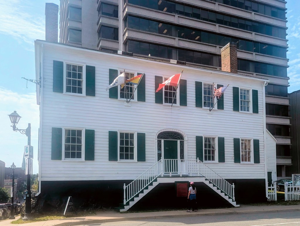
After a good night’s rest, we embarked on a self-guided walking tour of the city. Our first stop was the Loyalist House, a National Historic Site and a museum. Constructed in 1817, it was the home of the prosperous Merritt family, who were United Empire Loyalists who emigrated from New York after the American Revolutionary War. The house is a significant survivor of the Great Fire of Saint John in 1877, which destroyed much of the city. It is recognized for its early 19th-century classical architecture in Atlantic Canada and remains one of Saint John’s only buildings from that era that has never been structurally altered.
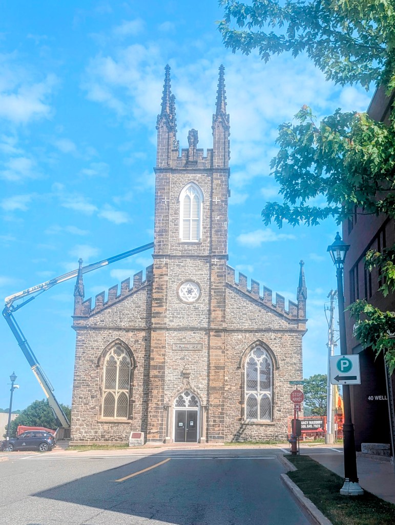
Next we visited St. John’s Stone Church, an Anglican church built between 1824 and 1826. It is a notable example of the Romantic Gothic Revival style in Canada. It earned the nickname “Stone Church” due to its construction using ballast stones brought from England by ships returning from transporting lumber. A piece of Caen stone from St. Andrew’s Church in Steyning, Sussex, England, known as the “Linking Stone,” is set in the Chancel arch, connecting it to the church’s English heritage.
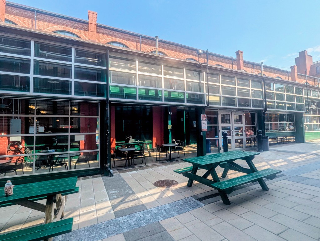
Next stop: The Saint John City Market, is the oldest continuously operated farmers’ market in Canada, with a charter dating from 1785.
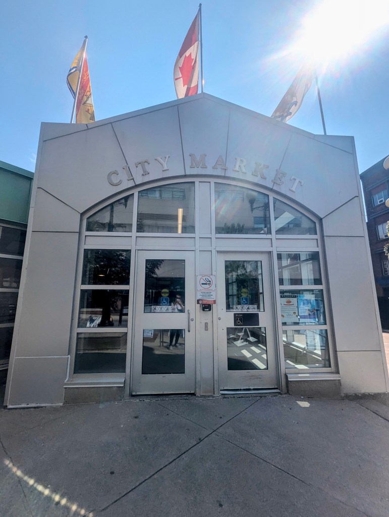
We stepped inside.
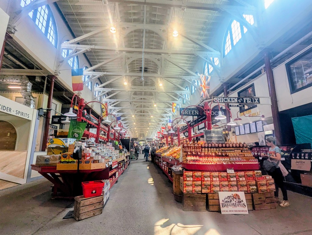
The flags indicate the nationality of the food served. In addition to a large selection of fresh produce, there are also restaurants
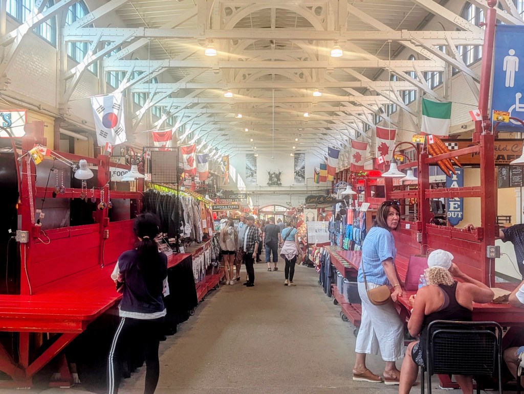
with more seating outside in the nice weather.
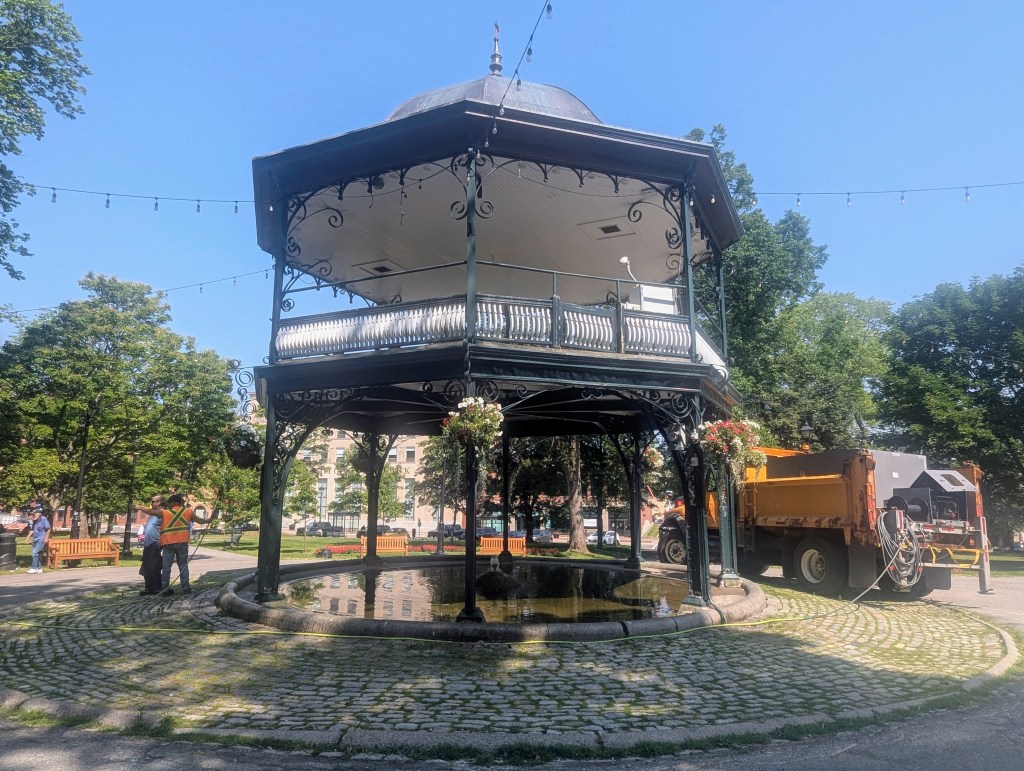
We made our way to King George’s Square. Established in 1785, just a year after the formation of New Brunswick, the King’s Square was aptly named after King George III. Over the years, it has become a cherished space adorned with various monuments and plaques, each paying homage to individuals who have played pivotal roles in shaping the city’s history. At the heart of King’s Square stands the majestic King Edward VII Memorial Bandstand, a two-story architectural gem crowned with a copper roof and adorned with an intricate metal framework. This bandstand, donated in 1909 by the City Coronet Band, serves as a central focal point and a symbol of homage to King Edward VII.
Among the notable monuments in the park is The Loyalist Cross, erected in 1934 to honor the first settlers representing the province. Unveiled on New Brunswick’s 150th anniversary, this cross stands as a timeless tribute to the enduring spirit of those who laid the foundation for the region.

A 20 foot tall monument commemorates John Frederick Young, a heroic 19-year-old who tragically drowned while attempting to rescue a 10-year-old boy in nearby waters on October 30, 1890.

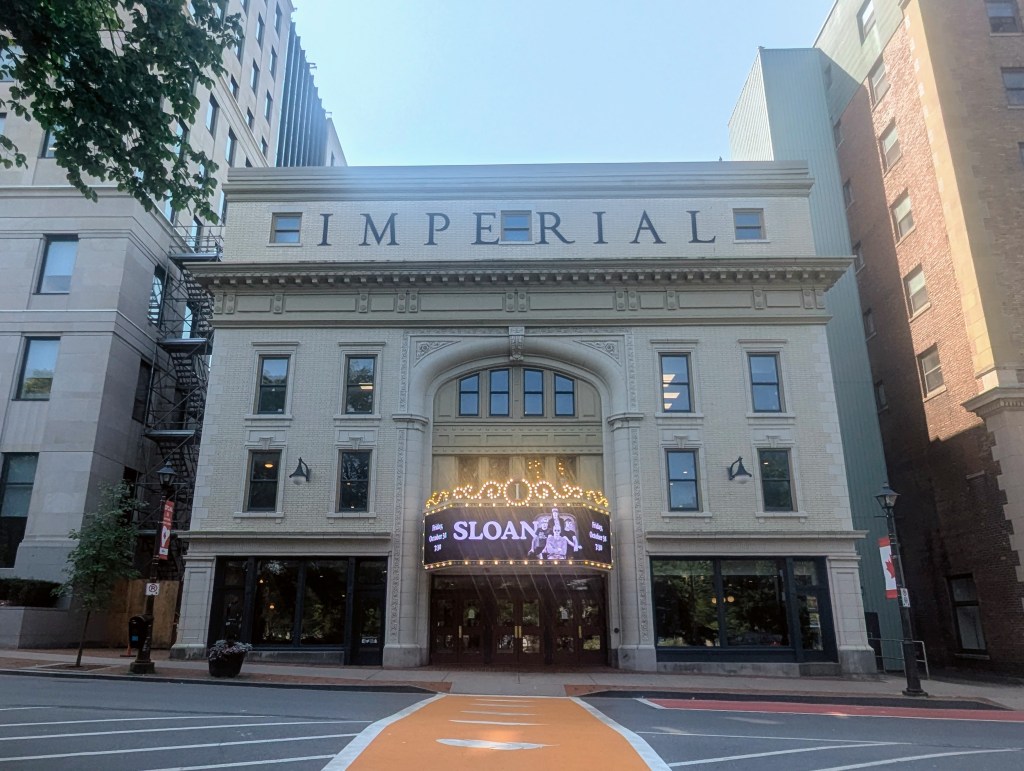
Across the street from King George’s Square is the Imperial Theatre. Built in 1912 , it opened to the public on September 19, 1913. In 1928 it became home to the first commercial radio station. The theatre was designed as a modern adaptation of the Italian Renaissance, and was used both for live vaudeville acts as well as “talkies”. In 1929, it was renamed the Capitol Theatre, and like most vaudeville houses across the continent, became a cinema.
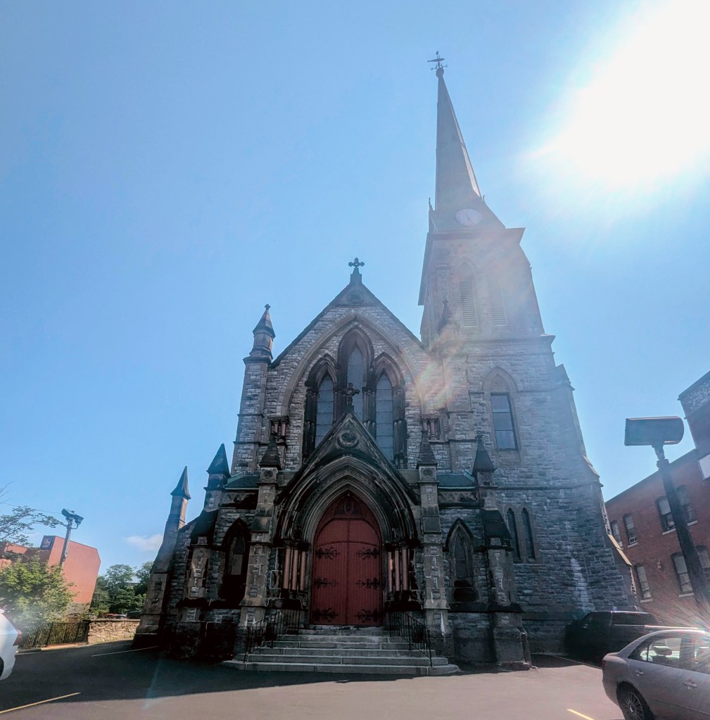
We strolled by the Trinity Anglican Church. Trinity Anglican Church holds a special place in the early religious history of Saint John. Established by the United Empire Loyalists shortly after their arrival, it became the inaugural congregation in the city, playing a pivotal role in shaping the religious landscape of the community. The church is part of a series of brick and stone buildings constructed between 1877 and 1881, a period of rebuilding following the devastating fire that consumed two-thirds of the City of Saint John in 1877. The original church structure, completed in 1791, fell victim to the destructive fire, leading to the construction of the present Trinity Anglican Church. The cornerstone for this new church was laid in May 1879, and it was completed in 1880. As a prime example of Gothic Revival architecture, the church stands as an impressive structure with a towering spire reaching 200 feet, making it visible from various vantage points in uptown Saint John. The resonant chimes of the clock, marking every half hour, contribute to the distinctive character of the city.
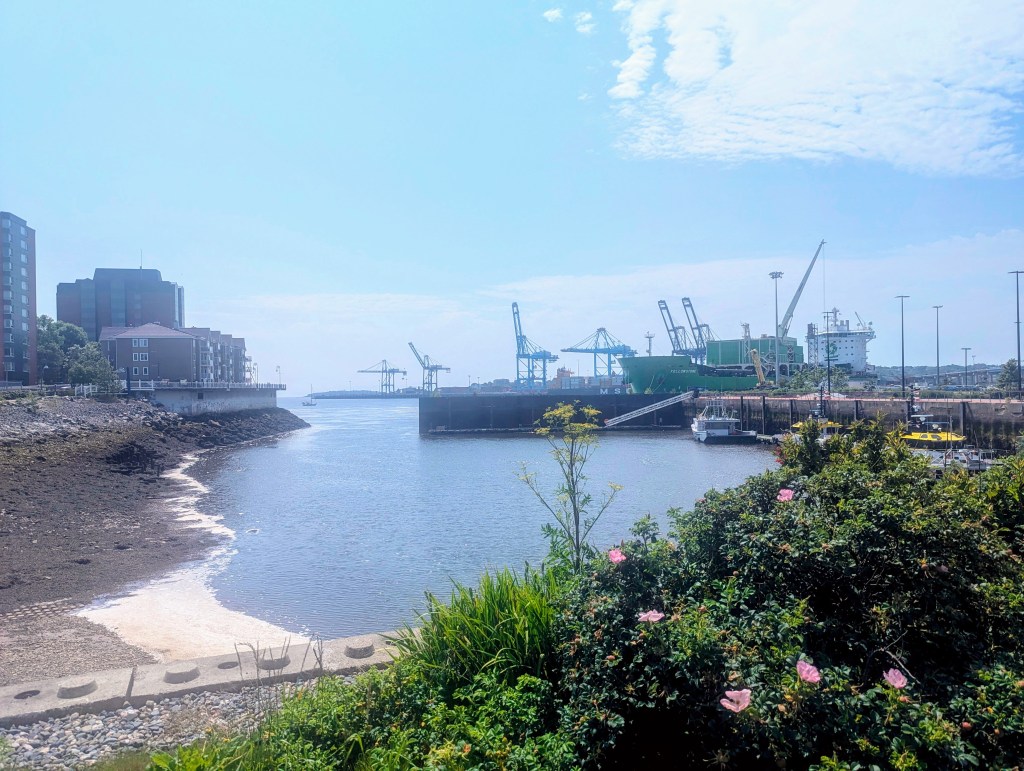
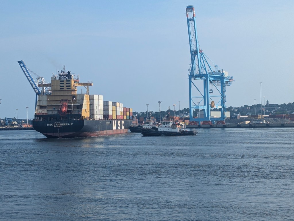
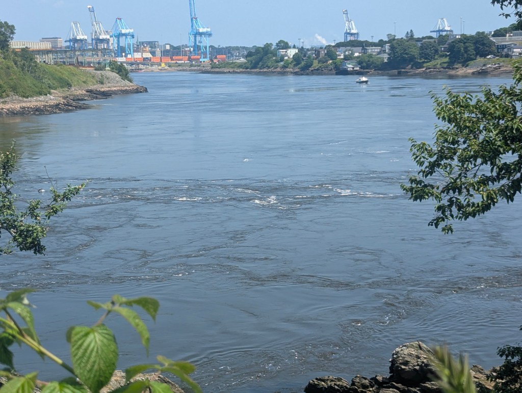
The Port of Saint John is Canada’s third-largest by tonnage with a cargo base that includes dry and liquid bulk, containers, and cruise.
We watched as two tug boats turn a large container vessel.

The one on the left is pulling; the one on the right is pushing.
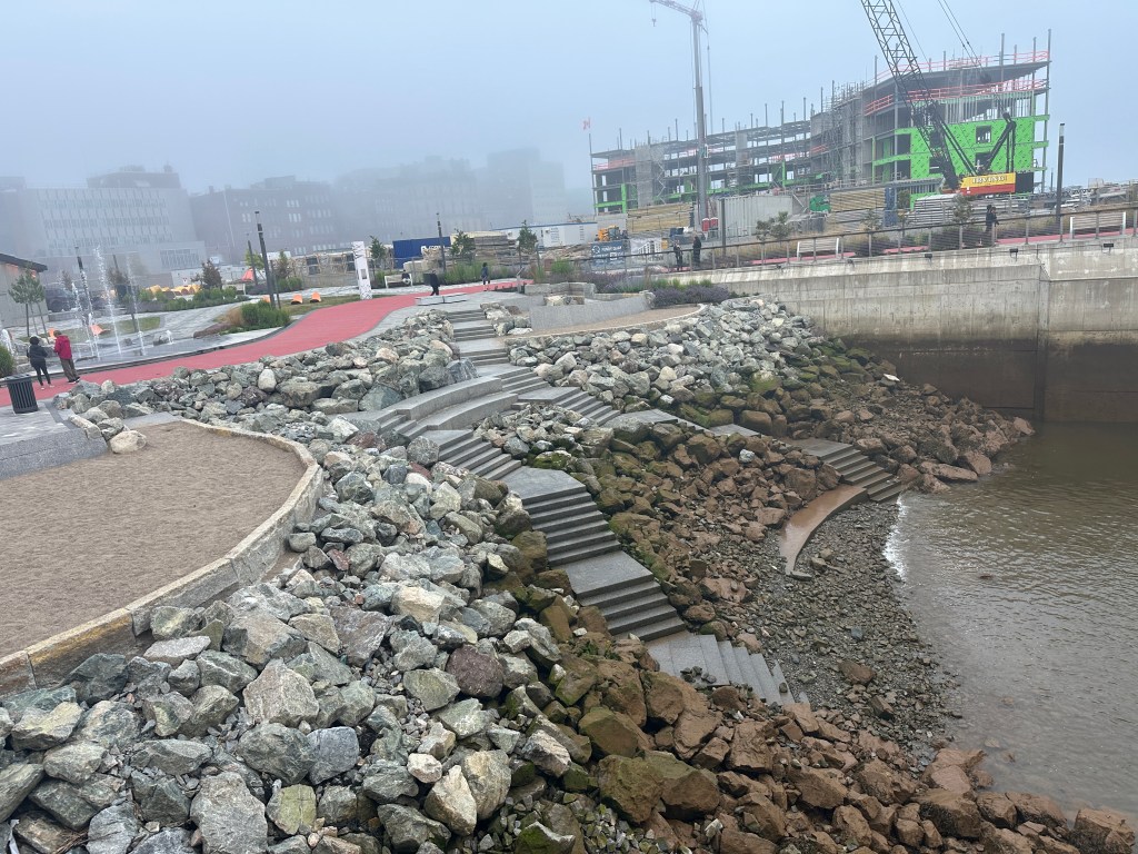
What Saint John is most noted for is that it sits on the Bay of Fundy, a bay between the provinces of New Brunswick and Nova Scotia. Its tidal range at 56 feet is the highest in the world. Some tides are higher than others, depending on the position of the moon, the sun, and atmospheric conditions. The steps into the bay just outside our hotel show this difference between almost high tide
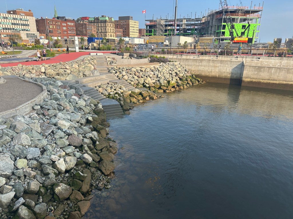
and approaching low tide.
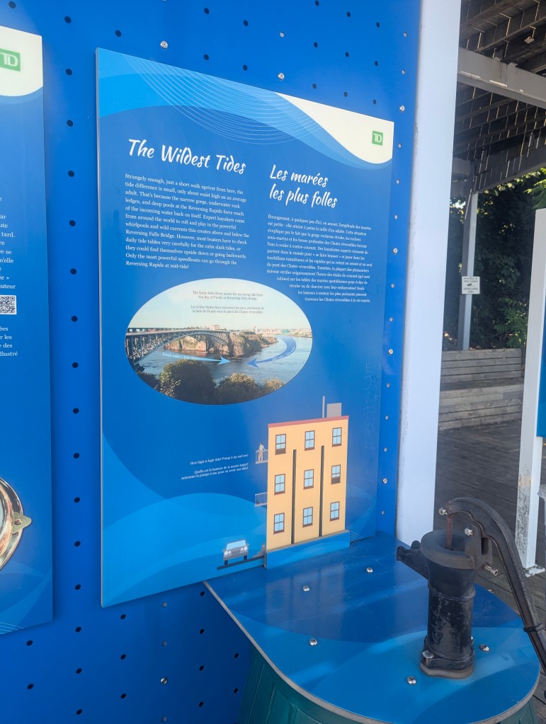
Because of tidal resonance in the funnel-shaped bay, the tides that flow through the channel are very powerful. In one half-day tidal cycle, about 100 billion tons of water flow in and out of the bay, which is twice as much as the combined total flow of all the rivers of the world over the same period.
We were told that the strength of the incoming tide actually pushes against the flowing Saint John River, resulting in the Reversing Falls. We decided to take the about 2.5 mile hike to see it. Along the way we passed the Fallen Heroes Memorial

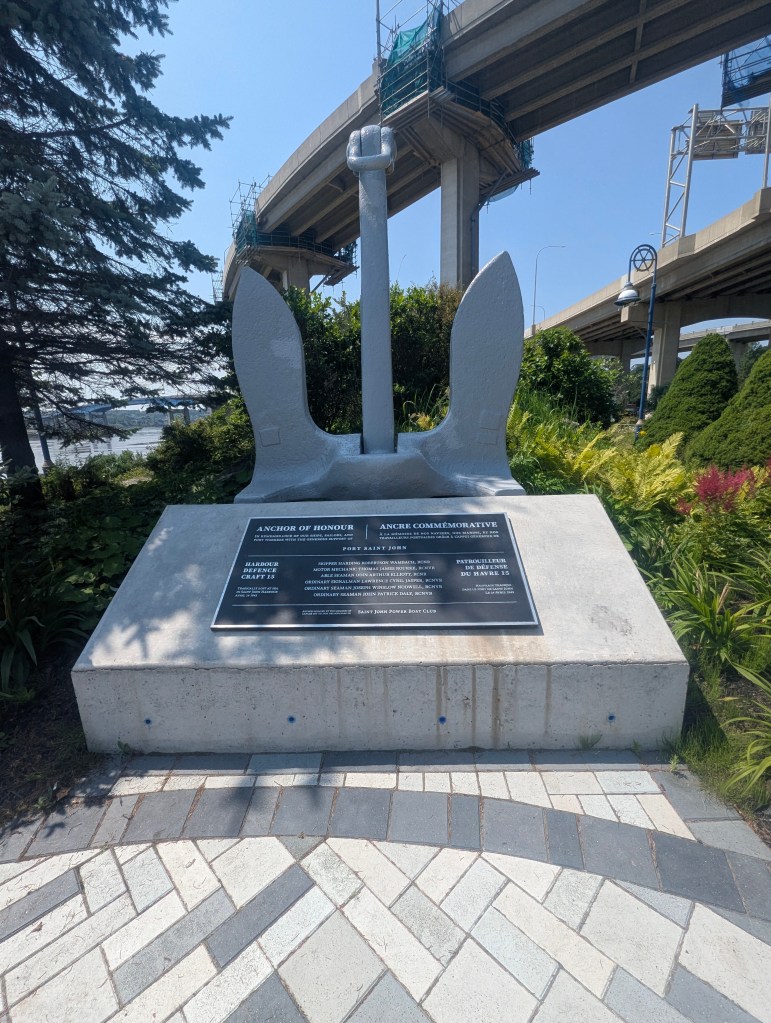
and the Naval Memorial
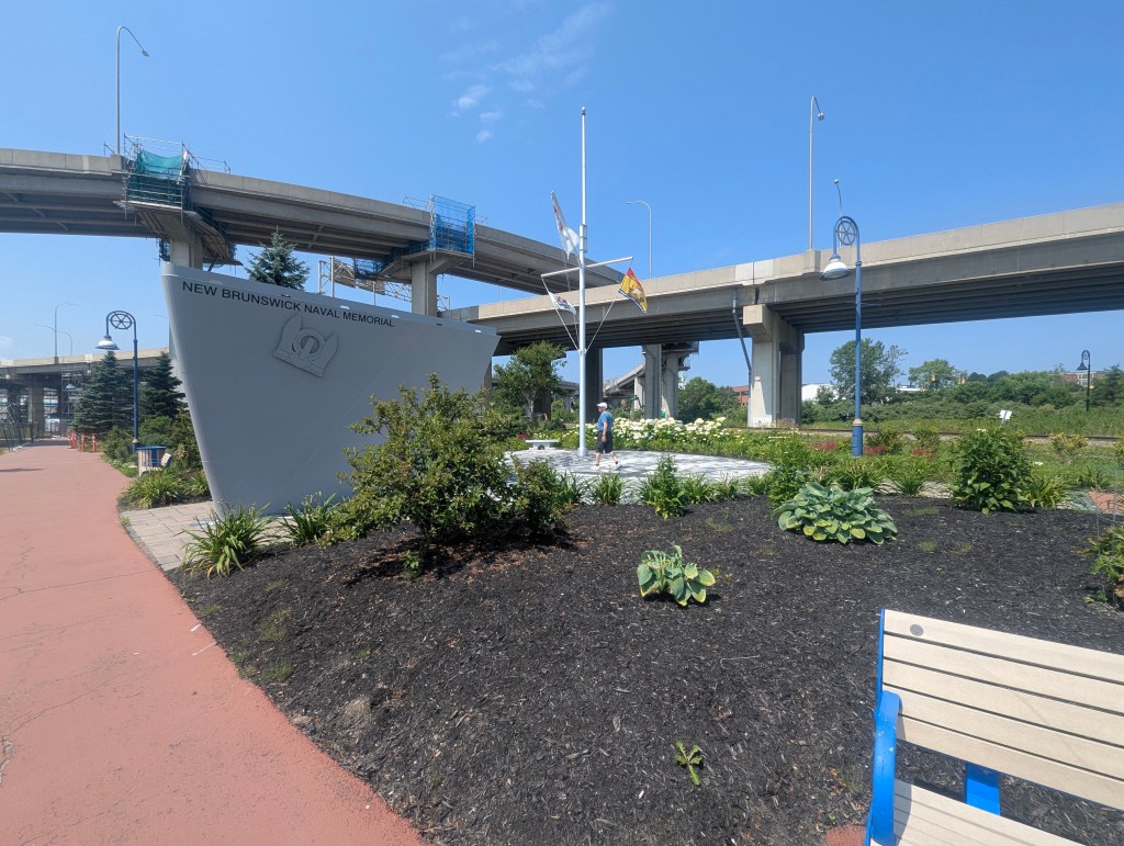
which honors the courage and sacrifice of New Brunswick mariners and maritime aviators who served Canada, including those who lost their lives and have no known grave.
Place Fort Latour, from their web page, ” commemorates 5700+ years of changing ceremonial, commercial, and industrial uses of this special place. The site of treachery, intrigue, and a memorable battle in early Acadian times, Place Fort La Tour provides today’s visitors with experiences and structures that are evocative of these stories and a current day meeting place, much like it has always been. Land Acknowledgement: Place Fort La Tour / Menaquesk is situated on the traditional and unceded and unsurrendered territory of the Wolastoqiyik/Maliseet. The Wolastoqiyik/Maliseet along with their Indigenous neighbours, the Mi’Kmaq/Mi’kmaw and Passamaquoddy/Peskotomuhkati.”
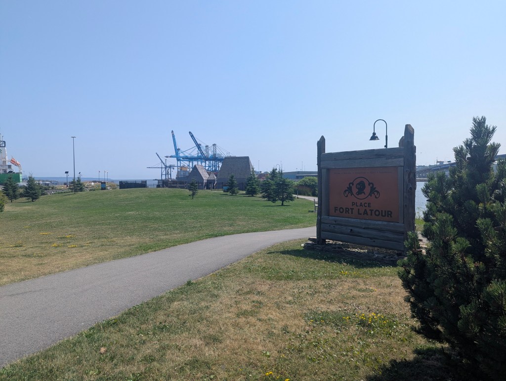

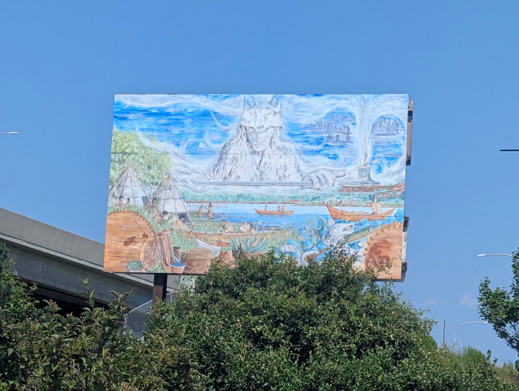
A mural by Barry Ogden, a notable figure in Saint John for organizing beautification projects, visually represents the significant events and cultures associated with Place Fort La Tour’s long history.
The Memory Vessel created by New Brunswick artist Peter Powning is situated at the eastern end of the Reversing Falls, within Irving Memorial Park. It serves as a memorial to five individuals who tragically died in an accident near the site. The canoe-shaped sculpture is made of stainless steel and contains small pieces of recycled glass, which illuminate at night with a soft glow. The artwork’s design, with its undulating columns and canoe-like form, reflects the city’s nautical heritage and the importance of memory.

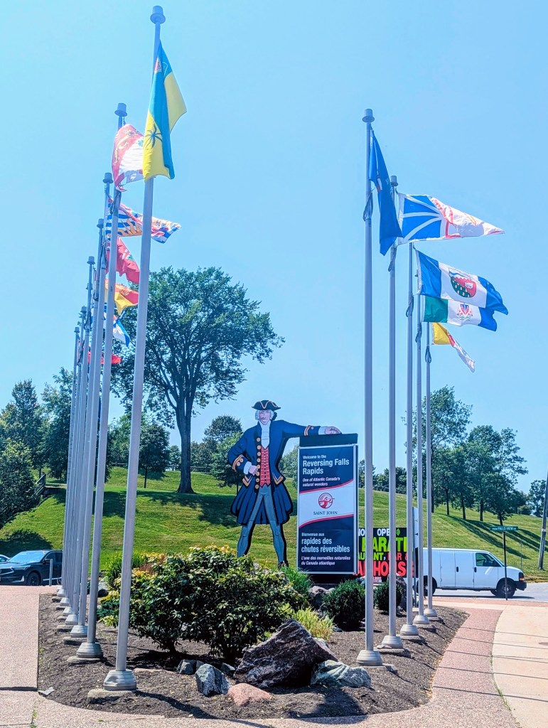
Finally we reached the Park from which to observe Reversing Falls.
The Reversing Falls is a unique series of rapids where the powerful tides of the Bay of Fundy force the Saint John River’s flow to reverse twice daily, creating churning water and whirlpools. At low tide, the river flows towards the bay, but as the tide rises, the bay’s immense water pressure gradually reverses the river’s flow, generating rapids and whirlpools that flow away from the harbor.

It is hard to discern from these stills (it is quite impressive in person), but the whirlpools give a sense of the water swirling in both directions at once.
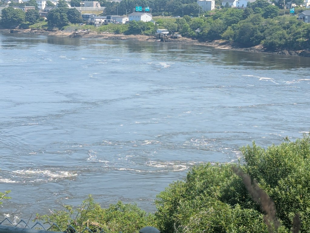
The water forms a line between the incoming tide and the flowing river.
After the long hike back it was time for another ale and dinner at the Marketplace
and to enjoy the sunset.


I look forward to reading your amazing adventures!
LikeLike